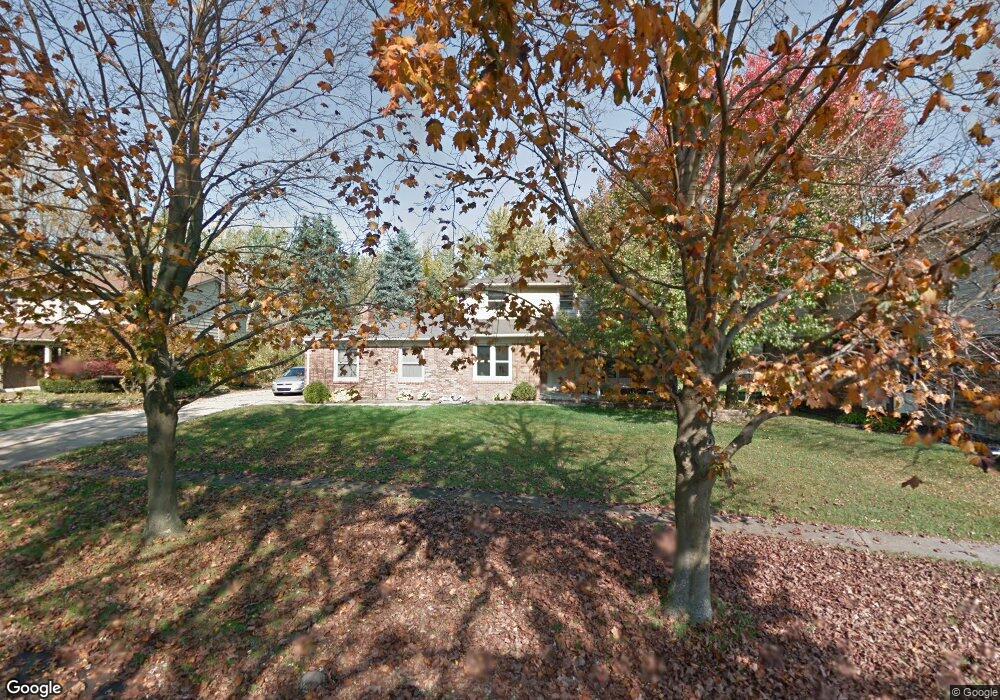
47465 Alliance Ct Unit Bldg-Unit Shelby Township, MI 48315
Estimated Value: $423,000 - $440,000
4
Beds
3
Baths
2,577
Sq Ft
$167/Sq Ft
Est. Value
About This Home
This home is located at 47465 Alliance Ct Unit Bldg-Unit, Shelby Township, MI 48315 and is currently estimated at $430,921, approximately $167 per square foot. 47465 Alliance Ct Unit Bldg-Unit is a home located in Macomb County with nearby schools including Jack Harvey Elementary School, Shelby Junior High School, and Utica High School.
Ownership History
Date
Name
Owned For
Owner Type
Purchase Details
Closed on
Jul 16, 2018
Sold by
Mitchenall David R and Mitchenall Suzette
Bought by
Kelley Robert W
Current Estimated Value
Home Financials for this Owner
Home Financials are based on the most recent Mortgage that was taken out on this home.
Original Mortgage
$241,750
Outstanding Balance
$209,512
Interest Rate
4.5%
Mortgage Type
New Conventional
Estimated Equity
$221,409
Create a Home Valuation Report for This Property
The Home Valuation Report is an in-depth analysis detailing your home's value as well as a comparison with similar homes in the area
Home Values in the Area
Average Home Value in this Area
Purchase History
| Date | Buyer | Sale Price | Title Company |
|---|---|---|---|
| Kelley Robert W | $265,000 | First American Title Insuran |
Source: Public Records
Mortgage History
| Date | Status | Borrower | Loan Amount |
|---|---|---|---|
| Open | Kelley Robert W | $241,750 |
Source: Public Records
Tax History Compared to Growth
Tax History
| Year | Tax Paid | Tax Assessment Tax Assessment Total Assessment is a certain percentage of the fair market value that is determined by local assessors to be the total taxable value of land and additions on the property. | Land | Improvement |
|---|---|---|---|---|
| 2025 | $4,670 | $195,600 | $0 | $0 |
| 2024 | $2,764 | $188,100 | $0 | $0 |
| 2023 | $2,618 | $166,400 | $0 | $0 |
| 2022 | $4,223 | $152,300 | $0 | $0 |
| 2021 | $4,107 | $142,400 | $0 | $0 |
| 2020 | $2,410 | $138,900 | $0 | $0 |
| 2019 | $3,760 | $129,000 | $0 | $0 |
| 2018 | $2,637 | $125,900 | $0 | $0 |
| 2017 | $2,610 | $120,800 | $34,350 | $86,450 |
| 2016 | $2,591 | $120,800 | $0 | $0 |
| 2015 | $2,604 | $115,750 | $0 | $0 |
| 2012 | -- | $0 | $0 | $0 |
Source: Public Records
Map
Nearby Homes
- 56745 Spruce Forest Dr
- 46974 Kramer Dr
- 13000 Janine Ct
- 48255 Amber Lane Dr
- 48325 Red Oak Dr
- 47136 Rosevillage Ct
- 47124 Rosevillage Ct
- 12212 Watkins Dr
- 12214 Anthony Dr
- 11705 Squiers Blvd Unit 114
- 11685 Squiers Blvd Unit 95
- 45874 Kensington St
- 47040 W Wayford Dr
- 49107 Cranberry Ct
- 45709 Kensington St
- 13267 Pearl Dr
- 49280 Wildwood Ct
- 46128 Sterritt St
- 12430 Conservation Trail Unit 337
- 11109 Messmore Rd
- 47465 Alliance Ct
- 47485 Alliance Ct
- 47447 Alliance Ct
- 47541 Ben Franklin Dr
- 47369 Alliance Ct
- 47351 Alliance Ct
- 47429 Alliance Ct
- 47555 Ben Franklin Dr
- 47512 Ben Franklin Dr
- 47577 Province Ct
- 47387 Alliance Ct
- 47500 Ben Franklin Dr
- 47528 Ben Franklin Dr
- 47319 Ben Franklin Dr
- 47544 Ben Franklin Dr
- 47141 Quaker Ct
- 47423 Alliance Ct
- 47405 Alliance Ct
- 47405 Alliance Ct
- 47405 Alliance Ct