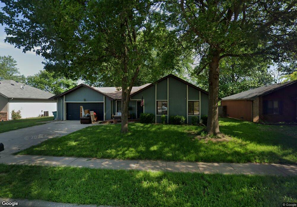
4747 W La Siesta St Springfield, MO 65802
Young-Lilly NeighborhoodEstimated Value: $209,000 - $214,000
3
Beds
2
Baths
1,151
Sq Ft
$183/Sq Ft
Est. Value
About This Home
This home is located at 4747 W La Siesta St, Springfield, MO 65802 and is currently estimated at $211,126, approximately $183 per square foot. 4747 W La Siesta St is a home located in Greene County with nearby schools including Willard Intermediate-South and Willard High School.
Ownership History
Date
Name
Owned For
Owner Type
Purchase Details
Closed on
Sep 18, 2020
Sold by
Mails Matthew J and Mails Samantha F
Bought by
Mails Samantha F and Guinn Robert D
Current Estimated Value
Purchase Details
Closed on
Oct 5, 2009
Sold by
Mercer Mark A and Mercer Malea
Bought by
Mails Matthew J and Mails Samantha F
Home Financials for this Owner
Home Financials are based on the most recent Mortgage that was taken out on this home.
Original Mortgage
$84,442
Outstanding Balance
$55,252
Interest Rate
5.12%
Mortgage Type
FHA
Estimated Equity
$155,874
Create a Home Valuation Report for This Property
The Home Valuation Report is an in-depth analysis detailing your home's value as well as a comparison with similar homes in the area
Home Values in the Area
Average Home Value in this Area
Purchase History
| Date | Buyer | Sale Price | Title Company |
|---|---|---|---|
| Mails Samantha F | -- | None Available | |
| Mails Matthew J | -- | Choice Escrow & Land Title L |
Source: Public Records
Mortgage History
| Date | Status | Borrower | Loan Amount |
|---|---|---|---|
| Open | Mails Matthew J | $84,442 |
Source: Public Records
Tax History Compared to Growth
Tax History
| Year | Tax Paid | Tax Assessment Tax Assessment Total Assessment is a certain percentage of the fair market value that is determined by local assessors to be the total taxable value of land and additions on the property. | Land | Improvement |
|---|---|---|---|---|
| 2025 | $1,291 | $26,390 | $5,700 | $20,690 |
| 2024 | $1,291 | $23,450 | $4,750 | $18,700 |
| 2023 | $1,286 | $23,450 | $4,750 | $18,700 |
| 2022 | $1,063 | $19,290 | $4,750 | $14,540 |
| 2021 | $1,064 | $19,290 | $4,750 | $14,540 |
| 2020 | $905 | $16,250 | $4,750 | $11,500 |
| 2019 | $901 | $16,250 | $4,750 | $11,500 |
| 2018 | $833 | $14,960 | $3,330 | $11,630 |
| 2017 | $826 | $14,430 | $3,330 | $11,100 |
| 2016 | $793 | $14,430 | $3,330 | $11,100 |
| 2015 | $787 | $14,430 | $3,330 | $11,100 |
| 2014 | $764 | $13,930 | $3,330 | $10,600 |
Source: Public Records
Map
Nearby Homes
- 209 N Miller Ave
- 4553 W La Siesta St
- 438 S Lulwood Ave
- 4543 W La Casa St
- 452 S Dove Valley Ave
- 4803 W Tilden Ct
- 4966 W Tarkio St
- 4533 W Tarkio St
- 4800 W Mount Vernon St
- 4449 W Madison St
- 651 S Canton Ave
- 4211 W Tarkio St
- 710 S Hazelnut Ave
- 4160 W Tarkio St
- 5147 W Sunstruck St
- 316 S Monterey Ave
- 5182 W Sunstruck St
- 5170 W Sunstruck St
- 5145 W Sunstruck St
- 5175 W Sunstruck St
- 4739 W La Siesta St
- 4755 W La Siesta St
- 4752 W Burbank St
- 4744 W Burbank St
- 4733 W La Siesta St
- 4763 W La Siesta St
- 4760 W Burbank St
- 4736 W Burbank St
- 4746 W La Siesta St
- 4754 W La Siesta St
- 4766 W Burbank St
- 4728 W Burbank St
- 4805 W La Siesta St
- 4725 W La Siesta St
- 4732 W La Siesta St
- 4762 W La Siesta St
- 4804 W Burbank St
- 4722 W Burbank St
- 4815 W La Siesta St
- 4724 W La Siesta St