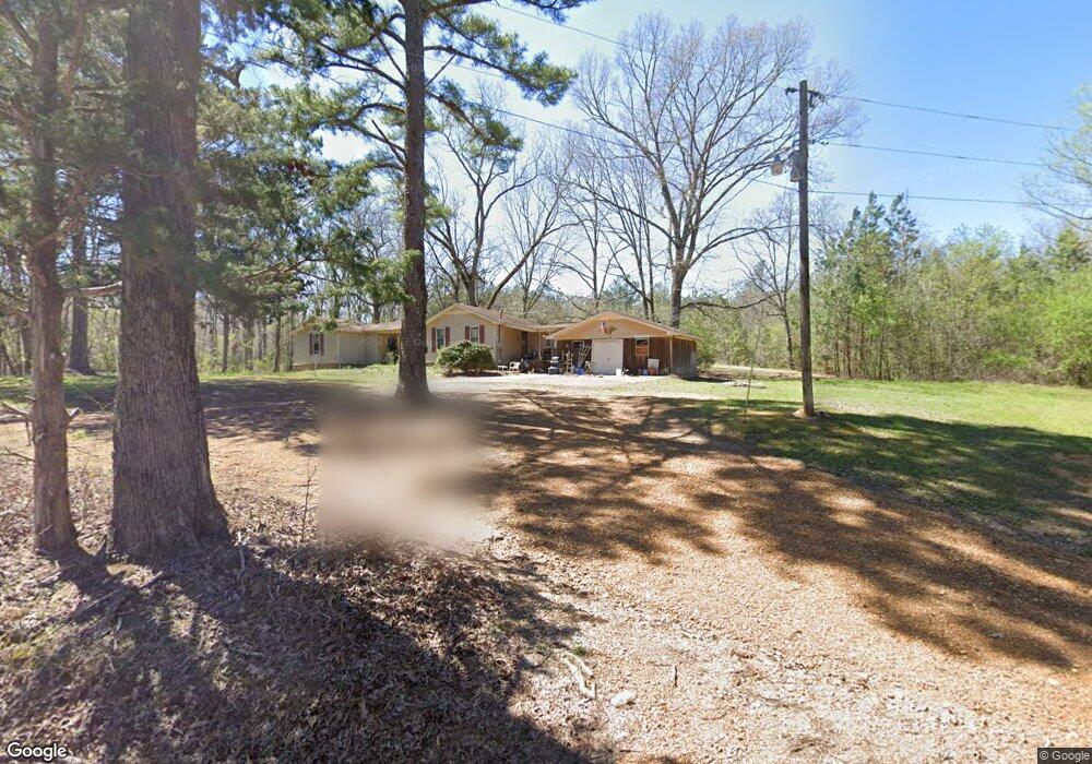
475 Coal Shute Rd Pocahontas, TN 38061
Estimated Value: $150,000 - $295,000
3
Beds
2
Baths
2,474
Sq Ft
$88/Sq Ft
Est. Value
About This Home
This home is located at 475 Coal Shute Rd, Pocahontas, TN 38061 and is currently estimated at $217,036, approximately $87 per square foot. 475 Coal Shute Rd is a home located in Hardeman County with nearby schools including Middleton Elementary School and Middleton High School.
Ownership History
Date
Name
Owned For
Owner Type
Purchase Details
Closed on
May 10, 2010
Sold by
Hsbc Mtg Svcs Inc
Bought by
Brown John W
Current Estimated Value
Purchase Details
Closed on
Jan 4, 2010
Sold by
Pipkin Ruble I
Bought by
Hsbc Mtg Svcs Inc
Purchase Details
Closed on
Jun 9, 2005
Sold by
Mccord Jerry L
Bought by
Pipkin Ruble I
Purchase Details
Closed on
Jul 16, 1976
Bought by
Mccord Jerry L and Mccord Phyllis
Purchase Details
Closed on
Jul 18, 1975
Create a Home Valuation Report for This Property
The Home Valuation Report is an in-depth analysis detailing your home's value as well as a comparison with similar homes in the area
Home Values in the Area
Average Home Value in this Area
Purchase History
| Date | Buyer | Sale Price | Title Company |
|---|---|---|---|
| Brown John W | $68,863 | -- | |
| Hsbc Mtg Svcs Inc | $59,448 | -- | |
| Pipkin Ruble I | $125,500 | -- | |
| Mccord Jerry L | -- | -- | |
| -- | -- | -- |
Source: Public Records
Tax History Compared to Growth
Tax History
| Year | Tax Paid | Tax Assessment Tax Assessment Total Assessment is a certain percentage of the fair market value that is determined by local assessors to be the total taxable value of land and additions on the property. | Land | Improvement |
|---|---|---|---|---|
| 2024 | $476 | $26,275 | $6,000 | $20,275 |
| 2023 | $584 | $26,275 | $6,000 | $20,275 |
| 2022 | $605 | $19,475 | $4,025 | $15,450 |
| 2021 | $605 | $19,475 | $4,025 | $15,450 |
| 2020 | $605 | $19,475 | $4,025 | $15,450 |
| 2019 | $605 | $19,475 | $4,025 | $15,450 |
| 2018 | $605 | $19,475 | $4,025 | $15,450 |
| 2017 | $639 | $24,600 | $4,025 | $20,575 |
| 2016 | $779 | $26,325 | $4,025 | $22,300 |
| 2015 | $671 | $26,325 | $4,025 | $22,300 |
| 2014 | $671 | $26,325 | $4,025 | $22,300 |
Source: Public Records
Map
Nearby Homes
- 3095 Buster Rd
- 0 Wolf Pen Rd
- 19760 Tennessee 57
- L1 & L2 Muddy Ridge Rd Unit L1 & L2
- 2395 Pocahontas Rd
- 0 Oscar Ln
- 822 Chandler Ln
- 7775 Pea Vine Rd
- 7675 Pea Vine Rd
- 0 Skylar Way -Kirk Loop Unit 2503988
- 0 Bass Rd
- 7000 Wolf Pen Rd
- 0 Tennessee 57
- 110 Reaves Rd
- 0 Reaves Rd Unit 10207865
- 0 Reaves Rd
- 111 Robin Cir
- 101 Winterberry Cir
- 242 Florida Ave
- 101112 Falcon Cove
- 545 Coal Shute Rd
- 1 Coal Shute Rd
- 390 Coal Shute Rd
- 440 Coal Chute Rd
- 440 Coal Shute Rd
- 675 Coal Shute Rd
- 270 Coal Shute Rd
- 225 Coal Shute Rd
- 325 Block Church Rd
- 295 Block Church Rd
- 22015 Highway 57 W
- 21995 Highway 57 W
- 21905 Hwy-57 W
- 72 Justin Way
- 40 Justin Way
- 22105 Highway 57 W
- 200 Block Church Rd
- 21635 Highway 57 W
- 320 Block Church Rd
- 1025 Coal Shute Rd