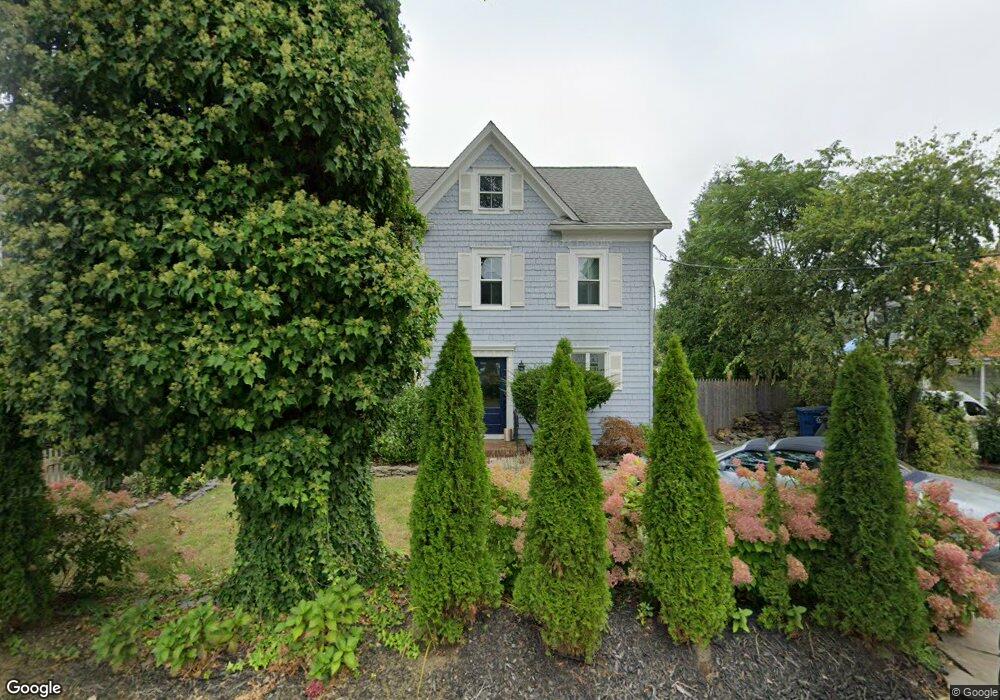
475 Locust Point Rd Rumson, NJ 07760
Locust NeighborhoodEstimated Value: $491,689 - $1,507,000
Studio
--
Bath
--
Sq Ft
3,485
Sq Ft Lot
About This Home
This home is located at 475 Locust Point Rd, Rumson, NJ 07760 and is currently estimated at $953,172. 475 Locust Point Rd is a home located in Monmouth County with nearby schools including Navesink Elementary School, Bayshore Middle School, and Middletown - South High School.
Ownership History
Date
Name
Owned For
Owner Type
Purchase Details
Closed on
Dec 3, 2007
Sold by
Boeckel Candace J and Bennett Patricia A
Bought by
Wainwright Robert
Current Estimated Value
Home Financials for this Owner
Home Financials are based on the most recent Mortgage that was taken out on this home.
Original Mortgage
$31,000
Interest Rate
5.94%
Mortgage Type
Unknown
Create a Home Valuation Report for This Property
The Home Valuation Report is an in-depth analysis detailing your home's value as well as a comparison with similar homes in the area
Home Values in the Area
Average Home Value in this Area
Purchase History
| Date | Buyer | Sale Price | Title Company |
|---|---|---|---|
| Wainwright Robert | $560,000 | None Available |
Source: Public Records
Mortgage History
| Date | Status | Borrower | Loan Amount |
|---|---|---|---|
| Closed | Wainwright Robert | $31,000 | |
| Open | Wainwright Robert | $417,000 |
Source: Public Records
Tax History
| Year | Tax Paid | Tax Assessment Tax Assessment Total Assessment is a certain percentage of the fair market value that is determined by local assessors to be the total taxable value of land and additions on the property. | Land | Improvement |
|---|---|---|---|---|
| 2025 | $2,808 | $191,400 | $157,500 | $33,900 |
| 2024 | $2,371 | $170,700 | $137,400 | $33,300 |
| 2023 | $2,371 | $136,400 | $123,400 | $13,000 |
| 2022 | $2,511 | $124,600 | $112,200 | $12,400 |
| 2021 | $2,511 | $120,700 | $109,700 | $11,000 |
| 2020 | $2,523 | $118,000 | $107,200 | $10,800 |
| 2019 | $2,490 | $117,900 | $107,200 | $10,700 |
| 2018 | $2,544 | $117,400 | $107,200 | $10,200 |
| 2017 | $2,487 | $117,100 | $107,200 | $9,900 |
| 2016 | $2,489 | $116,800 | $107,200 | $9,600 |
| 2015 | $2,491 | $116,600 | $107,200 | $9,400 |
| 2014 | $2,535 | $115,800 | $107,200 | $8,600 |
Source: Public Records
Map
Nearby Homes
- 934 Navesink River Rd
- 96 East Ave Unit 82
- 96 East Ave Unit 76
- 96 East Ave Unit 97
- 26 King James Ln
- 48 Starr Ct
- 96 E East Ave Unit 37
- 244 Van Kirk Ave
- 49 Pape Dr
- 20 Brianna Ct Unit 20
- 114 Memorial Pkwy
- 502 Central Ave
- 498 Central Ave
- 7100 Prospect Ave
- 6998 Prospect Ave
- 500 Central Ave
- 1 2nd St
- 19 Summit Ave
- 258 Ocean Blvd
- 50 Memorial Pkwy
- 475 Locust Point Rd
- 479 Locust Point Rd
- 467 Locust Point Rd
- 471 Locust Point Rd
- 201 Locust Ave
- 463 Locust Point Rd
- 491 Locust Point Rd
- 207 Locust Ave
- 211 Locust Ave
- 459 Locust Point Rd
- 458 Locust Point Rd
- 455 Locust Point Rd
- 501 Locust Point Rd
- 500 Locust Point Rd
- 474 Locust Point Rd
- 504 Locust Point Rd
- 451 Locust Point Rd
- 508 Locust Point Rd
- 509 Locust Point Rd
- 513 Locust Point Rd
Your Personal Tour Guide
Ask me questions while you tour the home.