Estimated Value: $289,000 - $453,000
Studio
--
Bath
--
Sq Ft
17,990
Sq Ft Lot
About This Home
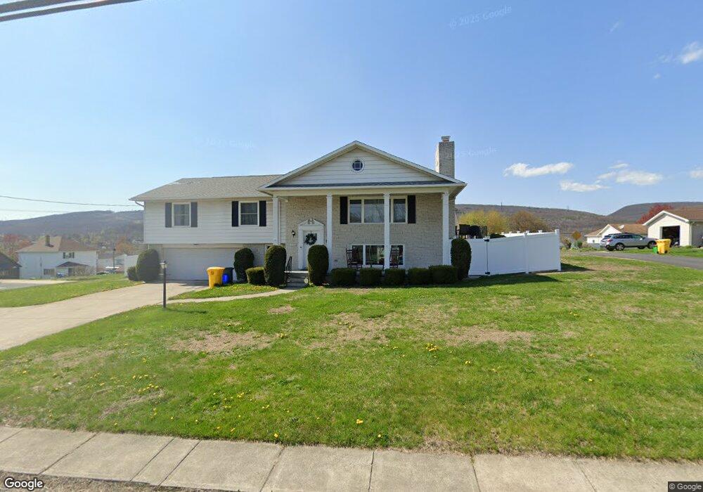
This home is located at 475 Main St, Eynon, PA 18403 and is currently estimated at $372,923. 475 Main St is a home located in Lackawanna County with nearby schools including Valley View Intermediate School, Valley View Middle School, and Valley View High School.
Ownership History
Date
Name
Owned For
Owner Type
Purchase Details
Closed on
Nov 10, 2022
Sold by
Barhight Damon R and Schneider-Sable Helena R
Bought by
Meyers Timothy and Meyers Tiffany
Current Estimated Value
Home Financials for this Owner
Home Financials are based on the most recent Mortgage that was taken out on this home.
Original Mortgage
$294,300
Outstanding Balance
$285,124
Interest Rate
6.92%
Mortgage Type
New Conventional
Estimated Equity
$87,799
Purchase Details
Closed on
Sep 8, 2020
Sold by
Rogers Ronald S and Curran Sandra Rogers
Bought by
Barhight Damon R and Schneider Sable Helena
Home Financials for this Owner
Home Financials are based on the most recent Mortgage that was taken out on this home.
Original Mortgage
$227,797
Interest Rate
2.9%
Mortgage Type
FHA
Purchase Details
Closed on
Oct 6, 2000
Bought by
Rogers Ronald S
Create a Home Valuation Report for This Property
The Home Valuation Report is an in-depth analysis detailing your home's value as well as a comparison with similar homes in the area
Home Values in the Area
Average Home Value in this Area
Purchase History
| Date | Buyer | Sale Price | Title Company |
|---|---|---|---|
| Meyers Timothy | $327,000 | None Listed On Document | |
| Barhight Damon R | $232,000 | None Available | |
| Rogers Ronald S | $180,000 | -- |
Source: Public Records
Mortgage History
| Date | Status | Borrower | Loan Amount |
|---|---|---|---|
| Open | Meyers Timothy | $294,300 | |
| Previous Owner | Barhight Damon R | $227,797 |
Source: Public Records
Tax History
| Year | Tax Paid | Tax Assessment Tax Assessment Total Assessment is a certain percentage of the fair market value that is determined by local assessors to be the total taxable value of land and additions on the property. | Land | Improvement |
|---|---|---|---|---|
| 2025 | $5,145 | $20,000 | $6,000 | $14,000 |
| 2024 | $4,414 | $20,000 | $6,000 | $14,000 |
| 2023 | $4,414 | $20,000 | $6,000 | $14,000 |
| 2022 | $4,276 | $20,000 | $6,000 | $14,000 |
| 2021 | $4,266 | $20,000 | $6,000 | $14,000 |
| 2020 | $4,186 | $20,000 | $0 | $20,000 |
| 2019 | $3,883 | $20,000 | $0 | $20,000 |
| 2018 | $3,813 | $20,000 | $0 | $20,000 |
| 2017 | $3,793 | $20,000 | $0 | $20,000 |
| 2016 | $2,051 | $20,000 | $0 | $0 |
| 2015 | -- | $20,000 | $0 | $0 |
| 2014 | -- | $20,000 | $0 | $0 |
Source: Public Records
Map
Nearby Homes
- 357 2nd St
- 136 East St
- 313 Betty St
- 0 Celli Dr
- 361 Scr Carbondale Hwy
- 446 Kennedy Dr
- 815 Oak St
- 0 Tenley Ln
- 0 Lower Celli Dr (Lot 41)
- 233 Shadow Wood Cir
- 1000 Scranton Cdale
- 426 Wildcat (Rt 247) Rd
- 1008 Lucas Dr
- 0 Wildcat Rd
- 409 Jenna Kay Dr
- 107 Daystrom Ave
- 0 Lower Celli Dr (Lot 48)
- 0 Jamie (Lot 21) Dr Unit GSBSC3063
- 0 Dr Unit GSBSC3064
- 344 Shadow Wood Cir
Your Personal Tour Guide
Ask me questions while you tour the home.