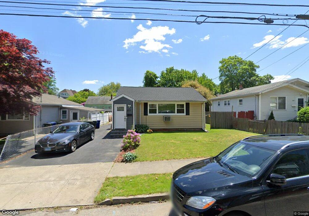
475 Merritt St Bridgeport, CT 06606
North End NeighborhoodEstimated Value: $355,000 - $380,676
3
Beds
1
Bath
1,076
Sq Ft
$345/Sq Ft
Est. Value
About This Home
This home is located at 475 Merritt St, Bridgeport, CT 06606 and is currently estimated at $371,419, approximately $345 per square foot. 475 Merritt St is a home located in Fairfield County with nearby schools including Blackham School, Central High School, and St Andrew School.
Ownership History
Date
Name
Owned For
Owner Type
Purchase Details
Closed on
Jan 7, 2002
Sold by
Dewitt Smith Jane Est
Bought by
Jadadlc Meliha
Current Estimated Value
Home Financials for this Owner
Home Financials are based on the most recent Mortgage that was taken out on this home.
Original Mortgage
$109,137
Outstanding Balance
$37,815
Interest Rate
6.72%
Estimated Equity
$333,604
Purchase Details
Closed on
Jan 7, 1994
Sold by
Fejes Louis and Fejes Barbara
Bought by
Smith William and Smith Jane
Home Financials for this Owner
Home Financials are based on the most recent Mortgage that was taken out on this home.
Original Mortgage
$64,240
Interest Rate
7.23%
Mortgage Type
Unknown
Create a Home Valuation Report for This Property
The Home Valuation Report is an in-depth analysis detailing your home's value as well as a comparison with similar homes in the area
Home Values in the Area
Average Home Value in this Area
Purchase History
| Date | Buyer | Sale Price | Title Company |
|---|---|---|---|
| Jadadlc Meliha | $110,000 | -- | |
| Jadadlc Meliha | $110,000 | -- | |
| Smith William | $87,000 | -- | |
| Smith William | $87,000 | -- |
Source: Public Records
Mortgage History
| Date | Status | Borrower | Loan Amount |
|---|---|---|---|
| Open | Smith William | $109,137 | |
| Closed | Smith William | $109,137 | |
| Previous Owner | Smith William | $64,240 |
Source: Public Records
Tax History Compared to Growth
Tax History
| Year | Tax Paid | Tax Assessment Tax Assessment Total Assessment is a certain percentage of the fair market value that is determined by local assessors to be the total taxable value of land and additions on the property. | Land | Improvement |
|---|---|---|---|---|
| 2025 | $6,224 | $143,250 | $75,310 | $67,940 |
| 2024 | $6,224 | $143,250 | $75,310 | $67,940 |
| 2023 | $6,224 | $143,250 | $75,310 | $67,940 |
| 2022 | $6,224 | $143,250 | $75,310 | $67,940 |
| 2021 | $6,224 | $143,250 | $75,310 | $67,940 |
| 2020 | $5,472 | $101,360 | $43,270 | $58,090 |
| 2019 | $5,472 | $101,360 | $43,270 | $58,090 |
| 2018 | $5,511 | $101,360 | $43,270 | $58,090 |
| 2017 | $5,511 | $101,360 | $43,270 | $58,090 |
| 2016 | $5,511 | $101,360 | $43,270 | $58,090 |
| 2015 | $5,716 | $135,440 | $49,980 | $85,460 |
| 2014 | $5,716 | $135,440 | $49,980 | $85,460 |
Source: Public Records
Map
Nearby Homes
- 375 Ruth St
- 604 Birmingham St
- 605 Merritt St
- 339 Goldenrod Ave
- 38 Enid St Unit B
- 720 Queen St
- 214 Burnsford Ave
- 495 Peet St
- 184 Merritt St
- 2346 Madison Ave
- 81 Ameridge Dr
- 260 Birmingham St
- 245 Glendale Ave Unit D8
- 783 Clark St
- 1095 Wayne St
- 520 Savoy St
- 113 Clark St
- 69 Plankton St
- 376 Savoy St
- 932 Thorme St
- 485 Merritt St
- 465 Merritt St
- 495 Merritt St
- 476 Burnsford Ave
- 455 Merritt St
- 466 Burnsford Ave
- 486 Burnsford Ave
- 464 Merritt St Unit 466
- 476 Merritt St Unit 2
- 476 Merritt St
- 484 Merritt St Unit 486
- 496 Burnsford Ave
- 474 Merritt St Unit 476
- 474 Merritt St Unit 1
- 474- Merritt St
- 456 Burnsford Ave
- 486 Merritt St
- 505 Merritt St
- 494 Merritt St Unit 496
- 494 Merritt St Unit 1