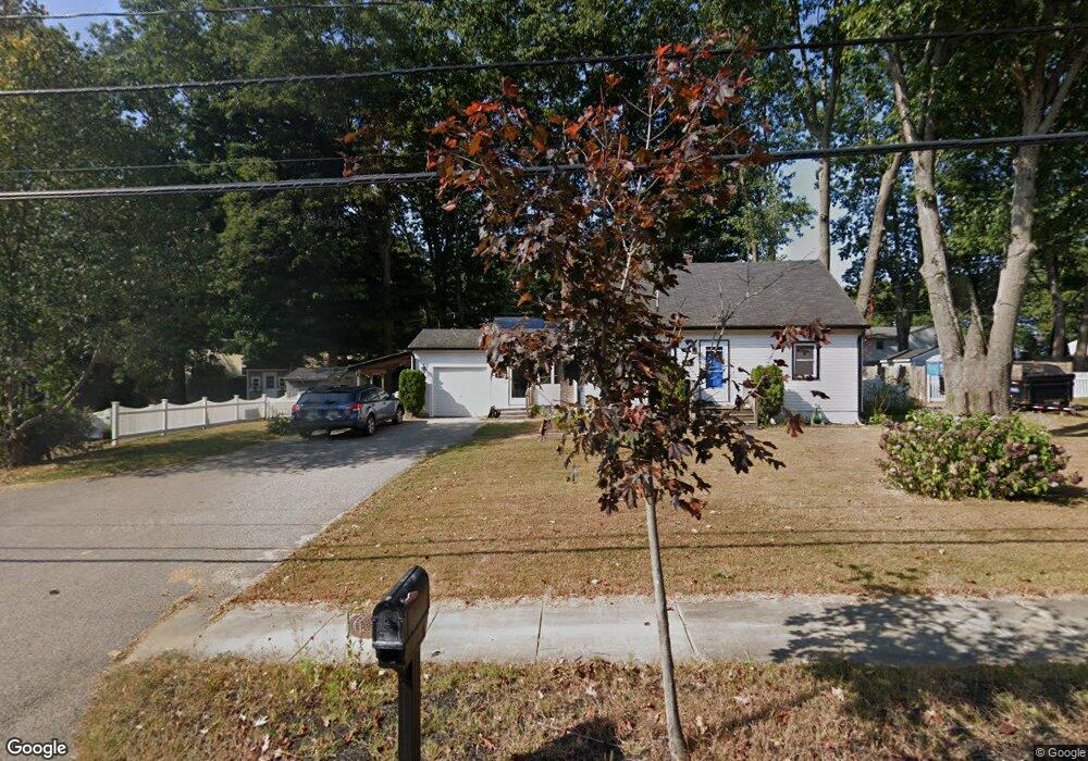
475 Ocean Rd Portsmouth, NH 03801
Estimated Value: $594,253 - $675,000
3
Beds
2
Baths
1,484
Sq Ft
$427/Sq Ft
Est. Value
About This Home
This home is located at 475 Ocean Rd, Portsmouth, NH 03801 and is currently estimated at $633,563, approximately $426 per square foot. 475 Ocean Rd is a home located in Rockingham County with nearby schools including Mary C. Dondero Elementary School, Portsmouth Middle School, and Portsmouth High School.
Ownership History
Date
Name
Owned For
Owner Type
Purchase Details
Closed on
Aug 31, 2012
Sold by
Delcourt David W and Delcourt Bonnie F
Bought by
Smith Michael W
Current Estimated Value
Purchase Details
Closed on
Jun 20, 1997
Sold by
Pitts Fordie H
Bought by
Delcourt David W and Delcourt Bonnie F
Home Financials for this Owner
Home Financials are based on the most recent Mortgage that was taken out on this home.
Original Mortgage
$115,100
Interest Rate
7.87%
Mortgage Type
Purchase Money Mortgage
Create a Home Valuation Report for This Property
The Home Valuation Report is an in-depth analysis detailing your home's value as well as a comparison with similar homes in the area
Home Values in the Area
Average Home Value in this Area
Purchase History
| Date | Buyer | Sale Price | Title Company |
|---|---|---|---|
| Smith Michael W | $255,000 | -- | |
| Smith Michael W | $255,000 | -- | |
| Delcourt David W | $116,500 | -- | |
| Delcourt David W | $116,500 | -- |
Source: Public Records
Mortgage History
| Date | Status | Borrower | Loan Amount |
|---|---|---|---|
| Previous Owner | Delcourt David W | $228,000 | |
| Previous Owner | Delcourt David W | $115,100 | |
| Closed | Delcourt David W | $0 |
Source: Public Records
Tax History Compared to Growth
Tax History
| Year | Tax Paid | Tax Assessment Tax Assessment Total Assessment is a certain percentage of the fair market value that is determined by local assessors to be the total taxable value of land and additions on the property. | Land | Improvement |
|---|---|---|---|---|
| 2024 | $5,780 | $517,000 | $219,100 | $297,900 |
| 2023 | $5,179 | $321,100 | $124,200 | $196,900 |
| 2022 | $4,881 | $321,100 | $124,200 | $196,900 |
| 2021 | $4,826 | $321,100 | $124,200 | $196,900 |
| 2020 | $4,694 | $319,300 | $124,200 | $195,100 |
| 2019 | $4,745 | $319,300 | $124,200 | $195,100 |
| 2018 | $4,877 | $307,900 | $132,800 | $175,100 |
| 2017 | $4,736 | $307,900 | $132,800 | $175,100 |
| 2016 | $4,371 | $256,500 | $103,700 | $152,800 |
| 2015 | $4,307 | $256,500 | $103,700 | $152,800 |
| 2014 | $4,433 | $244,900 | $112,500 | $132,400 |
| 2013 | $4,386 | $244,900 | $112,500 | $132,400 |
| 2012 | $4,208 | $239,800 | $112,500 | $127,300 |
Source: Public Records
Map
Nearby Homes
- 540 Ocean Rd
- 445 Ocean Rd Unit 4
- 380 Ocean Rd Unit 9
- 26 Mariette Dr
- 163 Ocean Rd
- Unit 31 Summerwind Place Unit 31
- Unit 13 Summerwind Place Unit 13
- 60 Ocean Rd
- Unit 15 Summerwind Place Unit 15
- 16 Summerwind Place Unit 16
- Unit 3 Summerwind Place Unit 3
- Unit 1 Summerwind Place Unit 1
- Unit 25 Summerwind Place Unit 25
- 115 Bluefish Blvd
- 103 Bluefish Blvd
- 315 Salmon Ave
- 204 Mackerel Ave
- 80 Constitution Ave Unit 225
- 80 Constitution Ave Unit 231
- 80 Constitution Ave Unit 321
- 485 Ocean Rd
- 146 Martha Terrace
- 166 Martha Terrace
- 126 Martha Terrace
- 487 Ocean Rd
- 469 Ocean Rd
- 480 Ocean Rd
- 104 Martha Terrace
- 186 Martha Terrace
- 147 Martha Terrace
- 127 Martha Terrace
- 169 Martha Terrace
- 489 Ocean Rd
- 455 Ocean Rd
- 102 Martha Terrace
- 206 Martha Terrace
- 1061 Banfield Rd
- 189 Martha Terrace
- 107 Martha Terrace
- 0 Patricia Dr