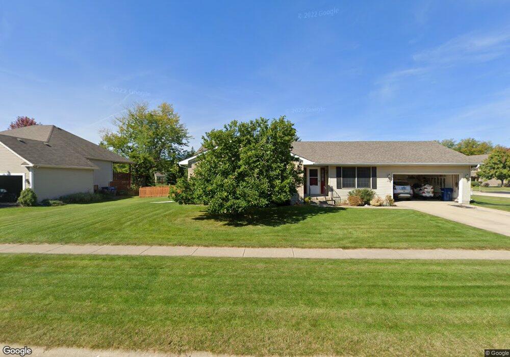
475 Red Wing Ln Dekalb, IL 60115
Estimated Value: $254,000 - $366,000
3
Beds
2
Baths
--
Sq Ft
9,148
Sq Ft Lot
About This Home
This home is located at 475 Red Wing Ln, Dekalb, IL 60115 and is currently estimated at $310,921. 475 Red Wing Ln is a home located in DeKalb County with nearby schools including Gwendolyn Brooks Elementary School, Clinton Rosette Middle School, and De Kalb High School.
Ownership History
Date
Name
Owned For
Owner Type
Purchase Details
Closed on
May 16, 2008
Sold by
Truckenbrod Brett L
Bought by
Schramer Wayne A and Schramer Yvonne M
Current Estimated Value
Home Financials for this Owner
Home Financials are based on the most recent Mortgage that was taken out on this home.
Original Mortgage
$152,250
Outstanding Balance
$96,671
Interest Rate
5.93%
Mortgage Type
New Conventional
Estimated Equity
$214,250
Create a Home Valuation Report for This Property
The Home Valuation Report is an in-depth analysis detailing your home's value as well as a comparison with similar homes in the area
Home Values in the Area
Average Home Value in this Area
Purchase History
| Date | Buyer | Sale Price | Title Company |
|---|---|---|---|
| Schramer Wayne A | $203,000 | -- |
Source: Public Records
Mortgage History
| Date | Status | Borrower | Loan Amount |
|---|---|---|---|
| Open | Schramer Wayne A | $152,250 |
Source: Public Records
Tax History
| Year | Tax Paid | Tax Assessment Tax Assessment Total Assessment is a certain percentage of the fair market value that is determined by local assessors to be the total taxable value of land and additions on the property. | Land | Improvement |
|---|---|---|---|---|
| 2024 | $5,871 | $84,145 | $9,785 | $74,360 |
| 2023 | $5,658 | $73,368 | $8,532 | $64,836 |
| 2022 | $5,658 | $66,985 | $9,738 | $57,247 |
| 2021 | $5,735 | $62,826 | $9,133 | $53,693 |
| 2020 | $5,844 | $61,824 | $8,987 | $52,837 |
| 2019 | $5,679 | $59,395 | $8,634 | $50,761 |
| 2018 | $5,501 | $57,381 | $8,341 | $49,040 |
| 2017 | $5,500 | $55,158 | $8,018 | $47,140 |
| 2016 | $5,404 | $53,766 | $7,816 | $45,950 |
| 2015 | -- | $50,944 | $7,406 | $43,538 |
| 2014 | -- | $53,669 | $15,781 | $37,888 |
| 2013 | -- | $56,375 | $16,577 | $39,798 |
Source: Public Records
Map
Nearby Homes
- 3051 Fairway Oaks Dr
- 2405 Glen Cir E
- 2315 Hickory Ln
- 102 Quinlan Ave
- 151 Quinlan Ave
- 2708 Greenwood Acres Dr
- 3160 Covered Bridge Ln
- 295 Larking Ave
- Lot 7 Aberdeen Ct
- Lot 104 Aberdeen Ct
- TBD Greenwood Acres Dr
- 368 Kingsbury Dr
- 1827 Kerrybrook Ct Unit 427
- 1827 Kerrybrook Ct Unit 441
- 700-900 Ridge Dr
- 3428 Comstock Ave
- 1506 Kennicott Ct Unit 632
- 1804 Raintree Ct Unit 42
- 3389 Comstock Ave
- 487 Quinlan Ave
- 3311 Meadow Trail E
- 467 Red Wing Ln
- 3327 Meadow Trail E
- 476 Red Wing Ln
- 3300 Meadow Trail E
- 459 Red Wing Ln
- 470 Red Wing Ln
- 3308 Meadow Trail E
- 464 Red Wing Ln
- 3284 Meadow Trail E
- 3312 Meadow Trail E
- 453 Red Wing Ln
- 3341 Meadow Trail E
- 458 Red Wing Ln
- 3255 Meadow Trail E
- 3324 Meadow Trail E
- 452 Red Wing Ln
- 3340 Meadow Trail W
- 439 Red Wing Ln
- 3336 Meadow Trail E
Your Personal Tour Guide
Ask me questions while you tour the home.