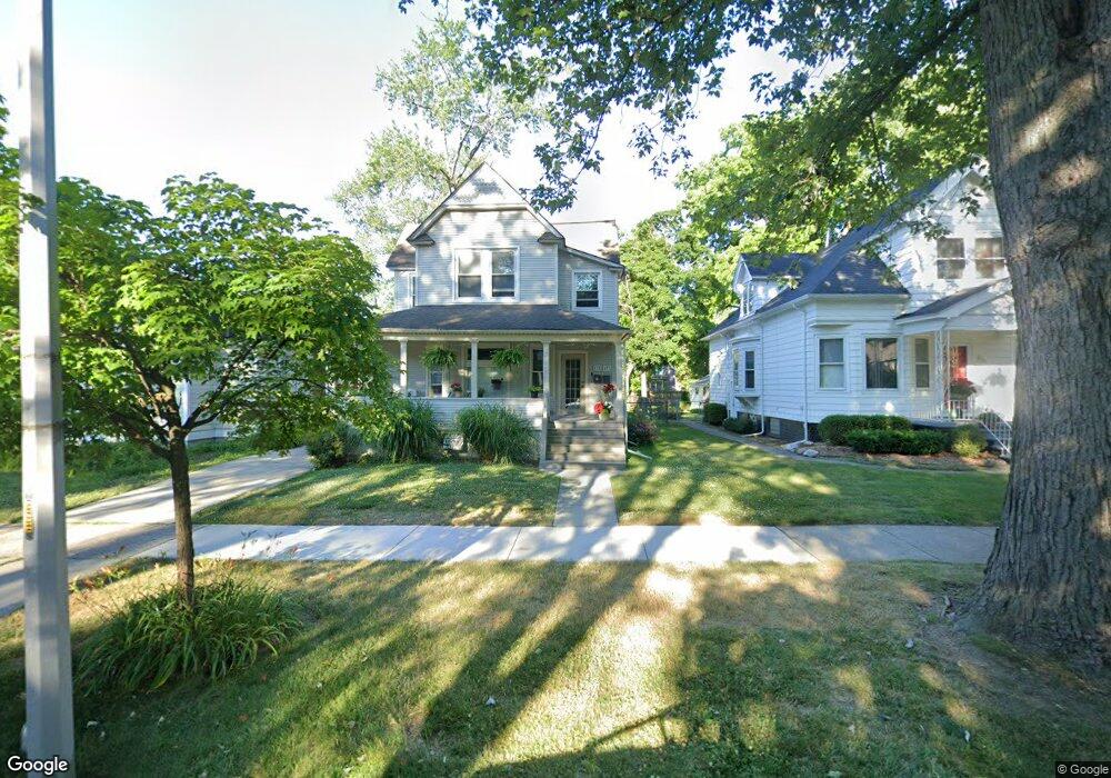
475 Saint Clair St Grosse Pointe, MI 48230
Estimated Value: $407,000 - $547,000
2
Beds
2
Baths
2,985
Sq Ft
$151/Sq Ft
Est. Value
About This Home
This home is located at 475 Saint Clair St, Grosse Pointe, MI 48230 and is currently estimated at $451,151, approximately $151 per square foot. 475 Saint Clair St is a home located in Wayne County with nearby schools including Lewis Maire Elementary School, Pierce Middle School, and Grosse Pointe South High School.
Ownership History
Date
Name
Owned For
Owner Type
Purchase Details
Closed on
Nov 21, 2017
Sold by
Allen Christine
Bought by
Allen Richard
Current Estimated Value
Purchase Details
Closed on
Feb 24, 2016
Sold by
King Penguin Properties Llc
Bought by
Allen Richard
Purchase Details
Closed on
Dec 26, 2006
Sold by
Mikelic Michael and Mikelic Olga
Bought by
King Penguin Properties Llc
Purchase Details
Closed on
Dec 15, 2006
Sold by
Hurley John C and Hurley Melissa Mae
Bought by
Mikelic Michael
Create a Home Valuation Report for This Property
The Home Valuation Report is an in-depth analysis detailing your home's value as well as a comparison with similar homes in the area
Home Values in the Area
Average Home Value in this Area
Purchase History
| Date | Buyer | Sale Price | Title Company |
|---|---|---|---|
| Allen Richard | -- | None Available | |
| Allen Richard | -- | None Available | |
| Allen Richard | $232,500 | Greco Title Agency Llc | |
| King Penguin Properties Llc | -- | None Available | |
| Mikelic Michael | $172,500 | Metropolitan Title Company |
Source: Public Records
Tax History
| Year | Tax Paid | Tax Assessment Tax Assessment Total Assessment is a certain percentage of the fair market value that is determined by local assessors to be the total taxable value of land and additions on the property. | Land | Improvement |
|---|---|---|---|---|
| 2025 | $4,511 | $179,600 | $0 | $0 |
| 2024 | $4,359 | $173,800 | $0 | $0 |
| 2023 | $4,157 | $169,000 | $0 | $0 |
| 2022 | $7,620 | $155,000 | $0 | $0 |
| 2021 | $7,419 | $145,400 | $0 | $0 |
| 2019 | $7,302 | $121,500 | $0 | $0 |
| 2018 | $3,608 | $104,400 | $0 | $0 |
| 2017 | $6,280 | $103,300 | $0 | $0 |
| 2016 | $4,545 | $98,300 | $0 | $0 |
| 2015 | $7,078 | $90,600 | $0 | $0 |
| 2013 | $6,857 | $78,200 | $0 | $0 |
| 2012 | -- | $71,700 | $0 | $0 |
Source: Public Records
Map
Nearby Homes
- 42 Cranford Ln
- 47 Cranford Ln
- 43 Cranford Ln
- 30 Cranford Ln
- 25 Village Ln
- 386 Notre Dame St
- 497 Neff Rd
- 516 Neff Ln
- 379 Lakeland St
- 1030 Bishop Rd
- 612 Cadieux Rd
- 320 Neff Rd
- 16761 E Jefferson Ave
- 10 Sycamore Ln
- 345 Roosevelt Place
- 296 Rivard Blvd
- 355 Lincoln Rd
- 277 Lincoln Rd
- 760 Loraine St
- 1264 Bishop Rd
- 475 Saint Clair St
- 17015 Maumee Ave
- 469 Saint Clair St
- 469 St Clair
- 502 Notre Dame St
- 479 Saint Clair St
- 508 Notre Dame St
- 508 Notre Dame St
- 485 Saint Clair St
- 17020 Maumee Ave
- 510 Notre Dame St
- 17006 Maumee Ave
- 453 Saint Clair St
- 453 St Clair
- 17030 Maumee Ave
- 489 Saint Clair St
- 17000 Maumee Ave
- 516 Notre Dame St
- 480 Notre Dame St Unit Bldg-Unit
- 480 Notre Dame St
Your Personal Tour Guide
Ask me questions while you tour the home.