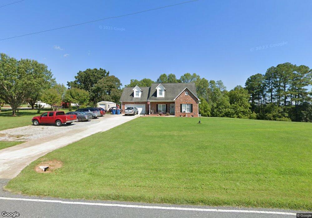
4752 Rifle Range Rd Conover, NC 28613
Estimated Value: $368,938 - $404,000
3
Beds
3
Baths
1,704
Sq Ft
$225/Sq Ft
Est. Value
About This Home
This home is located at 4752 Rifle Range Rd, Conover, NC 28613 and is currently estimated at $384,235, approximately $225 per square foot. 4752 Rifle Range Rd is a home located in Catawba County with nearby schools including Lyle Creek Elementary School, River Bend Middle School, and Bunker Hill High School.
Ownership History
Date
Name
Owned For
Owner Type
Purchase Details
Closed on
Jul 26, 2007
Sold by
Proffitt Richard Brian and Proffitt Tina M
Bought by
Kinard William R and Kinard Suzanne
Current Estimated Value
Purchase Details
Closed on
Apr 28, 2005
Sold by
Smart Eric Jason and Smart Casey L
Bought by
Proffit Richard Brian and Proffit Tina M
Home Financials for this Owner
Home Financials are based on the most recent Mortgage that was taken out on this home.
Original Mortgage
$146,640
Interest Rate
5.88%
Mortgage Type
Fannie Mae Freddie Mac
Purchase Details
Closed on
Feb 28, 2003
Purchase Details
Closed on
Jul 25, 2000
Purchase Details
Closed on
Jul 23, 1999
Create a Home Valuation Report for This Property
The Home Valuation Report is an in-depth analysis detailing your home's value as well as a comparison with similar homes in the area
Home Values in the Area
Average Home Value in this Area
Purchase History
| Date | Buyer | Sale Price | Title Company |
|---|---|---|---|
| Kinard William R | $207,000 | None Available | |
| Proffit Richard Brian | $183,500 | None Available | |
| -- | $175,000 | -- | |
| -- | $176,500 | -- | |
| -- | $8,600 | -- |
Source: Public Records
Mortgage History
| Date | Status | Borrower | Loan Amount |
|---|---|---|---|
| Previous Owner | Proffit Richard Brian | $146,640 |
Source: Public Records
Tax History
| Year | Tax Paid | Tax Assessment Tax Assessment Total Assessment is a certain percentage of the fair market value that is determined by local assessors to be the total taxable value of land and additions on the property. | Land | Improvement |
|---|---|---|---|---|
| 2025 | $1,790 | $317,300 | $17,900 | $299,400 |
| 2024 | $1,780 | $317,300 | $17,900 | $299,400 |
| 2023 | $812 | $219,900 | $17,900 | $202,000 |
| 2022 | $1,528 | $219,900 | $17,900 | $202,000 |
| 2021 | $1,528 | $219,900 | $17,900 | $202,000 |
| 2020 | $1,528 | $219,900 | $17,900 | $202,000 |
| 2019 | $1,528 | $219,900 | $0 | $0 |
| 2018 | $1,316 | $189,400 | $17,800 | $171,600 |
| 2017 | $1,316 | $0 | $0 | $0 |
| 2016 | $1,316 | $0 | $0 | $0 |
| 2015 | $1,388 | $189,400 | $17,800 | $171,600 |
| 2014 | $1,121 | $186,800 | $20,400 | $166,400 |
Source: Public Records
Map
Nearby Homes
- 5069 W Piedmont Cir
- 1158 Sunset Ct
- 4874 Stone Dr Unit 125
- 1371 Millrace Dr
- 4932 Sandstone Dr
- 1252 Houston Mill Rd
- 1113 Pecan St
- 5164 Lavern St Unit 1
- 4484 Springs Rd
- 4267 County Home Rd
- 4531 Springs Rd
- 5309 Hall St
- 4687 Ransom Dr
- 1581 Floyd Baker Rd
- 5217 Canterbury Dr
- 4829 County Home Rd
- 4051 Plum St
- 4120 Village Blvd NW
- 3951 Springs Rd
- 5505 Creek Point Dr
- 4770 Powder Horne Ln
- 4734 Rifle Range Rd
- 4760 Rifle Range Rd
- 4762 Powder Horne Ln
- 4755 Rifle Range Rd
- 4750 Powder Horne Ln
- 4766 Rifle Range Rd
- 4722 Rifle Range Rd
- 4738 Powder Horne Ln
- 4728 Musket Way
- 4776 Rifle Range Rd
- 4763 Rifle Range Rd
- 4721 Rifle Range Rd
- 4736 Musket Way
- 4730 Powder Horne Ln
- 4730 Powderhorn Ln
- 4786 Rifle Range Rd
- 4752 Musket Way
- 4735 Rifle Range Rd
- 4727 Musket Way
Your Personal Tour Guide
Ask me questions while you tour the home.