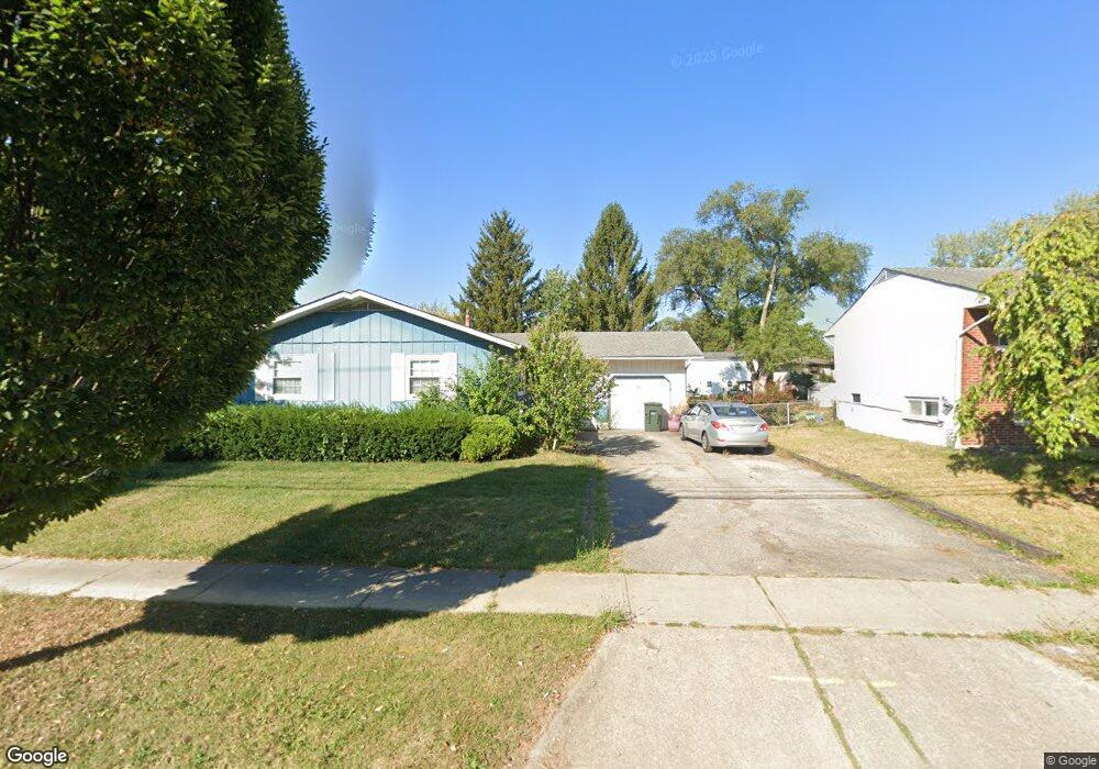
4753 Karl Rd Columbus, OH 43229
Woodward Park NeighborhoodEstimated Value: $265,000 - $276,000
3
Beds
2
Baths
1,261
Sq Ft
$214/Sq Ft
Est. Value
About This Home
This home is located at 4753 Karl Rd, Columbus, OH 43229 and is currently estimated at $269,428, approximately $213 per square foot. 4753 Karl Rd is a home located in Franklin County with nearby schools including Valley Forge Elementary School, Woodward Park Middle School, and Northland High School.
Ownership History
Date
Name
Owned For
Owner Type
Purchase Details
Closed on
Dec 15, 2020
Sold by
Estate Of Rosie L Smith
Bought by
Smith Obie R
Current Estimated Value
Purchase Details
Closed on
Jan 9, 1997
Sold by
Madeline D'Andrea Trst
Bought by
Smith Obie R and Smith Rosie L
Home Financials for this Owner
Home Financials are based on the most recent Mortgage that was taken out on this home.
Original Mortgage
$79,141
Interest Rate
7.58%
Mortgage Type
FHA
Purchase Details
Closed on
Feb 9, 1988
Create a Home Valuation Report for This Property
The Home Valuation Report is an in-depth analysis detailing your home's value as well as a comparison with similar homes in the area
Home Values in the Area
Average Home Value in this Area
Purchase History
| Date | Buyer | Sale Price | Title Company |
|---|---|---|---|
| Smith Obie R | -- | None Available | |
| Smith Obie R | $81,000 | -- | |
| -- | -- | -- |
Source: Public Records
Mortgage History
| Date | Status | Borrower | Loan Amount |
|---|---|---|---|
| Previous Owner | Smith Obie R | $79,141 |
Source: Public Records
Tax History
| Year | Tax Paid | Tax Assessment Tax Assessment Total Assessment is a certain percentage of the fair market value that is determined by local assessors to be the total taxable value of land and additions on the property. | Land | Improvement |
|---|---|---|---|---|
| 2025 | $3,851 | $84,040 | $22,610 | $61,430 |
| 2024 | $3,851 | $84,040 | $22,610 | $61,430 |
| 2023 | $3,803 | $84,035 | $22,610 | $61,425 |
| 2022 | $2,567 | $48,310 | $12,640 | $35,670 |
| 2021 | $2,055 | $48,310 | $12,640 | $35,670 |
| 2020 | $2,058 | $48,310 | $12,640 | $35,670 |
| 2019 | $1,776 | $38,020 | $10,120 | $27,900 |
| 2018 | $1,619 | $38,020 | $10,120 | $27,900 |
| 2017 | $1,694 | $38,020 | $10,120 | $27,900 |
| 2016 | $1,614 | $33,120 | $8,370 | $24,750 |
| 2015 | $1,465 | $33,120 | $8,370 | $24,750 |
| 2014 | $1,469 | $33,120 | $8,370 | $24,750 |
| 2013 | $776 | $34,860 | $8,820 | $26,040 |
Source: Public Records
Map
Nearby Homes
- 4795 Colonel Perry Dr
- 4800 Bourke Rd
- 4815 Bourke Rd
- 1451 Merton Dr
- 4827 Glendon Rd
- 1414 Alvina Dr
- 4923 Karl Rd Unit 4925
- 1637 Nestling Dr Unit 639
- 1485 Norma Rd
- 5004 Julie Place
- 5008 Sienna Ln
- 4857 Tamarack Blvd
- 1705 Ivyhill Loop S
- 4455 Kenfield Rd
- 4904 Almont Dr
- 4983 Almont Dr
- 1116 Tulsa Dr
- 1905 Denise Dr
- 4714 Ascot Dr
- 5231 Arrowood Ct
- 4761 Karl Rd
- 4745 Karl Rd
- 4737 Karl Rd
- 4771 Karl Rd
- 4760 Colonel Perry Dr
- 4770 Colonel Perry Dr
- 4752 Colonel Perry Dr
- 4779 Karl Rd
- 4744 Colonel Perry Dr
- 4778 Colonel Perry Dr
- 4723 Karl Rd
- 1540 Merton Dr
- 4786 Colonel Perry Dr
- 1530 Merton Dr
- 4787 Karl Rd
- 1576 Merton Dr
- 1570 Merton Dr
- 1582 Merton Dr
- 1588 Merton Dr
- 1594 Merton Dr
Your Personal Tour Guide
Ask me questions while you tour the home.