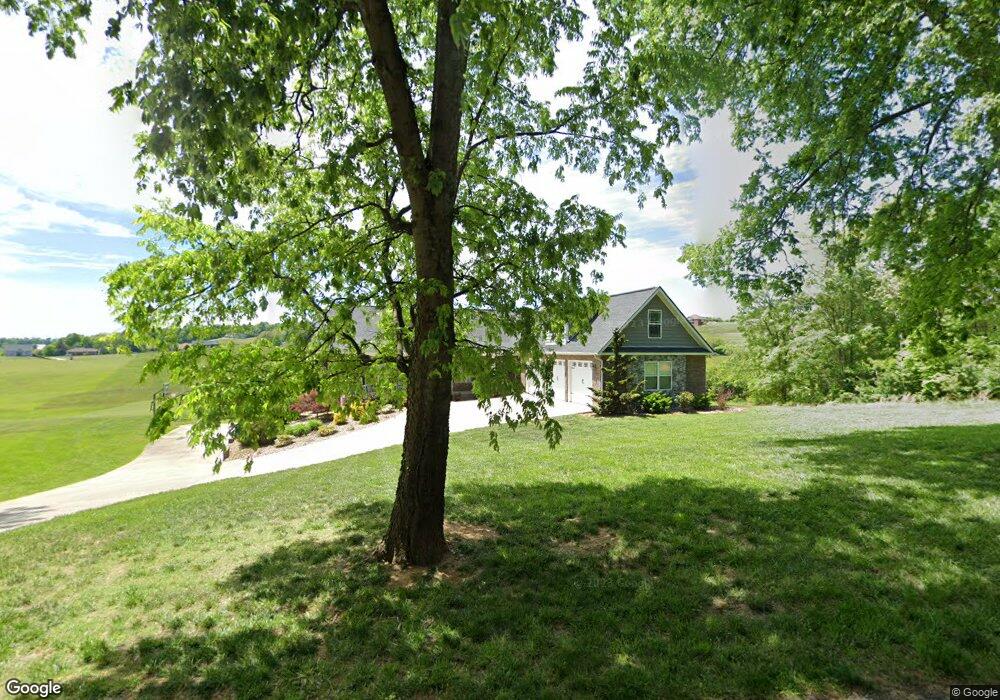
4758 Southfork Cir Morristown, TN 37813
Estimated Value: $562,000 - $1,034,000
3
Beds
5
Baths
3,376
Sq Ft
$244/Sq Ft
Est. Value
About This Home
This home is located at 4758 Southfork Cir, Morristown, TN 37813 and is currently estimated at $823,803, approximately $244 per square foot. 4758 Southfork Cir is a home with nearby schools including Union Heights Elementary School, East Ridge Middle School, and Morristown East High School.
Ownership History
Date
Name
Owned For
Owner Type
Purchase Details
Closed on
Aug 24, 2015
Sold by
Keith Ely John and King Deborah
Bought by
Keith Ely John and King Deborah
Current Estimated Value
Purchase Details
Closed on
Oct 15, 2014
Sold by
Keith Ely John and King Deborah
Bought by
Keith Ely John and King Deborah
Purchase Details
Closed on
Apr 12, 2013
Sold by
Lane Roy and Lane Ida F
Bought by
Keith Ely John and King Deborah
Purchase Details
Closed on
Dec 7, 2007
Sold by
Lane Roy and Lane Ida F
Bought by
Lane Roy and Lane Ida F
Purchase Details
Closed on
Feb 1, 1994
Sold by
Lane Roy and Lane Ida F
Bought by
Lane Roy and Lane Ida F
Purchase Details
Closed on
Feb 26, 1993
Sold by
Lane Roy and Lane Ida F
Bought by
Lane Roy and Lane Ida F
Purchase Details
Closed on
Oct 20, 1992
Sold by
Lane Roy and Lane Ida F
Bought by
Lane Roy and Lane Ida F
Purchase Details
Closed on
Jul 3, 1991
Sold by
Lane Roy and Lane Ida F
Bought by
Lane Roy and Lane Ida F
Purchase Details
Closed on
Feb 9, 1991
Sold by
Lane Roy and Lane Ida F
Bought by
Lane Roy and Lane Ida F
Purchase Details
Closed on
Apr 29, 1943
Sold by
Lane Roy and Lane Ida F
Bought by
Lane Roy and Lane Ida F
Create a Home Valuation Report for This Property
The Home Valuation Report is an in-depth analysis detailing your home's value as well as a comparison with similar homes in the area
Home Values in the Area
Average Home Value in this Area
Purchase History
| Date | Buyer | Sale Price | Title Company |
|---|---|---|---|
| Keith Ely John | $18,000 | -- | |
| Ely John Keith | $18,018 | -- | |
| Keith Ely John | $39,300 | -- | |
| Keith Ely John | $25,000 | -- | |
| Lane Roy | -- | -- | |
| Lane Roy | $60,100 | -- | |
| Lane Roy | -- | -- | |
| Lane Roy | $128,000 | -- | |
| Lane Roy | $128,000 | -- | |
| Lane Roy | -- | -- | |
| Lane Roy | -- | -- |
Source: Public Records
Tax History Compared to Growth
Tax History
| Year | Tax Paid | Tax Assessment Tax Assessment Total Assessment is a certain percentage of the fair market value that is determined by local assessors to be the total taxable value of land and additions on the property. | Land | Improvement |
|---|---|---|---|---|
| 2024 | $2,503 | $127,075 | $17,900 | $109,175 |
| 2023 | $2,503 | $127,075 | $0 | $0 |
| 2022 | $2,503 | $127,075 | $17,900 | $109,175 |
| 2021 | $2,503 | $127,075 | $17,900 | $109,175 |
| 2020 | $2,503 | $127,075 | $17,900 | $109,175 |
| 2019 | $2,337 | $109,725 | $17,900 | $91,825 |
| 2018 | $2,337 | $109,725 | $17,900 | $91,825 |
| 2017 | $2,337 | $109,725 | $17,900 | $91,825 |
| 2016 | $2,184 | $109,725 | $17,900 | $91,825 |
| 2015 | $331 | $17,900 | $17,900 | $0 |
| 2014 | -- | $16,700 | $16,700 | $0 |
| 2013 | -- | $10,900 | $0 | $0 |
Source: Public Records
Map
Nearby Homes
- 4996 Saint Paul Rd
- 5056 Spencer Hale Rd
- 848 Spencer Hale Rd
- 4207 Clyde Thomas Rd
- 1163 Nathan Dr
- 0 Tbd River View Dr Unit Lot@WP001
- 5474 Saint Paul Rd
- TBD Buell Chapel Rd
- 5262 Buell Chapel Rd
- 58/Ac Tbd River View Dr
- 58/Ac Tbd River View Dr Unit 2
- 236 Sequoyah Dr
- 5704 Long Creek Rd
- 2036 River View Dr
- 2034 River View Dr
- 2034 River View Dr Unit 1
- 1500 S Davy Crockett Pkwy
- 0 Old White Pine Rd
- 1051 Wilson Hale Rd
- 4520 Enka Hwy
- Lot 19 S Fork Cir
- 0 Southfork Cir Unit 612442
- Lot # 11 Southfork Cir
- 0 Southfork Cir Unit 587805
- 0 Southfork Cir
- 4772 Southfork Cir
- 4792 Southfork Cir
- 4792 Southfork Cir
- 4830 Southfork Cir
- 4850 Southfork Cir
- 1251 Longstreet Rd
- 4845 Southfork Cir
- 4851 Spencer Hale Rd
- 4940 Southfork Cir
- 4940 Southfork Cir
- 4600 Southfork Cir
- 4661 Southfork Cir
- 4634 Southfork Cir
- 4504 Southfork Cir
- 4510 Southfork Cir