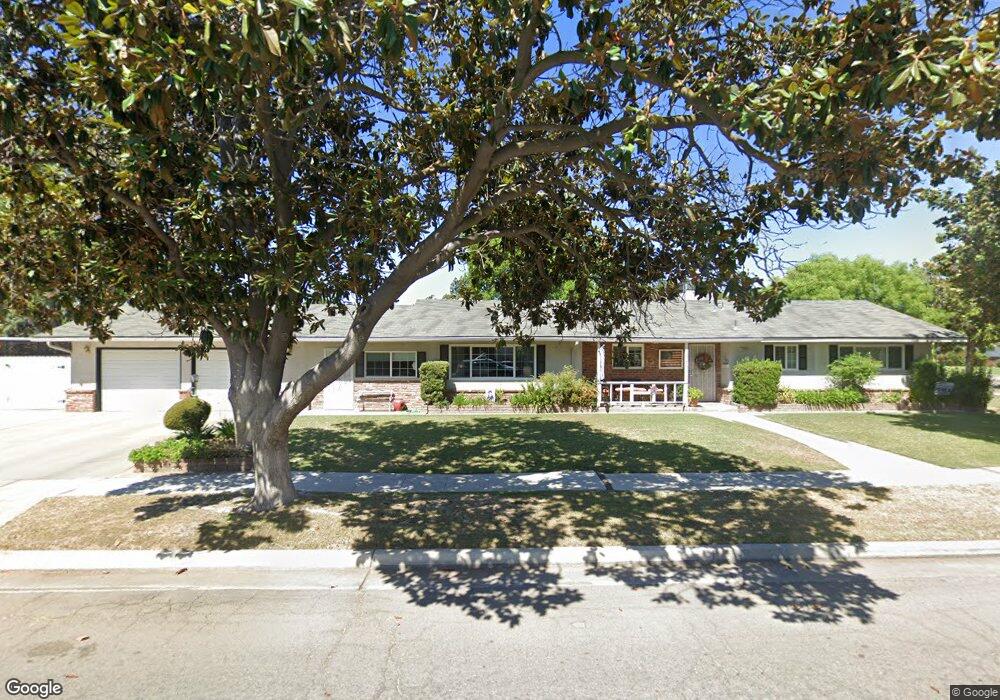
4759 N Delno Ave Fresno, CA 93705
Bullard NeighborhoodEstimated Value: $349,022 - $420,000
3
Beds
2
Baths
1,437
Sq Ft
$268/Sq Ft
Est. Value
About This Home
This home is located at 4759 N Delno Ave, Fresno, CA 93705 and is currently estimated at $385,006, approximately $267 per square foot. 4759 N Delno Ave is a home located in Fresno County with nearby schools including Powers-Ginsburg Elementary, Bullard High School, and Endeavor Charter.
Ownership History
Date
Name
Owned For
Owner Type
Purchase Details
Closed on
Mar 1, 2013
Sold by
Harding Thomas E and Harding Betty L
Bought by
Harding Thomas E and Harding Betty L
Current Estimated Value
Home Financials for this Owner
Home Financials are based on the most recent Mortgage that was taken out on this home.
Original Mortgage
$85,000
Interest Rate
3.4%
Mortgage Type
New Conventional
Purchase Details
Closed on
Mar 14, 2005
Sold by
Harding Thomas E and Harding Betty L
Bought by
Harding Thomas E and Harding Betty L
Create a Home Valuation Report for This Property
The Home Valuation Report is an in-depth analysis detailing your home's value as well as a comparison with similar homes in the area
Home Values in the Area
Average Home Value in this Area
Purchase History
| Date | Buyer | Sale Price | Title Company |
|---|---|---|---|
| Harding Thomas E | -- | First American Title Company | |
| Harding Thomas E | -- | -- |
Source: Public Records
Mortgage History
| Date | Status | Borrower | Loan Amount |
|---|---|---|---|
| Closed | Harding Thomas E | $85,000 |
Source: Public Records
Tax History Compared to Growth
Tax History
| Year | Tax Paid | Tax Assessment Tax Assessment Total Assessment is a certain percentage of the fair market value that is determined by local assessors to be the total taxable value of land and additions on the property. | Land | Improvement |
|---|---|---|---|---|
| 2025 | $1,609 | $134,619 | $49,698 | $84,921 |
| 2023 | $1,577 | $129,393 | $47,769 | $81,624 |
| 2022 | $1,554 | $126,857 | $46,833 | $80,024 |
| 2021 | $1,510 | $124,370 | $45,915 | $78,455 |
| 2020 | $1,503 | $123,096 | $45,445 | $77,651 |
| 2019 | $1,444 | $120,683 | $44,554 | $76,129 |
| 2018 | $1,411 | $118,318 | $43,681 | $74,637 |
| 2017 | $1,385 | $115,999 | $42,825 | $73,174 |
| 2016 | $1,338 | $113,726 | $41,986 | $71,740 |
| 2015 | $1,317 | $112,019 | $41,356 | $70,663 |
| 2014 | $1,288 | $109,825 | $40,546 | $69,279 |
Source: Public Records
Map
Nearby Homes
- 709 W Alamos Ave
- 4702 N Fruit Ave
- 4939 N Fruit Ave
- 733 W Gettysburg Ave
- 1110 W Fairmont Ave
- 929 W Norwich Ave
- 4895 N Thorne Ave
- 1473 W Scott Ave
- 4837 N Ila Ave
- 1027 W Ashcroft Ave
- 4734 N Harrison Ave
- 4666 N Harrison Ave
- 1458 W Norwich Ave
- 1582 W San Jose Ave
- 116 E Alamos Ave
- 5180 N Channing Way
- 4822 N Safford Ave
- 5124 N Via Trevi
- 4366 N Holt Ave
- 4843 N Palm Ave
- 723 W Acacia Ave
- 4741 N Delno Ave
- 733 W Acacia Ave
- 641 W Acacia Ave
- 4742 N Pacific Ave
- 640 W San Gabriel Ave
- 4727 N Delno Ave
- 4779 N Delno Ave
- 722 W Acacia Ave
- 4728 N Pacific Ave
- 738 W Acacia Ave
- 624 W San Gabriel Ave
- 632 W Acacia Ave
- 4711 N Delno Ave
- 724 W Rialto Ave
- 4795 N Delno Ave
- 746 W Acacia Ave
- 4712 N Delno Ave
- 723 W Santa Ana Ave
- 4796 N Delno Ave