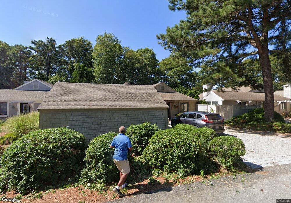
476 Mashie Cir Mashpee, MA 02649
New Seabury-Popponesset Island NeighborhoodEstimated Value: $823,000 - $1,179,000
2
Beds
2
Baths
1,270
Sq Ft
$750/Sq Ft
Est. Value
About This Home
This home is located at 476 Mashie Cir, Mashpee, MA 02649 and is currently estimated at $952,044, approximately $749 per square foot. 476 Mashie Cir is a home located in Barnstable County with nearby schools including Kenneth C. Coombs School, Quashnet School, and Mashpee Middle School.
Ownership History
Date
Name
Owned For
Owner Type
Purchase Details
Closed on
Mar 1, 2000
Sold by
Pieper Charles P
Bought by
Wells Larry
Current Estimated Value
Home Financials for this Owner
Home Financials are based on the most recent Mortgage that was taken out on this home.
Original Mortgage
$180,500
Outstanding Balance
$60,821
Interest Rate
8.21%
Mortgage Type
Purchase Money Mortgage
Estimated Equity
$891,223
Create a Home Valuation Report for This Property
The Home Valuation Report is an in-depth analysis detailing your home's value as well as a comparison with similar homes in the area
Home Values in the Area
Average Home Value in this Area
Purchase History
| Date | Buyer | Sale Price | Title Company |
|---|---|---|---|
| Wells Larry | $190,000 | -- |
Source: Public Records
Mortgage History
| Date | Status | Borrower | Loan Amount |
|---|---|---|---|
| Open | Wells Larry | $180,500 |
Source: Public Records
Tax History Compared to Growth
Tax History
| Year | Tax Paid | Tax Assessment Tax Assessment Total Assessment is a certain percentage of the fair market value that is determined by local assessors to be the total taxable value of land and additions on the property. | Land | Improvement |
|---|---|---|---|---|
| 2025 | $4,807 | $726,100 | $405,500 | $320,600 |
| 2024 | $4,336 | $674,300 | $368,700 | $305,600 |
| 2023 | $3,994 | $569,700 | $315,900 | $253,800 |
| 2022 | $3,764 | $460,700 | $251,200 | $209,500 |
| 2021 | $3,784 | $417,200 | $241,700 | $175,500 |
| 2020 | $3,653 | $401,900 | $232,400 | $169,500 |
| 2019 | $3,822 | $422,300 | $262,100 | $160,200 |
| 2018 | $3,713 | $416,300 | $276,900 | $139,400 |
| 2017 | $3,708 | $403,500 | $276,900 | $126,600 |
| 2016 | $3,665 | $396,600 | $276,900 | $119,700 |
| 2015 | $3,562 | $391,000 | $276,900 | $114,100 |
| 2014 | $3,606 | $384,000 | $271,300 | $112,700 |
Source: Public Records
Map
Nearby Homes
- 59 Mashie Cir
- 28 Quinns Way
- 3 Niblick Ln
- 7 Brassie Way
- 5 Tide Run
- 51 Fairway Ln
- 4 Lanyard Way Unit 7242C
- 51 Walton Heath Way
- 72 Walton Heath Way
- 1 Manitoba Rd
- 23 Topping Lift
- 16 Slice Way
- 12 Mizzenmast
- 3 Mizzenmast
- 51 Manitoba Rd
- 90 Shore Dr W Unit 16D
- 111 Waterline Dr S
- 89 Troon Way
- 128 Whippoorwill Cir
- 40 Triton Way
- 71 Mashie Cir
- 475 Mashie Cir
- 477 Mashie Cir
- 73 Mashie Cir
- 69 Mashie Cir
- 65 Mashie Cir
- 474 Mashie Cir
- 68 Mid Iron Way Unit 7542
- 68 Mid Iron Way Unit 7835
- 68 Mid Iron Way Unit 7552
- 68 Mid Iron Way Unit 7551
- 68 Mid Iron Way Unit 7550
- 68 Mid Iron Way Unit 527
- 68 Mid Iron Way Unit 526
- 68 Mid Iron Way Unit 525
- 68 Mid Iron Way Unit 524
- 68 Mid Iron Way Unit 523
- 68 Mid Iron Way Unit 522
- 68 Mid Iron Way Unit 521
- 68 Mid Iron Way Unit 520