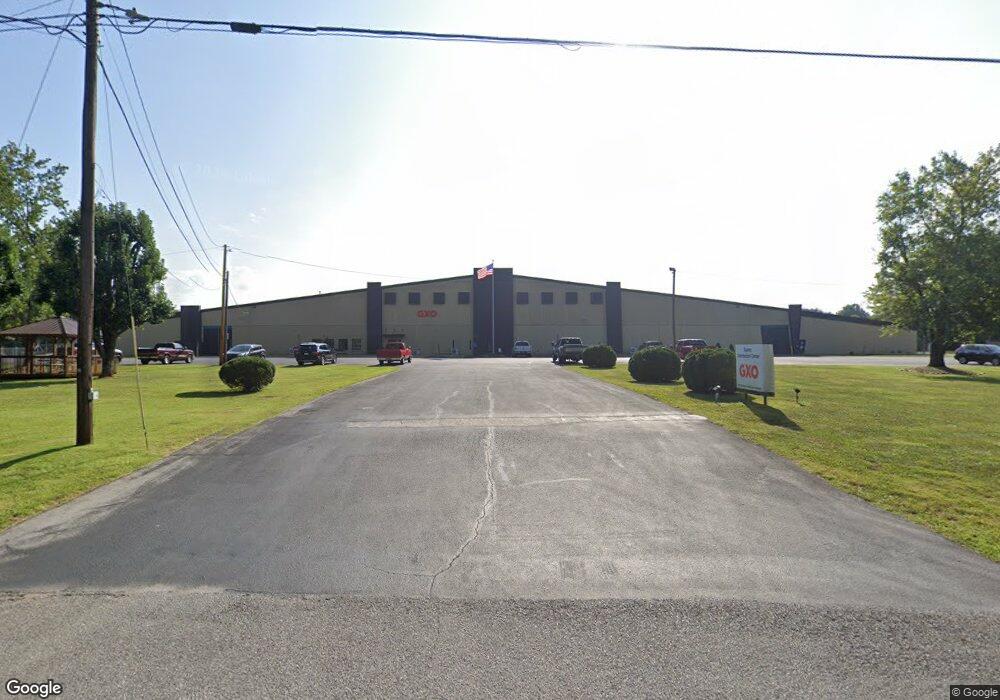
4760 Roberts Matthews Hwy Sparta, TN 38583
Estimated Value: $223,000 - $2,825,520
--
Bed
2
Baths
1,000
Sq Ft
$1,524/Sq Ft
Est. Value
About This Home
This home is located at 4760 Roberts Matthews Hwy, Sparta, TN 38583 and is currently estimated at $1,524,260, approximately $1,524 per square foot. 4760 Roberts Matthews Hwy is a home with nearby schools including Northfield Elementary School, White County Middle School, and White County High School.
Ownership History
Date
Name
Owned For
Owner Type
Purchase Details
Closed on
Mar 31, 2021
Sold by
Big Dollar Warehouse Incorporated
Bought by
Sparta Tennessee Llc
Current Estimated Value
Home Financials for this Owner
Home Financials are based on the most recent Mortgage that was taken out on this home.
Original Mortgage
$5,200,000
Outstanding Balance
$3,888,314
Interest Rate
2.8%
Mortgage Type
Construction
Estimated Equity
-$2,364,054
Purchase Details
Closed on
Mar 30, 2021
Sold by
Big Dollar Warehouse Incorporated
Bought by
Sparta Tennessee Llc
Home Financials for this Owner
Home Financials are based on the most recent Mortgage that was taken out on this home.
Original Mortgage
$5,200,000
Outstanding Balance
$3,888,314
Interest Rate
2.8%
Mortgage Type
Construction
Estimated Equity
-$2,364,054
Create a Home Valuation Report for This Property
The Home Valuation Report is an in-depth analysis detailing your home's value as well as a comparison with similar homes in the area
Home Values in the Area
Average Home Value in this Area
Purchase History
| Date | Buyer | Sale Price | Title Company |
|---|---|---|---|
| Sparta Tennessee Llc | $10,400,000 | None Available | |
| Sparta Tennessee Llc | -- | None Available |
Source: Public Records
Mortgage History
| Date | Status | Borrower | Loan Amount |
|---|---|---|---|
| Open | Sparta Tennessee Llc | $5,200,000 |
Source: Public Records
Tax History Compared to Growth
Tax History
| Year | Tax Paid | Tax Assessment Tax Assessment Total Assessment is a certain percentage of the fair market value that is determined by local assessors to be the total taxable value of land and additions on the property. | Land | Improvement |
|---|---|---|---|---|
| 2024 | $39,147 | $1,909,600 | $101,520 | $1,808,080 |
| 2023 | $39,147 | $1,909,600 | $101,520 | $1,808,080 |
| 2022 | $39,147 | $1,909,600 | $101,520 | $1,808,080 |
| 2021 | $39,143 | $1,909,600 | $101,520 | $1,808,080 |
| 2020 | $39,143 | $1,909,400 | $101,320 | $1,808,080 |
| 2019 | $36,538 | $1,782,320 | $90,080 | $1,692,240 |
| 2018 | $36,538 | $1,782,320 | $90,080 | $1,692,240 |
| 2017 | $36,538 | $1,782,320 | $90,080 | $1,692,240 |
| 2016 | $36,538 | $1,782,320 | $90,080 | $1,692,240 |
| 2015 | $32,973 | $1,782,320 | $90,080 | $1,692,240 |
| 2014 | -- | $1,782,320 | $90,080 | $1,692,240 |
| 2013 | -- | $1,680,600 | $90,080 | $1,590,520 |
Source: Public Records
Map
Nearby Homes
- 221 Magnolia Rd
- 147 Bob White Dr
- 130 Mallard Dr
- 1045 Mullican Rd
- 0 Saylor Rd
- 00 Saylor Rd
- 366 S Bunker Hill Rd
- 191 Rustling Oaks Dr
- 159 Rustling Oaks Dr
- lot 7 James Holman Rd
- lot 6 James Holman Rd
- 156 Horseshoe Dr
- 141 Ray Cemetery Rd
- 00 Milk Plant Rd
- 1298 S Bunker Hill Rd
- 355 Dillon Gribble Rd
- 00 Oakcrest Dr
- 887 Ray Cemetery Rd
- 712 Brookemeade Dr
- 748 Brookemeade Dr
- 682 Brookemeade Dr
- 778 Brookemeade Dr
- 655 Brookemeade Dr
- 9/10 Ac Brookemeade Dr
- 2 Lots Brookemeade Dr
- 816 Brookemeade Dr
- 9/10 AC Brookemeade Dr
- 731 Brookemeade Dr
- 787 Brookemeade Dr
- 4600 Roberts Matthews Hwy
- 573 Brookemeade Dr
- 815 Brookemeade Dr
- 616 Brookemeade Dr
- 505 Brookemeade Dr
- 4755 Roberts Matthews Hwy
- 491 Brookemeade Dr
- 374 Brookemeade Dr
- 550 Brookemeade Dr