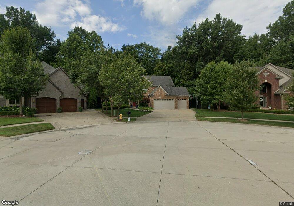
47643 Dloski Ct Unit 289 Macomb, MI 48044
Estimated Value: $503,000 - $555,000
Studio
2
Baths
2,734
Sq Ft
$195/Sq Ft
Est. Value
About This Home
This home is located at 47643 Dloski Ct Unit 289, Macomb, MI 48044 and is currently estimated at $532,619, approximately $194 per square foot. 47643 Dloski Ct Unit 289 is a home located in Macomb County with nearby schools including Atwood Elementary School, L'Anse Creuse Middle School - North, and L'Anse Creuse High School - North.
Ownership History
Date
Name
Owned For
Owner Type
Purchase Details
Closed on
Jan 23, 2004
Sold by
Gtr Builders Inc
Bought by
Ciolino Frank P and Ciolino Cathy L
Current Estimated Value
Create a Home Valuation Report for This Property
The Home Valuation Report is an in-depth analysis detailing your home's value as well as a comparison with similar homes in the area
Home Values in the Area
Average Home Value in this Area
Purchase History
| Date | Buyer | Sale Price | Title Company |
|---|---|---|---|
| Ciolino Frank P | $130,000 | -- |
Source: Public Records
Tax History
| Year | Tax Paid | Tax Assessment Tax Assessment Total Assessment is a certain percentage of the fair market value that is determined by local assessors to be the total taxable value of land and additions on the property. | Land | Improvement |
|---|---|---|---|---|
| 2025 | $4,130 | $246,700 | $0 | $0 |
| 2024 | $40 | $234,400 | $0 | $0 |
| 2023 | $3,809 | $200,200 | $0 | $0 |
| 2022 | $5,909 | $187,400 | $0 | $0 |
| 2021 | $6,091 | $180,700 | $0 | $0 |
| 2020 | $3,496 | $174,400 | $0 | $0 |
| 2019 | $5,911 | $168,000 | $0 | $0 |
| 2018 | $5,674 | $165,900 | $0 | $0 |
| 2017 | $5,609 | $160,940 | $37,500 | $123,440 |
| 2016 | $5,237 | $160,920 | $0 | $0 |
| 2015 | $5,036 | $151,830 | $0 | $0 |
| 2014 | $5,036 | $133,220 | $26,500 | $106,720 |
| 2013 | $2,937 | $133,220 | $0 | $0 |
Source: Public Records
Map
Nearby Homes
- 47376 Hidden Meadows Dr
- 47848 Card Rd
- 47400 Card Rd
- 47033 Woodberry Estates Dr
- 22377 Massey Ln
- 47846 North Ave
- 46536 Red River Dr
- 23199 Hidden Creek Dr
- 21559 Waverly Dr
- 21254 Clayton Dr
- 21370 Carlton Dr
- 23206 21 Mile Rd
- 21258 Fairfield Dr
- 44604 Bonapart
- 47338 Hunters Chase Dr
- 47848 Sonnett Dr
- 49287 London Bridge Dr
- 21310 Boquet Dr
- 21220 Briar Rose Dr
- 23346 Spring Creek Dr
- 47669 Dloski Ct
- 47669 Dloski Ct
- 47617 Dloski Ct Unit 290
- 47699 Dloski Ct
- 47618 Dloski Ct Unit 291
- 47644 Dloski Ct Unit 292
- 47670 Dloski Ct Unit Bldg-Unit
- 47696 Dloski Ct Unit 294
- 47670 Dloski Ct
- 22314 Beech Knoll Dr Unit 286
- 22296 Beech Knoll Dr Unit 285
- 22278 Beech Knoll Dr Unit 284
- 22368 Beech Knoll Dr Unit 296
- 22368 Beech Knoll Dr
- 22350 Beech Knoll Dr Unit 295
- 47651 Brennan Dr
- 47607 Brennan Dr Unit 302
- 47607 Brennan Dr
- 47609 Bucci Ct Unit Bldg-Unit
- 47566 Bucci Ct
Your Personal Tour Guide
Ask me questions while you tour the home.