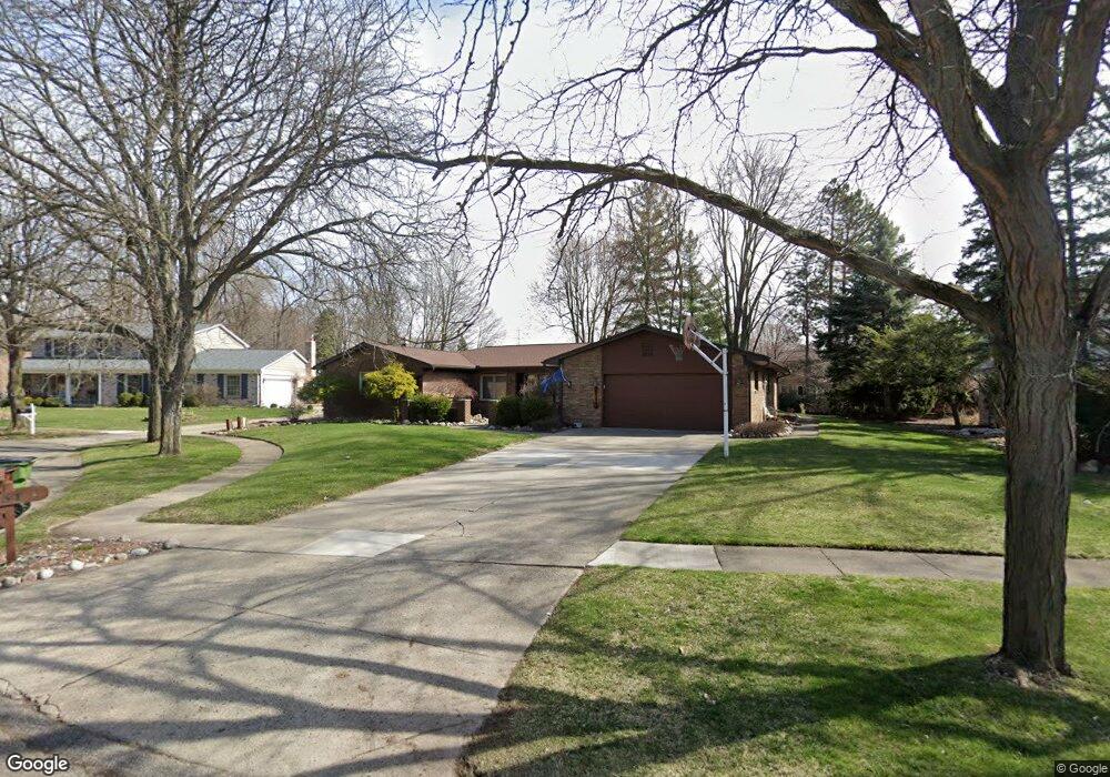
47651 Province Ct Shelby Township, MI 48315
Estimated Value: $410,111 - $460,000
3
Beds
3
Baths
2,426
Sq Ft
$177/Sq Ft
Est. Value
About This Home
This home is located at 47651 Province Ct, Shelby Township, MI 48315 and is currently estimated at $430,278, approximately $177 per square foot. 47651 Province Ct is a home located in Macomb County with nearby schools including Jack Harvey Elementary School, Shelby Junior High School, and Utica High School.
Ownership History
Date
Name
Owned For
Owner Type
Purchase Details
Closed on
Nov 21, 2007
Sold by
Freeland Diane Louise and Freeland D
Bought by
Vavruska Kenneth J and Vavruska Amy T
Current Estimated Value
Home Financials for this Owner
Home Financials are based on the most recent Mortgage that was taken out on this home.
Original Mortgage
$176,000
Outstanding Balance
$111,069
Interest Rate
6.33%
Mortgage Type
Purchase Money Mortgage
Estimated Equity
$319,209
Create a Home Valuation Report for This Property
The Home Valuation Report is an in-depth analysis detailing your home's value as well as a comparison with similar homes in the area
Home Values in the Area
Average Home Value in this Area
Purchase History
| Date | Buyer | Sale Price | Title Company |
|---|---|---|---|
| Vavruska Kenneth J | $220,000 | Title Source Inc |
Source: Public Records
Mortgage History
| Date | Status | Borrower | Loan Amount |
|---|---|---|---|
| Open | Vavruska Kenneth J | $176,000 |
Source: Public Records
Tax History Compared to Growth
Tax History
| Year | Tax Paid | Tax Assessment Tax Assessment Total Assessment is a certain percentage of the fair market value that is determined by local assessors to be the total taxable value of land and additions on the property. | Land | Improvement |
|---|---|---|---|---|
| 2025 | $3,571 | $187,600 | $0 | $0 |
| 2024 | $2,114 | $185,600 | $0 | $0 |
| 2023 | $2,002 | $176,300 | $0 | $0 |
| 2022 | $3,229 | $159,500 | $0 | $0 |
| 2021 | $3,141 | $151,900 | $0 | $0 |
| 2020 | $1,843 | $147,400 | $0 | $0 |
| 2019 | $2,875 | $132,100 | $0 | $0 |
| 2018 | $2,819 | $119,900 | $0 | $0 |
| 2017 | $2,790 | $115,900 | $34,700 | $81,200 |
| 2016 | $2,770 | $115,900 | $0 | $0 |
| 2015 | $2,730 | $107,600 | $0 | $0 |
| 2012 | -- | $0 | $0 | $0 |
Source: Public Records
Map
Nearby Homes
- 47935 Ben Franklin Dr
- 46974 Kramer Dr
- 56745 Spruce Forest Dr
- 48255 Amber Lane Dr
- 13000 Janine Ct
- 48325 Red Oak Dr
- 12214 Anthony Dr
- 47136 Rosevillage Ct
- 47124 Rosevillage Ct
- 49280 Wildwood Ct
- 13267 Pearl Dr
- 12212 Watkins Dr
- 12430 Conservation Trail Unit 337
- 45874 Kensington St
- 47040 W Wayford Dr
- 11705 Squiers Blvd Unit 114
- 11685 Squiers Blvd Unit 95
- 15055 22 Mile Rd
- 45709 Kensington St
- 11109 Messmore Rd
- 47639 Province Ct
- 47667 Province Ct
- 47755 Ben Franklin Dr
- 47773 Ben Franklin Dr
- 47633 Province Ct
- 47733 Ben Franklin Dr
- 47611 Province Ct
- 47629 Province Ct
- 47623 Province Ct
- 47672 Homestead Ct
- 47791 Ben Franklin Dr
- 47601 Province Ct
- 47691 Province Ct
- 47589 Province Ct
- 47660 Homestead Ct
- 47466 Colony Ct
- 47811 Ben Franklin Dr
- 47676 Homestead Ct
- 47456 Colony Ct
- 47738 Ben Franklin Dr