Studio
--
Bath
2,803
Sq Ft
11,326
Sq Ft
About This Home
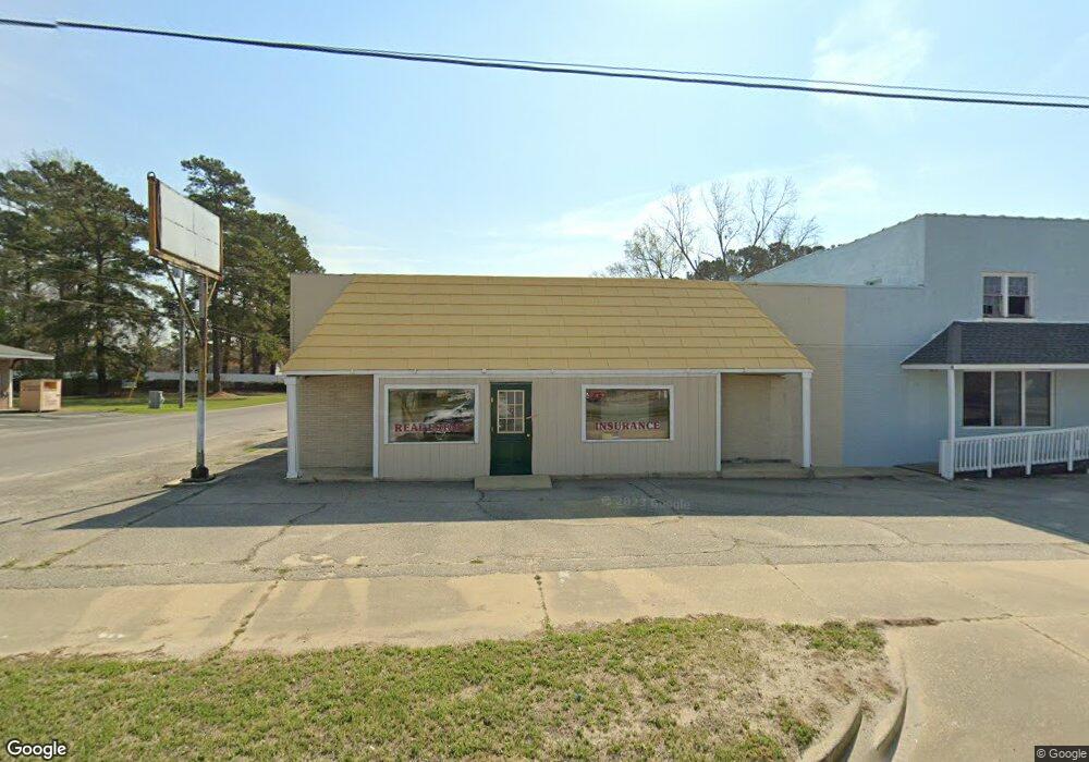
This home is located at 4766 Broad St, Loris, SC 29569. 4766 Broad St is a home located in Horry County with nearby schools including Loris Elementary School, Loris Middle School, and Loris High School.
Ownership History
Date
Name
Owned For
Owner Type
Purchase Details
Closed on
Aug 2, 2015
Sold by
The Conway National Bank
Bought by
Santinos Pizza Inc
Home Financials for this Owner
Home Financials are based on the most recent Mortgage that was taken out on this home.
Original Mortgage
$60,000
Outstanding Balance
$46,639
Interest Rate
4.09%
Purchase Details
Closed on
Jan 10, 2014
Sold by
Master In Equity Horry County
Bought by
Conway National Bank
Purchase Details
Closed on
Dec 31, 2013
Sold by
Wilson Ralph J and Dal Title Distribution Inc
Bought by
The Conway National Bank
Purchase Details
Closed on
Nov 4, 2013
Sold by
Master In Equity Horry County
Bought by
Conway National Bank
Purchase Details
Closed on
Nov 29, 2011
Sold by
Spivey Sonya
Bought by
Wilson Ralph
Purchase Details
Closed on
Dec 15, 2005
Sold by
Spivey Sonya and Estate Of Elmer Gene Anderson
Bought by
Anderson Phylis K
Create a Home Valuation Report for This Property
The Home Valuation Report is an in-depth analysis detailing your home's value as well as a comparison with similar homes in the area
Home Values in the Area
Average Home Value in this Area
Purchase History
| Date | Buyer | Sale Price | Title Company |
|---|---|---|---|
| Santinos Pizza Inc | $57,500 | -- | |
| Conway National Bank | $75,000 | -- | |
| The Conway National Bank | $75,000 | -- | |
| Conway National Bank | $75,000 | -- | |
| Wilson Ralph | $142,200 | -- | |
| Anderson Phylis K | -- | None Available |
Source: Public Records
Mortgage History
| Date | Status | Borrower | Loan Amount |
|---|---|---|---|
| Open | Santinos Pizza Inc | $60,000 |
Source: Public Records
Tax History
| Year | Tax Paid | Tax Assessment Tax Assessment Total Assessment is a certain percentage of the fair market value that is determined by local assessors to be the total taxable value of land and additions on the property. | Land | Improvement |
|---|---|---|---|---|
| 2025 | $1,273 | $0 | $0 | $0 |
| 2024 | $1,273 | $7,550 | $4,357 | $3,193 |
| 2023 | $1,273 | $3,966 | $3,083 | $883 |
| 2021 | $1,160 | $8,146 | $3,352 | $4,794 |
| 2020 | $1,150 | $8,146 | $3,352 | $4,794 |
| 2019 | $1,180 | $8,146 | $3,352 | $4,794 |
| 2018 | $0 | $3,449 | $2,681 | $768 |
| 2017 | $1,824 | $5,999 | $2,681 | $3,318 |
| 2016 | -- | $5,999 | $2,681 | $3,318 |
| 2015 | $2,903 | $11,814 | $2,688 | $9,126 |
| 2014 | $2,801 | $11,814 | $2,688 | $9,126 |
Source: Public Records
Map
Nearby Homes
- TBD100 U S 701 Hwy
- 4151 Maple St
- 4526 Railroad Ave
- 4625 Graham St
- Tbd Sand Hill Bay Rd
- Tbd Heritage Rd
- Horry County
- Tbd Hwy 9
- TBD Graham St
- Parcel B U S 701 Hwy
- Parcel C U S 701 Hwy
- Parcel A U S 701 Hwy
- 5180 Graham St
- TBD Highway 410
- TBD Franklin St
- 3499 S Carolina 9 Business
- 1929 S Carolina 9 Business
- 1925 S Carolina 9 Business
- TBD S Carolina 9 Business Unit HERITAGE RD SUBD
- TBD S Carolina 9 Business
- 4744 Broad St Unit Hwy 701
- 4318 Holly St
- 4820 Broad St
- 4616 Broad St
- 4316 Holly St
- 4317 Holly St
- 4914 Broad St
- 4220 Dogwood St
- 4615 Broad St Unit Broad Street
- 4615 Broad St
- 0 Holly St Unit 4806-4812; 4820-4830
- 4304 Dogwood St Unit 4302
- 4613 Broad St
- 4508 Holly St
- 4921 Powers St
- 4810 Powers St
- 4612 Broad St
- 4824 Powers St
- 4223 Dogwood St
- 4239 Dogwood St
Your Personal Tour Guide
Ask me questions while you tour the home.