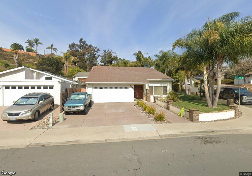
4768 Robbins St San Diego, CA 92122
University City NeighborhoodEstimated Value: $1,547,684 - $1,699,000
4
Beds
2
Baths
1,893
Sq Ft
$868/Sq Ft
Est. Value
About This Home
This home is located at 4768 Robbins St, San Diego, CA 92122 and is currently estimated at $1,643,421, approximately $868 per square foot. 4768 Robbins St is a home located in San Diego County with nearby schools including Marie Curie Elementary School, Standley Middle School, and University City High School.
Ownership History
Date
Name
Owned For
Owner Type
Purchase Details
Closed on
Dec 3, 2018
Sold by
Giesting Walter Edward and Giesting Carol Tobin
Bought by
Taylor Darnes J and Taylor Regina
Current Estimated Value
Purchase Details
Closed on
Feb 15, 2006
Sold by
Wyatt Danny E and Wyatt Brenda E
Bought by
Giesting Walter Edward and Giesting Carol Tobin
Purchase Details
Closed on
Sep 19, 2005
Sold by
Markins Enid
Bought by
Wyatt Danny E and Wyatt Brenda E
Home Financials for this Owner
Home Financials are based on the most recent Mortgage that was taken out on this home.
Original Mortgage
$123,000
Interest Rate
5.7%
Mortgage Type
Credit Line Revolving
Purchase Details
Closed on
Dec 31, 1986
Purchase Details
Closed on
Apr 27, 1984
Create a Home Valuation Report for This Property
The Home Valuation Report is an in-depth analysis detailing your home's value as well as a comparison with similar homes in the area
Home Values in the Area
Average Home Value in this Area
Purchase History
| Date | Buyer | Sale Price | Title Company |
|---|---|---|---|
| Taylor Darnes J | -- | None Available | |
| Giesting Walter Edward | $767,000 | Fidelity National Title | |
| Wyatt Danny E | $615,000 | Fidelity National Title Co | |
| -- | $160,000 | -- | |
| -- | $152,500 | -- |
Source: Public Records
Mortgage History
| Date | Status | Borrower | Loan Amount |
|---|---|---|---|
| Previous Owner | Wyatt Danny E | $123,000 | |
| Previous Owner | Wyatt Danny E | $492,000 |
Source: Public Records
Tax History Compared to Growth
Tax History
| Year | Tax Paid | Tax Assessment Tax Assessment Total Assessment is a certain percentage of the fair market value that is determined by local assessors to be the total taxable value of land and additions on the property. | Land | Improvement |
|---|---|---|---|---|
| 2025 | $12,654 | $1,048,088 | $737,898 | $310,190 |
| 2024 | $12,654 | $1,027,538 | $723,430 | $304,108 |
| 2023 | $12,375 | $1,007,392 | $709,246 | $298,146 |
| 2022 | $12,046 | $987,640 | $695,340 | $292,300 |
| 2021 | $11,964 | $968,275 | $681,706 | $286,569 |
| 2020 | $11,224 | $910,000 | $700,000 | $210,000 |
| 2019 | $10,443 | $845,000 | $592,000 | $253,000 |
| 2018 | $9,077 | $770,000 | $540,000 | $230,000 |
| 2017 | $8,102 | $690,000 | $484,000 | $206,000 |
| 2016 | $7,956 | $675,000 | $474,000 | $201,000 |
| 2015 | $7,782 | $660,000 | $464,000 | $196,000 |
| 2014 | $6,515 | $550,000 | $387,000 | $163,000 |
Source: Public Records
Map
Nearby Homes
- 4612 Benhurst Ave
- 7056 Haworth St
- 7212 Florey St
- 4635 Pauling Ave
- 4627 Huggins St
- 4224 Governor Dr
- 4282 Robbins St
- 4138 Combe Way
- 7190 Shoreline Dr Unit 6313
- 6214 Agee St Unit 34
- 7160 Shoreline Dr Unit 4213
- 6180 Agee St Unit 159
- 6188 Agee St Unit 230
- 6190 Agee St Unit 260
- 5889 Cozzens St
- 6330 Genesee Ave Unit 319
- 6330 Genesee Ave Unit 220
- 6330 Genesee Ave Unit 119
- 6330 Genesee Ave Unit 112
- 6330 Genesee Ave Unit 213
- 4758 Robbins St
- 6840 Robbins Ct
- 4748 Robbins St
- 6825 Robbins Ct
- 6845 Robbins Ct
- 6880 Robbins Ct
- 6860 Robbins Ct
- 4775 Robbins St
- 4785 Robbins St
- 4738 Robbins St
- 6885 Robbins Ct
- 6865 Robbins Ct
- 4790 Robbins St
- 4763 Robbins St
- 4795 Robbins St
- 4728 Robbins St
- 6840 Gullstrand St
- 4751 Robbins St
- 6760 Gullstrand St
- 6860 Gullstrand St