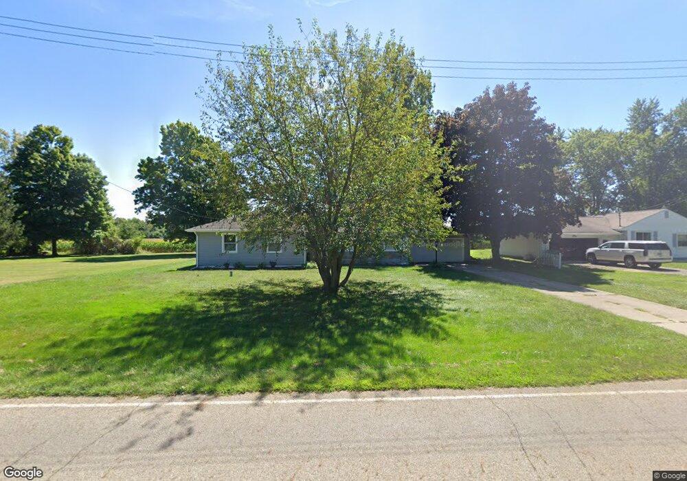
477 Dorrance Rd Coldwater, MI 49036
Estimated Value: $184,000 - $253,000
--
Bed
--
Bath
1,592
Sq Ft
$138/Sq Ft
Est. Value
About This Home
This home is located at 477 Dorrance Rd, Coldwater, MI 49036 and is currently estimated at $220,330, approximately $138 per square foot. 477 Dorrance Rd is a home located in Branch County with nearby schools including Coldwater High School, Pansophia Academy, and St. Charles Borromeo Catholic School.
Ownership History
Date
Name
Owned For
Owner Type
Purchase Details
Closed on
Nov 3, 2020
Sold by
Wood Aaron R and Wood Jessica
Bought by
Ward Michael
Current Estimated Value
Home Financials for this Owner
Home Financials are based on the most recent Mortgage that was taken out on this home.
Original Mortgage
$135,000
Outstanding Balance
$120,346
Interest Rate
2.9%
Mortgage Type
New Conventional
Estimated Equity
$99,984
Purchase Details
Closed on
Jul 23, 2018
Sold by
Draper Delton M and Draper Julie A
Bought by
Wood Aaron R and Wood Jessica L
Home Financials for this Owner
Home Financials are based on the most recent Mortgage that was taken out on this home.
Original Mortgage
$64,800
Interest Rate
4.6%
Mortgage Type
New Conventional
Purchase Details
Closed on
Aug 17, 2001
Sold by
Draper Delton
Bought by
Draper Delton M and Draper Julie A
Create a Home Valuation Report for This Property
The Home Valuation Report is an in-depth analysis detailing your home's value as well as a comparison with similar homes in the area
Home Values in the Area
Average Home Value in this Area
Purchase History
| Date | Buyer | Sale Price | Title Company |
|---|---|---|---|
| Ward Michael | $150,000 | Branch Cnty Abstract & Ttl I | |
| Wood Aaron R | $81,000 | Brach County Abstract & Titl | |
| Draper Delton M | -- | -- |
Source: Public Records
Mortgage History
| Date | Status | Borrower | Loan Amount |
|---|---|---|---|
| Open | Ward Michael | $135,000 | |
| Previous Owner | Wood Aaron R | $64,800 |
Source: Public Records
Tax History Compared to Growth
Tax History
| Year | Tax Paid | Tax Assessment Tax Assessment Total Assessment is a certain percentage of the fair market value that is determined by local assessors to be the total taxable value of land and additions on the property. | Land | Improvement |
|---|---|---|---|---|
| 2025 | $2,025 | $96,200 | $0 | $0 |
| 2024 | $810 | $85,100 | $0 | $0 |
| 2023 | $736 | $80,000 | $0 | $0 |
| 2022 | $1,853 | $74,800 | $0 | $0 |
| 2021 | $1,960 | $65,900 | $0 | $0 |
| 2020 | -- | $43,300 | $0 | $0 |
| 2019 | -- | $45,100 | $0 | $0 |
| 2018 | -- | $36,300 | $0 | $0 |
| 2017 | -- | $35,400 | $0 | $0 |
| 2016 | -- | $37,000 | $0 | $0 |
| 2015 | -- | $32,700 | $0 | $0 |
| 2014 | -- | $29,500 | $0 | $0 |
| 2013 | -- | $29,100 | $0 | $0 |
Source: Public Records
Map
Nearby Homes
- 222 Randy Dr
- 586 Schaeffer Dr
- 0 Tree Ln Unit 24036814
- 256 Perkins St
- 608 E Chicago St
- 169 E Washington St
- 200 S Clay St
- 28 Avery Dr
- 59 Wright St
- 50 N Sprague St
- 67 W Washington St
- 0 Lott Rd
- 197 Jay St
- 162 Walnut St
- N/A North Dr
- 195 Cutter Ave
- VL N Fiske Rd
- 37 N Monroe St
- 181 Smith St
- 175 N Michigan Ave Unit 117