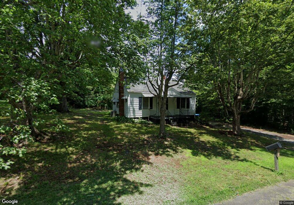
477 E Salisbury St Denton, NC 27239
Estimated Value: $106,000 - $206,000
2
Beds
1
Bath
1,152
Sq Ft
$122/Sq Ft
Est. Value
About This Home
This home is located at 477 E Salisbury St, Denton, NC 27239 and is currently estimated at $140,215, approximately $121 per square foot. 477 E Salisbury St is a home located in Davidson County with nearby schools including Denton Elementary School and South Davidson Middle and High School.
Ownership History
Date
Name
Owned For
Owner Type
Purchase Details
Closed on
May 29, 2024
Sold by
Hardister Randy C and Surratt Pamela C
Bought by
Seymour Cheryl and Deegan Louis
Current Estimated Value
Home Financials for this Owner
Home Financials are based on the most recent Mortgage that was taken out on this home.
Original Mortgage
$88,369
Outstanding Balance
$86,690
Interest Rate
7.1%
Mortgage Type
FHA
Estimated Equity
$53,525
Purchase Details
Closed on
Oct 4, 2001
Sold by
Randy Surratt D and Randy Hardis
Bought by
Hardister Randy C
Purchase Details
Closed on
Jul 1, 1996
Purchase Details
Closed on
Sep 1, 1995
Purchase Details
Closed on
Aug 1, 1991
Create a Home Valuation Report for This Property
The Home Valuation Report is an in-depth analysis detailing your home's value as well as a comparison with similar homes in the area
Purchase History
| Date | Buyer | Sale Price | Title Company |
|---|---|---|---|
| Seymour Cheryl | $90,000 | None Listed On Document | |
| Hardister Randy C | -- | -- | |
| -- | $36,000 | -- | |
| -- | -- | -- | |
| -- | $68,000 | -- | |
| -- | $29,000 | -- |
Source: Public Records
Mortgage History
| Date | Status | Borrower | Loan Amount |
|---|---|---|---|
| Open | Seymour Cheryl | $88,369 |
Source: Public Records
Tax History
| Year | Tax Paid | Tax Assessment Tax Assessment Total Assessment is a certain percentage of the fair market value that is determined by local assessors to be the total taxable value of land and additions on the property. | Land | Improvement |
|---|---|---|---|---|
| 2025 | $801 | $71,320 | $0 | $0 |
| 2024 | $801 | $71,320 | $0 | $0 |
| 2023 | $801 | $71,320 | $0 | $0 |
| 2022 | $801 | $71,320 | $0 | $0 |
| 2021 | $801 | $71,320 | $0 | $0 |
| 2020 | $722 | $64,270 | $0 | $0 |
| 2019 | $1,140 | $64,270 | $0 | $0 |
| 2018 | $733 | $64,270 | $0 | $0 |
| 2017 | $733 | $64,270 | $0 | $0 |
| 2016 | $733 | $64,270 | $0 | $0 |
| 2015 | $701 | $64,270 | $0 | $0 |
| 2014 | $694 | $63,690 | $0 | $0 |
Source: Public Records
Map
Nearby Homes
- 434 E Salisbury St
- 398 E Salisbury St
- 61 Haywood St
- 17980 S Nc Highway 109
- 178 E Salisbury St
- 130 Garner St
- 148 Garner St
- 320 Forest Park Dr
- 278 Forest Park Dr
- 166 S Main St
- 356 Eastside Dr
- 69 Lanning Dr
- 532 N Main St
- 0000 Bombay Rd
- 108 N Bingham St
- 354 Anderson St
- 141 W Noell Ave
- 219 Dot St
- 165 Brown St
- 149 Seeley Dr
- 451 E Salisbury St
- 441 Harvard St
- 470 E Salisbury St
- 298 Farmer Rd
- 458 E Salisbury St
- 429 E Salisbury St
- 446 E Salisbury St
- 420 E Salisbury St
- 131 Restoration Aly
- 151 Farmer Rd
- 384 E Salisbury St
- 109 E 1st St
- 368 E Salisbury St
- 97 Farmer Rd
- 426 E 2nd St
- 120 Haywood St
- 384 E 2nd St
- 45 Haywood St
- 333 E Salisbury St
- 109 Farmer Rd
Your Personal Tour Guide
Ask me questions while you tour the home.