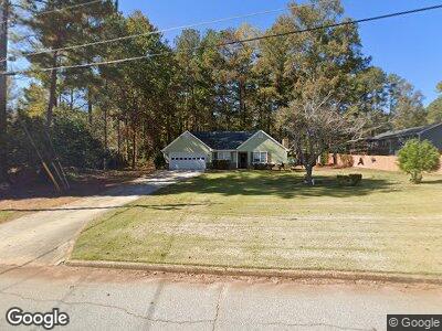
4771 Cedar Brook Dr SE Unit 4 Conyers, GA 30094
Estimated Value: $228,261 - $248,000
3
Beds
2
Baths
1,354
Sq Ft
$174/Sq Ft
Est. Value
About This Home
This home is located at 4771 Cedar Brook Dr SE Unit 4, Conyers, GA 30094 and is currently estimated at $236,065, approximately $174 per square foot. 4771 Cedar Brook Dr SE Unit 4 is a home located in Rockdale County with nearby schools including Barksdale Elementary School, Gen. Ray Davis Middle School, and Salem High School.
Ownership History
Date
Name
Owned For
Owner Type
Purchase Details
Closed on
Oct 7, 2002
Sold by
Tatum James M
Bought by
Townshend Peder R
Current Estimated Value
Home Financials for this Owner
Home Financials are based on the most recent Mortgage that was taken out on this home.
Original Mortgage
$115,090
Outstanding Balance
$53,597
Interest Rate
6.18%
Mortgage Type
FHA
Purchase Details
Closed on
Jun 22, 1999
Sold by
Crowley Constance A
Bought by
Clark Marlin C
Home Financials for this Owner
Home Financials are based on the most recent Mortgage that was taken out on this home.
Original Mortgage
$92,945
Interest Rate
7.13%
Mortgage Type
FHA
Purchase Details
Closed on
Feb 11, 1993
Sold by
Callahan John M and Callahan Lisa S
Bought by
Crowley Constance A
Home Financials for this Owner
Home Financials are based on the most recent Mortgage that was taken out on this home.
Original Mortgage
$62,200
Interest Rate
7.83%
Create a Home Valuation Report for This Property
The Home Valuation Report is an in-depth analysis detailing your home's value as well as a comparison with similar homes in the area
Home Values in the Area
Average Home Value in this Area
Purchase History
| Date | Buyer | Sale Price | Title Company |
|---|---|---|---|
| Townshend Peder R | $116,000 | -- | |
| Clark Marlin C | $93,000 | -- | |
| Crowley Constance A | $77,800 | -- |
Source: Public Records
Mortgage History
| Date | Status | Borrower | Loan Amount |
|---|---|---|---|
| Open | Townshend Peder R | $115,090 | |
| Previous Owner | Tatum James M | $94,000 | |
| Previous Owner | Clark Marlin C | $35,000 | |
| Previous Owner | Clark Marlin C | $92,945 | |
| Previous Owner | Crowley Constance A | $62,200 |
Source: Public Records
Tax History Compared to Growth
Tax History
| Year | Tax Paid | Tax Assessment Tax Assessment Total Assessment is a certain percentage of the fair market value that is determined by local assessors to be the total taxable value of land and additions on the property. | Land | Improvement |
|---|---|---|---|---|
| 2024 | $1,777 | $76,920 | $17,040 | $59,880 |
| 2023 | $1,495 | $68,120 | $17,720 | $50,400 |
| 2022 | $1,107 | $53,000 | $14,160 | $38,840 |
| 2021 | $1,051 | $48,600 | $10,200 | $38,400 |
| 2020 | $841 | $42,440 | $9,160 | $33,280 |
| 2019 | $643 | $35,360 | $7,640 | $27,720 |
| 2018 | $489 | $30,240 | $6,840 | $23,400 |
| 2017 | $282 | $23,440 | $4,920 | $18,520 |
| 2016 | $262 | $23,440 | $4,920 | $18,520 |
| 2015 | $224 | $22,120 | $3,600 | $18,520 |
| 2014 | $214 | $22,388 | $3,600 | $18,788 |
| 2013 | -- | $30,144 | $6,000 | $24,144 |
Source: Public Records
Map
Nearby Homes
- 4902 Cedar Ct SE
- 816 Cedar Lake Dr SE
- 2178 NE Hillwood Dr
- 4741 W Lake Dr SE
- 4811 W Lake Dr SE
- 4671 W Lake Dr SE
- 5157 Highway 20 S
- 4620 Cedar Brook Dr SE
- 5309 Ashley Dr SE
- 4710 Meadowlark Dr SE
- 620 Bell Rd SE
- 570 Bell Rd SE
- 4761 Habersham Way SE
- 55 Stone Creek Dr
- 4824 Georgia 20
- 530 Bell Rd SE
- 4775 Hemlock Dr SE
- 430 Birch Ln SE
- 4771 Cedar Brook Dr SE Unit 4
- 813 Brook Hollow Cir SE
- 803 Brook Hollow Cir SE
- 0 Brook Hollow Cir SE Unit 7326791
- 0 Brook Hollow Cir SE Unit 3157930
- 0 Brook Hollow Cir SE Unit 8709376
- 0 Brook Hollow Cir SE Unit 8607660
- 0 Brook Hollow Cir SE Unit 8493255
- 0 Brook Hollow Cir SE Unit 8483910
- 0 Brook Hollow Cir SE Unit 8154996
- 0 Brook Hollow Cir SE
- 4791 Cedar Brook Dr SE
- 4800 Cedar Brook Dr SE
- 4820 Cedar Brook Dr SE
- 4801 Cedar Brook Dr SE
- 4801 Cedar Brook Dr SE
- 0 Cedar Cir SE Unit 3200890
- 0 Cedar Cir SE Unit 8580721
- 0 Cedar Cir SE Unit 8498284
- 0 Cedar Cir SE Unit 8296076