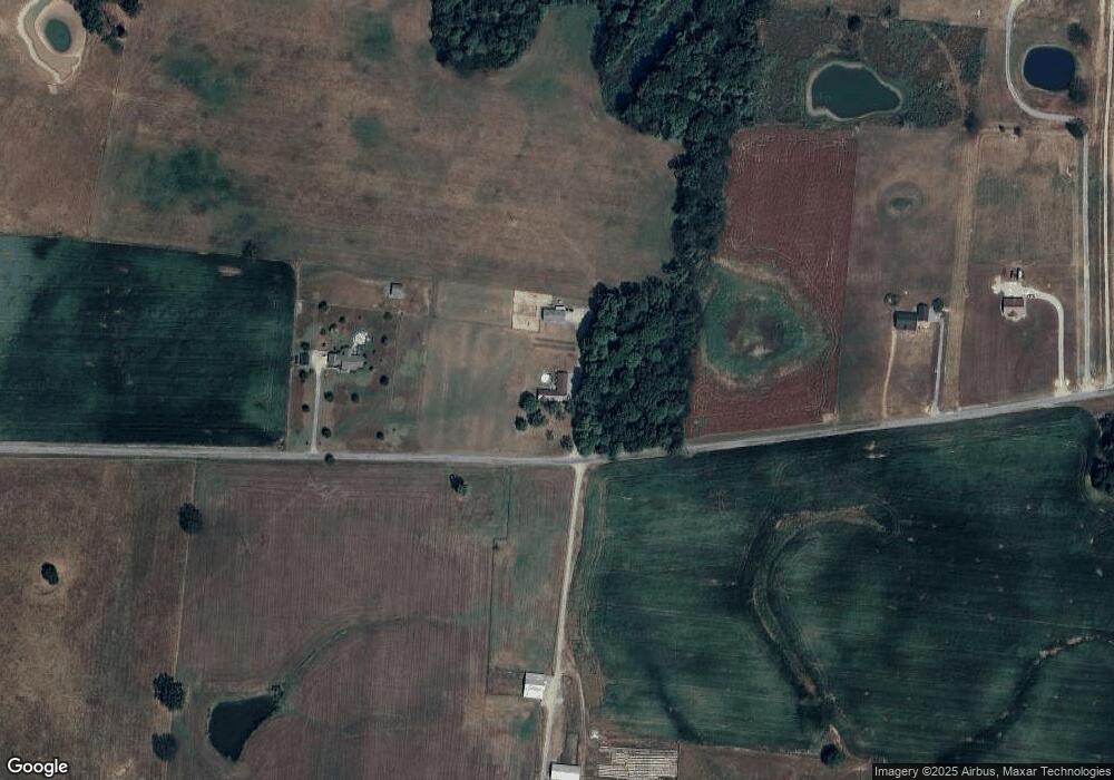
4776 Homer Worsham Rd Springfield, TN 37172
Estimated Value: $441,000 - $663,000
--
Bed
2
Baths
1,970
Sq Ft
$266/Sq Ft
Est. Value
About This Home
This home is located at 4776 Homer Worsham Rd, Springfield, TN 37172 and is currently estimated at $524,228, approximately $266 per square foot. 4776 Homer Worsham Rd is a home located in Robertson County with nearby schools including Krisle Elementary School and East Robertson High School.
Ownership History
Date
Name
Owned For
Owner Type
Purchase Details
Closed on
Jan 2, 2020
Sold by
Db Commercial Llc
Bought by
Draughon Brothers Llc
Current Estimated Value
Purchase Details
Closed on
Dec 30, 2019
Sold by
Draughon Bros Lp
Bought by
Db Commercial Llc
Purchase Details
Closed on
Dec 16, 2004
Sold by
Leslie Cope
Bought by
Shultz Glenn W and Shultz Barbara L
Home Financials for this Owner
Home Financials are based on the most recent Mortgage that was taken out on this home.
Original Mortgage
$133,000
Interest Rate
5.66%
Purchase Details
Closed on
Feb 28, 1997
Sold by
Jacquelyn Guthrie
Bought by
Draughon Bros Lp
Purchase Details
Closed on
Mar 5, 1992
Bought by
Cope Leslie and Cope Kimberely
Create a Home Valuation Report for This Property
The Home Valuation Report is an in-depth analysis detailing your home's value as well as a comparison with similar homes in the area
Home Values in the Area
Average Home Value in this Area
Purchase History
| Date | Buyer | Sale Price | Title Company |
|---|---|---|---|
| Draughon Brothers Llc | -- | None Available | |
| Db Commercial Llc | -- | None Available | |
| Shultz Glenn W | $173,000 | -- | |
| Draughon Bros Lp | -- | -- | |
| Cope Leslie | -- | -- |
Source: Public Records
Mortgage History
| Date | Status | Borrower | Loan Amount |
|---|---|---|---|
| Previous Owner | Cope Leslie | $133,000 |
Source: Public Records
Tax History Compared to Growth
Tax History
| Year | Tax Paid | Tax Assessment Tax Assessment Total Assessment is a certain percentage of the fair market value that is determined by local assessors to be the total taxable value of land and additions on the property. | Land | Improvement |
|---|---|---|---|---|
| 2024 | $1,628 | $90,450 | $20,100 | $70,350 |
| 2023 | $1,773 | $90,450 | $20,100 | $70,350 |
| 2022 | $1,286 | $49,925 | $15,025 | $34,900 |
| 2021 | $1,286 | $49,925 | $15,025 | $34,900 |
| 2020 | $1,286 | $49,925 | $15,025 | $34,900 |
| 2019 | $1,286 | $49,925 | $15,025 | $34,900 |
| 2018 | $1,286 | $49,925 | $15,025 | $34,900 |
| 2017 | $1,367 | $44,325 | $11,250 | $33,075 |
| 2016 | $1,367 | $44,325 | $11,250 | $33,075 |
| 2015 | $1,312 | $44,325 | $11,250 | $33,075 |
| 2014 | $1,312 | $44,325 | $11,250 | $33,075 |
Source: Public Records
Map
Nearby Homes
- 0 Homer Worsham Rd
- 4844 Homer Worsham Rd
- 4534 Roy Cole Rd
- 3966 Baggett Rd
- 6809 Lovel Cook Rd
- 4031 Wells Rd
- 4616 Woodrow Wilson Rd
- 6214 Lincoln Park Rd
- 6216 Lincoln Park Rd
- 0 Pinson Rd
- 6453 Hopewell Rd
- 1074 Pair Six Dr
- 3972 Baggett Rd
- 4002 Baggett Rd
- 6241 Green Rd
- 0 Hopewell Rd
- 6210 Green Rd
- 0 Woodrow Wilson Rd
- 5859 Lakeview Rd
- 7265 Highway 25 E
- 4772 Homer Worsham Rd
- 0 Homer Worsham Rd
- 0 Homer Worsham Rd
- 4832 Homer Worsham Rd
- 6443 Highway 25 E
- 4905 Homer Worsham Rd
- 4909 Homer Worsham Rd
- 6445 Highway 25 E
- 4927 Homer Worsham Rd
- 2040 Durham Ln
- 6441 Highway 25 E
- 6441 Highway 25 E
- 4949 Homer Worsham Rd
- 4603 Homer Worsham Rd
- 4212 Keith Rd
- 0 Hwy 25 Unit RTC2169795
- 0 Hwy 25 Unit RTC2240263
- 4180 Keith Rd
- 4220 Keith Rd
- 6421 Highway 25 E
