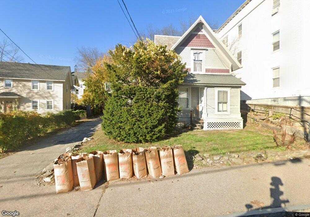
478 Lake Ave Manchester, NH 03103
Hallsville NeighborhoodEstimated Value: $411,172 - $497,000
4
Beds
2
Baths
1,613
Sq Ft
$286/Sq Ft
Est. Value
About This Home
This home is located at 478 Lake Ave, Manchester, NH 03103 and is currently estimated at $460,543, approximately $285 per square foot. 478 Lake Ave is a home located in Hillsborough County with nearby schools including McDonough Elementary School, Wilson School, and Hillside Middle School.
Ownership History
Date
Name
Owned For
Owner Type
Purchase Details
Closed on
Nov 19, 2004
Sold by
Wiggins Mark S and Wiggins Judith A
Bought by
Fragala Seth M
Current Estimated Value
Home Financials for this Owner
Home Financials are based on the most recent Mortgage that was taken out on this home.
Original Mortgage
$168,000
Interest Rate
5.8%
Mortgage Type
Purchase Money Mortgage
Purchase Details
Closed on
Jul 3, 2003
Sold by
Winters David and Winters Suzanne
Bought by
Wiggins Judith A
Purchase Details
Closed on
May 8, 1998
Sold by
Stamp Donald A
Bought by
Winters David P and Winters Suzanne S
Home Financials for this Owner
Home Financials are based on the most recent Mortgage that was taken out on this home.
Original Mortgage
$77,505
Interest Rate
7.05%
Create a Home Valuation Report for This Property
The Home Valuation Report is an in-depth analysis detailing your home's value as well as a comparison with similar homes in the area
Home Values in the Area
Average Home Value in this Area
Purchase History
| Date | Buyer | Sale Price | Title Company |
|---|---|---|---|
| Fragala Seth M | $210,000 | -- | |
| Wiggins Judith A | $180,000 | -- | |
| Winters David P | $81,400 | -- |
Source: Public Records
Mortgage History
| Date | Status | Borrower | Loan Amount |
|---|---|---|---|
| Open | Winters David P | $180,000 | |
| Closed | Winters David P | $33,500 | |
| Closed | Winters David P | $168,000 | |
| Previous Owner | Winters David P | $77,505 |
Source: Public Records
Tax History Compared to Growth
Tax History
| Year | Tax Paid | Tax Assessment Tax Assessment Total Assessment is a certain percentage of the fair market value that is determined by local assessors to be the total taxable value of land and additions on the property. | Land | Improvement |
|---|---|---|---|---|
| 2024 | $5,666 | $289,400 | $85,000 | $204,400 |
| 2023 | $5,458 | $289,400 | $85,000 | $204,400 |
| 2022 | $5,279 | $289,400 | $85,000 | $204,400 |
| 2021 | $5,117 | $289,400 | $85,000 | $204,400 |
| 2020 | $4,325 | $175,400 | $58,600 | $116,800 |
| 2019 | $4,266 | $175,400 | $58,600 | $116,800 |
| 2018 | $4,153 | $175,400 | $58,600 | $116,800 |
| 2017 | $4,090 | $175,400 | $58,600 | $116,800 |
| 2016 | $4,059 | $175,400 | $58,600 | $116,800 |
| 2015 | $3,797 | $162,000 | $58,600 | $103,400 |
| 2014 | $3,807 | $162,000 | $58,600 | $103,400 |
| 2013 | $3,673 | $162,000 | $58,600 | $103,400 |
Source: Public Records
Map
Nearby Homes
- 10 Hayes Ave
- 440 Laurel St
- 527 Hanover St
- 651 Summer St
- 426 Manchester St
- 635 Green St
- 625 Green St
- 383 Manchester St
- 379 Manchester St
- 377 Manchester St
- 383 Concord St
- 383 Concord St Hcrd Plan 42577
- 601 Hall St
- 394 Cedar St
- 662 Amherst St
- 335 Cypress St Unit 4A
- 335 Cypress St Unit 2P
- 362 Amherst St
- 352 Lowell St
- 445 E High St