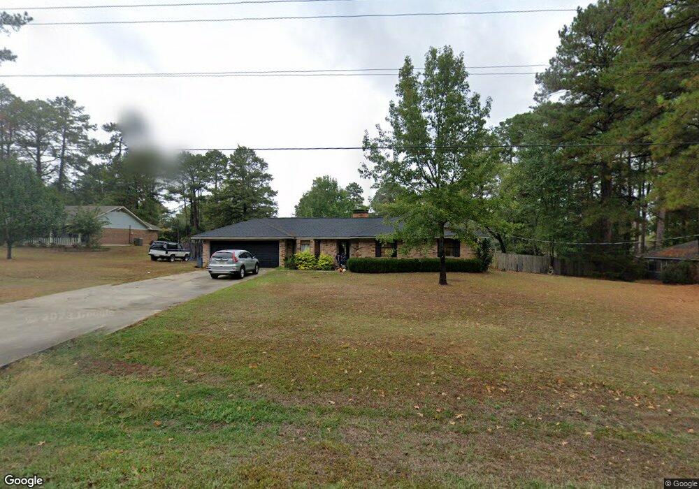
478 Stable Rd Ruston, LA 71270
Estimated Value: $212,000 - $243,000
Studio
--
Bath
1,448
Sq Ft
$160/Sq Ft
Est. Value
About This Home
This home is located at 478 Stable Rd, Ruston, LA 71270 and is currently estimated at $230,956, approximately $159 per square foot. 478 Stable Rd is a home located in Lincoln Parish with nearby schools including Choudrant Elementary School, Choudrant High School, and Ruston Junior High School.
Ownership History
Date
Name
Owned For
Owner Type
Purchase Details
Closed on
Jul 31, 2014
Sold by
Mccullin Matthew Jarod
Bought by
Haddox Gregory Lamar and Haddox Kelsey Hopkins
Current Estimated Value
Home Financials for this Owner
Home Financials are based on the most recent Mortgage that was taken out on this home.
Original Mortgage
$142,373
Interest Rate
4.07%
Mortgage Type
FHA
Purchase Details
Closed on
Mar 24, 2006
Sold by
Bratton Stephen Chad and Bratton Sonya Davis
Bought by
Mccullin Matthew Jarod
Home Financials for this Owner
Home Financials are based on the most recent Mortgage that was taken out on this home.
Original Mortgage
$102,000
Interest Rate
6.21%
Mortgage Type
Purchase Money Mortgage
Create a Home Valuation Report for This Property
The Home Valuation Report is an in-depth analysis detailing your home's value as well as a comparison with similar homes in the area
Purchase History
| Date | Buyer | Sale Price | Title Company |
|---|---|---|---|
| Haddox Gregory Lamar | $145,000 | First American Title Ins Co | |
| Mccullin Matthew Jarod | $118,900 | None Available |
Source: Public Records
Mortgage History
| Date | Status | Borrower | Loan Amount |
|---|---|---|---|
| Previous Owner | Haddox Gregory Lamar | $142,373 | |
| Previous Owner | Mccullin Matthew Jarod | $102,000 |
Source: Public Records
Tax History
| Year | Tax Paid | Tax Assessment Tax Assessment Total Assessment is a certain percentage of the fair market value that is determined by local assessors to be the total taxable value of land and additions on the property. | Land | Improvement |
|---|---|---|---|---|
| 2025 | $1,369 | $16,787 | $1,995 | $14,792 |
| 2024 | $1,369 | $16,787 | $1,995 | $14,792 |
| 2023 | $1,224 | $14,328 | $1,596 | $12,732 |
| 2022 | $1,216 | $14,328 | $1,596 | $12,732 |
| 2021 | $1,197 | $14,328 | $1,596 | $12,732 |
| 2020 | $1,190 | $14,208 | $1,596 | $12,612 |
| 2019 | $1,206 | $14,208 | $1,596 | $12,612 |
| 2018 | $1,207 | $14,208 | $1,596 | $12,612 |
| 2017 | $1,210 | $14,208 | $1,596 | $12,612 |
| 2016 | $1,234 | $0 | $0 | $0 |
| 2015 | $1,205 | $12,817 | $1,283 | $11,534 |
| 2013 | $1,222 | $12,817 | $1,283 | $11,534 |
Source: Public Records
Map
Nearby Homes
- 145 Woodshire Ln
- 0 Stable Run Cir
- 197 Baxter Rd
- 173 Oak Alley Dr
- 135 Camillia Cir
- 209 Burgessville Rd
- 294 Moody Rd
- 150 Burgessville Rd
- 128 Marlou Cir
- 144 Creeks Crossing
- 155 Creekside Dr
- 634 Cheatwood Rd
- 0 Spillers Rd
- 185 Mount Harmony Church Rd
- Lot 1B Unit 1 Harmony Church Rd
- 2420 Highway 33
- 112 Shade Tree Trace
- 136 Shade Tree Trace
- 641 Goodgoin Rd
- 0 Louisiana 33
Your Personal Tour Guide
Ask me questions while you tour the home.