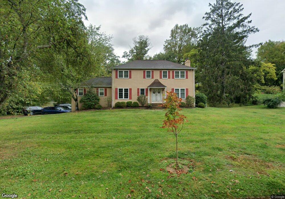
478 Wyldhaven Rd Bryn Mawr, PA 19010
Estimated Value: $1,011,000 - $1,324,000
5
Beds
4
Baths
2,791
Sq Ft
$415/Sq Ft
Est. Value
About This Home
This home is located at 478 Wyldhaven Rd, Bryn Mawr, PA 19010 and is currently estimated at $1,159,517, approximately $415 per square foot. 478 Wyldhaven Rd is a home located in Delaware County with nearby schools including Radnor El School, Radnor Middle School, and Radnor Senior High School.
Ownership History
Date
Name
Owned For
Owner Type
Purchase Details
Closed on
Aug 30, 2008
Sold by
Briscoe Tom W and Briscoe Mary A
Bought by
Wildt Brian A and Wildt Amy B
Current Estimated Value
Home Financials for this Owner
Home Financials are based on the most recent Mortgage that was taken out on this home.
Original Mortgage
$51,000
Interest Rate
6.22%
Mortgage Type
Credit Line Revolving
Purchase Details
Closed on
Sep 30, 2002
Sold by
Barksdale James E and Barksdale Agnes A
Bought by
Briscoe Tom W and Briscoe Mary A
Home Financials for this Owner
Home Financials are based on the most recent Mortgage that was taken out on this home.
Original Mortgage
$300,000
Interest Rate
6.27%
Mortgage Type
Purchase Money Mortgage
Create a Home Valuation Report for This Property
The Home Valuation Report is an in-depth analysis detailing your home's value as well as a comparison with similar homes in the area
Home Values in the Area
Average Home Value in this Area
Purchase History
| Date | Buyer | Sale Price | Title Company |
|---|---|---|---|
| Wildt Brian A | $585,000 | Stewart Title Guaranty Co | |
| Briscoe Tom W | $520,000 | -- |
Source: Public Records
Mortgage History
| Date | Status | Borrower | Loan Amount |
|---|---|---|---|
| Closed | Wildt Brian A | $51,000 | |
| Open | Wildt Brian A | $417,000 | |
| Previous Owner | Briscoe Tom W | $300,000 | |
| Closed | Briscoe Tom W | $50,000 |
Source: Public Records
Tax History Compared to Growth
Tax History
| Year | Tax Paid | Tax Assessment Tax Assessment Total Assessment is a certain percentage of the fair market value that is determined by local assessors to be the total taxable value of land and additions on the property. | Land | Improvement |
|---|---|---|---|---|
| 2025 | $12,792 | $632,680 | $224,660 | $408,020 |
| 2024 | $12,792 | $632,680 | $224,660 | $408,020 |
| 2023 | $12,285 | $632,680 | $224,660 | $408,020 |
| 2022 | $12,151 | $632,680 | $224,660 | $408,020 |
| 2021 | $19,517 | $632,680 | $224,660 | $408,020 |
| 2020 | $11,423 | $328,370 | $127,210 | $201,160 |
| 2019 | $11,101 | $328,370 | $127,210 | $201,160 |
| 2018 | $10,883 | $328,370 | $0 | $0 |
| 2017 | $10,655 | $328,370 | $0 | $0 |
| 2016 | $1,802 | $328,370 | $0 | $0 |
| 2015 | $1,802 | $328,370 | $0 | $0 |
| 2014 | $1,802 | $328,370 | $0 | $0 |
Source: Public Records
Map
Nearby Homes
- 406 Barclay Rd
- 560 S Bryn Mawr Ave
- 100 Radnor Ave
- 215 Cornell Dr
- 12 Chalous Ln
- 4 Lockwood Ln
- 15 Lockwood Ln
- 7 Lockwood Ln
- 625 Conestoga Rd
- 200 S Ithan Ave
- 3 Lockwood Ln
- 12 Lockwood Ln
- 219 S Ithan Ave
- 390 S Bryn Mawr Ave
- 189 Meredith Ave
- 101 Highfield Rd
- 253 Ithan Creek Rd
- 307 B B000 Summit Dr Unit B
- 202 Summit Dr Unit B
- 103 Summit Dr Unit B
- 484 Wyldhaven Rd
- 472 Wyldhaven Rd
- 547 Brandymede Rd
- 539 Brandymede Rd
- 535 Brandymede Rd
- 478 Marlbridge Rd
- 461 Wyldhaven Rd
- 474 Marlbridge Rd
- 531 Brandymede Rd
- 462 Wyldhaven Rd
- 540 Brandymede Rd
- 536 Brandymede Rd
- 490 Wyldhaven Rd
- 468 Marlbridge Rd
- 475 Marlbridge Rd
- 457 Wyldhaven Rd
- 527 Brandymede Rd
- 532 Brandymede Rd
- 481 Marlbridge Rd
- 528 Brandymede Rd