Estimated Value: $362,556 - $411,000
2
Beds
2
Baths
2,770
Sq Ft
$137/Sq Ft
Est. Value
About This Home
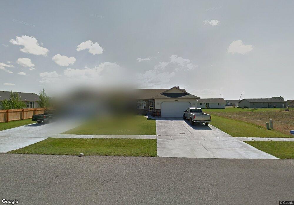
This home is located at 4780 Denning Ave, Iona, ID 83427 and is currently estimated at $379,139, approximately $136 per square foot. 4780 Denning Ave is a home with nearby schools including Iona Elementary School, Rocky Mountain Middle School, and Bonneville High School.
Ownership History
Date
Name
Owned For
Owner Type
Purchase Details
Closed on
Apr 25, 2007
Sold by
Muntain Ridge Estates Lcl
Bought by
Kirkpatrick Gerald B and Kirkpatrick Bonnie G
Current Estimated Value
Home Financials for this Owner
Home Financials are based on the most recent Mortgage that was taken out on this home.
Original Mortgage
$154,746
Outstanding Balance
$93,512
Interest Rate
6.14%
Mortgage Type
New Conventional
Estimated Equity
$285,627
Create a Home Valuation Report for This Property
The Home Valuation Report is an in-depth analysis detailing your home's value as well as a comparison with similar homes in the area
Home Values in the Area
Average Home Value in this Area
Purchase History
| Date | Buyer | Sale Price | Title Company |
|---|---|---|---|
| Kirkpatrick Gerald B | -- | Idaho Title & Trust |
Source: Public Records
Mortgage History
| Date | Status | Borrower | Loan Amount |
|---|---|---|---|
| Open | Kirkpatrick Gerald B | $154,746 |
Source: Public Records
Tax History
| Year | Tax Paid | Tax Assessment Tax Assessment Total Assessment is a certain percentage of the fair market value that is determined by local assessors to be the total taxable value of land and additions on the property. | Land | Improvement |
|---|---|---|---|---|
| 2025 | $1,303 | $367,994 | $55,197 | $312,797 |
| 2024 | $1,463 | $377,666 | $46,618 | $331,048 |
| 2023 | $1,328 | $330,558 | $46,618 | $283,940 |
| 2022 | $1,573 | $297,798 | $40,538 | $257,260 |
| 2021 | $1,259 | $209,048 | $40,538 | $168,510 |
| 2019 | $1,401 | $176,831 | $29,821 | $147,010 |
| 2018 | $1,296 | $180,564 | $27,114 | $153,450 |
| 2017 | $1,220 | $160,098 | $22,588 | $137,510 |
| 2016 | $1,196 | $148,798 | $22,588 | $126,210 |
| 2015 | $1,142 | $138,254 | $20,134 | $118,120 |
| 2014 | $18,526 | $138,254 | $20,134 | $118,120 |
| 2013 | $1,123 | $130,394 | $20,134 | $110,260 |
Source: Public Records
Map
Nearby Homes
- 3142 Quaky Aspen Dr
- 5289 E Free Ave
- 3528 N Elim Ln
- 2850 Sable Chase Rd
- 5113 Ryanne Way
- 5311 E Dutson
- 5136 Ryanne Way
- 5082 Nelson Dr
- 4307 E Marlin Ave
- 4372 E Arcadia Ave
- 5317 E Buchanan Ave
- 4343 E Arcadia Ave
- 4129 E Marlin Ave
- 4019 Baldwin Ave
- 3720 Barcelona Ave
- 2920 Sunlight Dr
- 4175 N Catalina Ave
- 4150 N Main St
- 3866 N Ola Vista Ave
- 5571 E Iona Rd
- 4782 Denning Ave
- 4770 Denning Ave
- 4752 Denning Ave
- 4763 Weigel Cir
- 3071 Lilac Cir
- 4742 Denning Ave
- 3001 Lilac Cir
- 3110 Quaky Aspen Dr
- 3110 Quakey Aspen Dr
- 3103 Alder Cir
- 4740 Denning Ave
- 4770 Weigel Cir
- 4741 Weigel Cir
- 3112 Quaky Aspen Dr
- 3112 Quakey Aspen Dr
- 4722 Denning Ave
- 2975 Lilac Cir
- 4721 Weigel Cir
- 3141 Alder Cir
- 3140 Quakey Aspen Dr
Your Personal Tour Guide
Ask me questions while you tour the home.