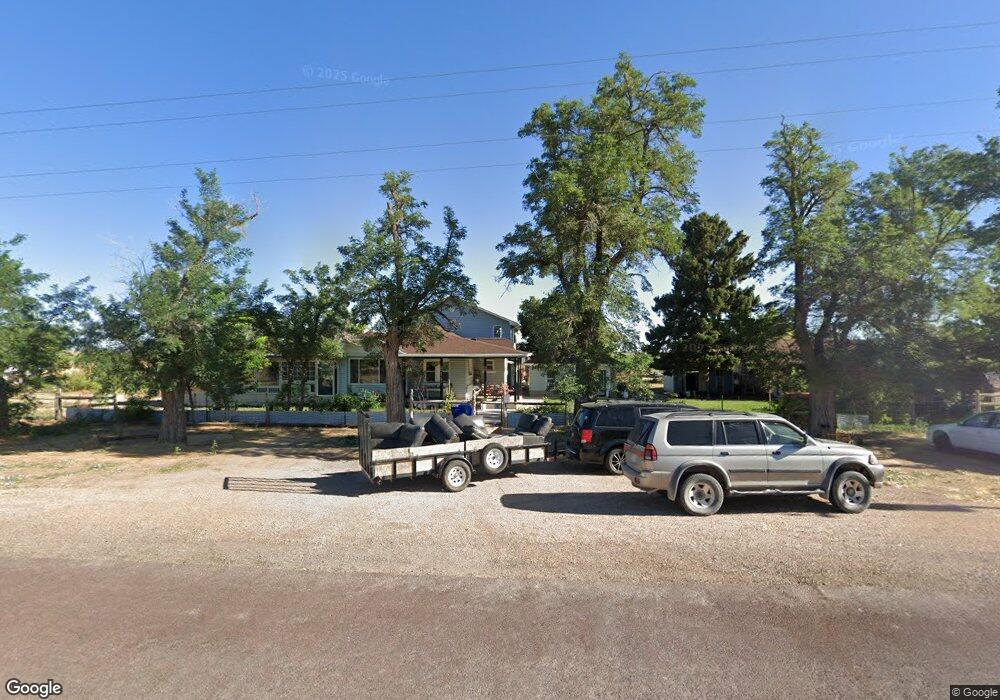
4780 W Hatton Rd Kanosh, UT 84637
Estimated Value: $467,000 - $515,000
3
Beds
3
Baths
4,019
Sq Ft
$122/Sq Ft
Est. Value
About This Home
This home is located at 4780 W Hatton Rd, Kanosh, UT 84637 and is currently estimated at $491,000, approximately $122 per square foot. 4780 W Hatton Rd is a home located in Millard County.
Ownership History
Date
Name
Owned For
Owner Type
Purchase Details
Closed on
Apr 8, 2022
Sold by
Lloyd Craig J
Bought by
Lloyd Craig J and Spears-Lloyd Billie
Current Estimated Value
Home Financials for this Owner
Home Financials are based on the most recent Mortgage that was taken out on this home.
Original Mortgage
$94,474
Outstanding Balance
$88,887
Interest Rate
4.72%
Mortgage Type
Credit Line Revolving
Estimated Equity
$402,113
Purchase Details
Closed on
Nov 1, 2021
Sold by
Lioyd Craig J
Bought by
Lioyd Craig J and Lioyd Billie Spcais
Purchase Details
Closed on
Aug 11, 2020
Sold by
Wood Para A
Bought by
Lloyd Craig J
Home Financials for this Owner
Home Financials are based on the most recent Mortgage that was taken out on this home.
Original Mortgage
$256,272
Interest Rate
2.9%
Mortgage Type
FHA
Purchase Details
Closed on
Jul 9, 2019
Sold by
Wood Dale and Wood Para A
Bought by
Wood Dale G and Wood Living Trust
Create a Home Valuation Report for This Property
The Home Valuation Report is an in-depth analysis detailing your home's value as well as a comparison with similar homes in the area
Purchase History
We collect this data history from publicly available records. To have your information removed, we recommend requesting removal directly through your county’s website.
| Date | Buyer | Sale Price | Title Company |
|---|---|---|---|
| Lloyd Craig J | -- | None Listed On Document | |
| Lioyd Craig J | -- | None Available | |
| Lloyd Craig J | -- | First American Title Insuran | |
| Wood Dale G | -- | None Available |
Source: Public Records
Mortgage History
We collect this data history from publicly available records. To have your information removed, we recommend requesting removal directly through your county’s website.
| Date | Status | Borrower | Loan Amount |
|---|---|---|---|
| Open | Lloyd Craig J | $94,474 | |
| Previous Owner | Lloyd Craig J | $256,272 |
Source: Public Records
Tax History
| Year | Tax Paid | Tax Assessment Tax Assessment Total Assessment is a certain percentage of the fair market value that is determined by local assessors to be the total taxable value of land and additions on the property. | Land | Improvement |
|---|---|---|---|---|
| 2025 | $2,589 | $344,621 | $21,000 | $323,621 |
| 2024 | $2,589 | $265,698 | $15,508 | $250,190 |
| 2023 | $2,791 | $265,698 | $15,508 | $250,190 |
| 2022 | $1,790 | $171,426 | $14,700 | $156,726 |
| 2021 | $1,501 | $138,824 | $12,963 | $125,861 |
| 2020 | $1,301 | $121,826 | $12,963 | $108,863 |
| 2019 | $1,183 | $111,664 | $12,963 | $98,701 |
| 2018 | $1,152 | $111,551 | $12,850 | $98,701 |
| 2017 | $1,170 | $108,251 | $9,550 | $98,701 |
| 2016 | $1,116 | $108,251 | $9,550 | $98,701 |
| 2015 | $1,108 | $107,391 | $9,550 | $97,841 |
| 2014 | -- | $107,391 | $9,550 | $97,841 |
| 2013 | -- | $107,391 | $9,550 | $97,841 |
Source: Public Records
Map
Nearby Homes
- 115 W 200 S
- 195 E 200 South St
- 73 E 700 S
- 135 E 200 N
- 0 County Road 4616
- 4909 W 6150 S
- 80 W 470 N
- 11 S 200 E
- 479 E 100 N
- 1565 W Sunflower Ln Unit 3
- 1615 W Sunflower Ln
- 1615 W Sunflower Ln Unit 4
- 1565 W Sunflower Ln
- 0 Tbd Black Rock Rd Unit LotWP001
- 2000 N West Frontage I-15
- 1100 S 725 Rd W
- 310 S 500 West Rd
- 465 S 100 W
- 760 E 700 St S
- 155 E 500 St S
Your Personal Tour Guide
Ask me questions while you tour the home.