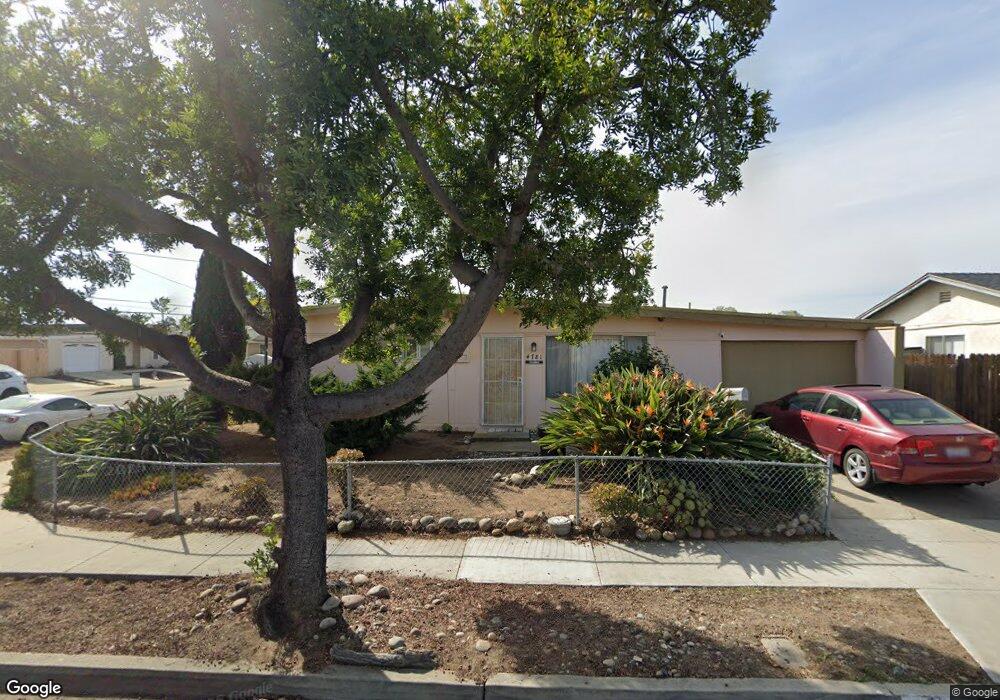
4781 Pauling Ave San Diego, CA 92122
University City NeighborhoodEstimated Value: $1,199,194 - $1,432,000
3
Beds
2
Baths
1,204
Sq Ft
$1,132/Sq Ft
Est. Value
About This Home
This home is located at 4781 Pauling Ave, San Diego, CA 92122 and is currently estimated at $1,362,799, approximately $1,131 per square foot. 4781 Pauling Ave is a home located in San Diego County with nearby schools including Marie Curie Elementary School, Standley Middle School, and University City High School.
Ownership History
Date
Name
Owned For
Owner Type
Purchase Details
Closed on
Jul 27, 2006
Sold by
Shnitzer Yigal and Shnitzer Hadasah
Bought by
Schnitzer Yigal and Schnitzer Hadasah
Current Estimated Value
Purchase Details
Closed on
Nov 13, 2002
Sold by
Shnitzer Yigal and Shnitzer Hadasah
Bought by
Shnitzer Yigal and Shnitzer Hadasah
Purchase Details
Closed on
Jul 25, 1996
Sold by
Yigal Schnitzer
Bought by
Shnitzer Yigal and Shnitzer Hadasah
Purchase Details
Closed on
Apr 28, 1989
Create a Home Valuation Report for This Property
The Home Valuation Report is an in-depth analysis detailing your home's value as well as a comparison with similar homes in the area
Home Values in the Area
Average Home Value in this Area
Purchase History
| Date | Buyer | Sale Price | Title Company |
|---|---|---|---|
| Schnitzer Yigal | -- | None Available | |
| Shnitzer Yigal | -- | -- | |
| Shnitzer Yigal | -- | -- | |
| -- | $205,000 | -- |
Source: Public Records
Tax History Compared to Growth
Tax History
| Year | Tax Paid | Tax Assessment Tax Assessment Total Assessment is a certain percentage of the fair market value that is determined by local assessors to be the total taxable value of land and additions on the property. | Land | Improvement |
|---|---|---|---|---|
| 2025 | $4,666 | $384,661 | $155,623 | $229,038 |
| 2024 | $4,666 | $377,120 | $152,572 | $224,548 |
| 2023 | $4,563 | $369,727 | $149,581 | $220,146 |
| 2022 | $4,442 | $362,479 | $146,649 | $215,830 |
| 2021 | $4,412 | $355,373 | $143,774 | $211,599 |
| 2020 | $4,359 | $351,730 | $142,300 | $209,430 |
| 2019 | $4,281 | $344,834 | $139,510 | $205,324 |
| 2018 | $4,003 | $338,074 | $136,775 | $201,299 |
| 2017 | $3,908 | $331,446 | $134,094 | $197,352 |
| 2016 | $3,845 | $324,948 | $131,465 | $193,483 |
| 2015 | $3,789 | $320,068 | $129,491 | $190,577 |
| 2014 | $3,730 | $313,799 | $126,955 | $186,844 |
Source: Public Records
Map
Nearby Homes
- 7212 Florey St
- 7056 Haworth St
- 4950 Whipple Way
- 4635 Pauling Ave
- 4612 Benhurst Ave
- 4627 Huggins St
- 4282 Robbins St
- 4224 Governor Dr
- 7190 Shoreline Dr Unit 6309
- 7190 Shoreline Dr Unit 6313
- 4138 Combe Way
- 7160 Shoreline Dr Unit 4213
- 6214 Agee St Unit 34
- 6180 Agee St Unit 159
- 6188 Agee St Unit 230
- 6190 Agee St Unit 260
- 5889 Cozzens St
- 6330 Genesee Ave Unit 319
- 6330 Genesee Ave Unit 220
- 6330 Genesee Ave Unit 119
- 4773 Pauling Ave
- 4744 Ramsay Ave
- 4767 Pauling Ave
- 4734 Ramsay Ave
- 4724 Ramsay Ave
- 7046 Florey St
- 4774 Pauling Ave
- 4761 Pauling Ave
- 6979 Florey St
- 7015 Florey St
- 6969 Florey St
- 4768 Pauling Ave
- 4714 Ramsay Ave
- 7029 Florey St
- 6959 Florey St
- 4755 Pauling Ave
- 4762 Pauling Ave
- 7043 Florey St
- 6949 Florey St
- 4704 Ramsay Ave