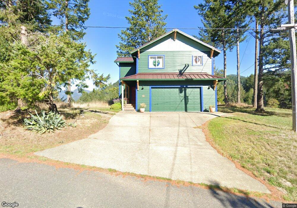
479 Humboldt Loop Whitethorn, CA 95589
Estimated Value: $472,359 - $844,000
2
Beds
2
Baths
1,500
Sq Ft
$394/Sq Ft
Est. Value
About This Home
This home is located at 479 Humboldt Loop, Whitethorn, CA 95589 and is currently estimated at $591,340, approximately $394 per square foot. 479 Humboldt Loop is a home located in Humboldt County.
Ownership History
Date
Name
Owned For
Owner Type
Purchase Details
Closed on
Feb 7, 2025
Sold by
Andres Timothy Paul
Bought by
Trust Of Timothy P Andres and Andres
Current Estimated Value
Purchase Details
Closed on
Jun 4, 2021
Sold by
Parry Alun and Parry Noreen
Bought by
Andres Eva Kaminker and Andres Timothy Paul
Home Financials for this Owner
Home Financials are based on the most recent Mortgage that was taken out on this home.
Original Mortgage
$345,000
Interest Rate
2.9%
Mortgage Type
Commercial
Create a Home Valuation Report for This Property
The Home Valuation Report is an in-depth analysis detailing your home's value as well as a comparison with similar homes in the area
Home Values in the Area
Average Home Value in this Area
Purchase History
| Date | Buyer | Sale Price | Title Company |
|---|---|---|---|
| Trust Of Timothy P Andres | -- | None Listed On Document | |
| Andres Eva Kaminker | $420,000 | Fidelity Natl Ttl Co Of Ca |
Source: Public Records
Mortgage History
| Date | Status | Borrower | Loan Amount |
|---|---|---|---|
| Previous Owner | Andres Eva Kaminker | $345,000 |
Source: Public Records
Tax History
| Year | Tax Paid | Tax Assessment Tax Assessment Total Assessment is a certain percentage of the fair market value that is determined by local assessors to be the total taxable value of land and additions on the property. | Land | Improvement |
|---|---|---|---|---|
| 2025 | $5,024 | $454,621 | $184,013 | $270,608 |
| 2024 | $5,024 | $445,707 | $180,405 | $265,302 |
| 2023 | $5,042 | $436,968 | $176,868 | $260,100 |
| 2022 | $4,965 | $428,400 | $173,400 | $255,000 |
| 2021 | $1,827 | $138,867 | $17,266 | $121,601 |
| 2020 | $1,836 | $137,444 | $17,089 | $120,355 |
| 2019 | $1,797 | $134,750 | $16,754 | $117,996 |
| 2018 | $1,771 | $132,109 | $16,426 | $115,683 |
| 2017 | $1,643 | $129,519 | $16,104 | $113,415 |
| 2016 | $1,634 | $126,981 | $15,789 | $111,192 |
| 2015 | $1,627 | $125,074 | $15,552 | $109,522 |
| 2014 | $1,600 | $122,625 | $15,248 | $107,377 |
Source: Public Records
Map
Nearby Homes
- 560 Upper Pacific Dr
- 48 Cinch Ct
- 80 Eel Ct
- 68 Eel Ct
- 133 Eel Ct
- 761 Redwood Rd
- 972 Spring Rd
- 199 Spring Road 166 Debbie Ln
- 134 Albatross Rd
- 745 Spring Rd
- 266 Dolphin Dr
- 1002 Spring Rd
- 124 Albatross Rd
- 245 Albatross Rd
- 146 Spring Rd
- 93 Dolphin Dr
- 663 Redwood Rd
- 829 Spring Rd
- 1104 Spring Rd
- 65 Eileen Rd
- 478 Humboldt Loop
- 464 Humboldt Loop
- 489 & 508 Humboldt Loop Rd
- 490 Humboldt Loop
- 499 Humboldt Loop Rd
- 440 Humboldt Loop
- 508 Humboldt Loop Rd
- 443 Humboldt Loop
- 509 Humboldt Loop
- 424 Humboldt Loop
- 415 Humboldt Loop
- 13 Tern Rd
- 625 Upper Pacific Dr
- 635 Upper Pacific Dr
- 420 Humboldt Loop
- 615 Upper Pacific Dr
- 6 Seaview Point
- 701 Upper Pacific Dr
- 37 Tern Rd
- 416 Spring Rd
