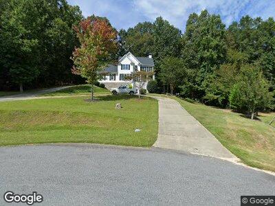
479 Lake Laurel Dr Unit 35 Dahlonega, GA 30533
Estimated Value: $625,000 - $821,000
5
Beds
5
Baths
4,643
Sq Ft
$159/Sq Ft
Est. Value
About This Home
This home is located at 479 Lake Laurel Dr Unit 35, Dahlonega, GA 30533 and is currently estimated at $740,351, approximately $159 per square foot. 479 Lake Laurel Dr Unit 35 is a home located in Lumpkin County with nearby schools including Lumpkin County High School.
Ownership History
Date
Name
Owned For
Owner Type
Purchase Details
Closed on
Feb 4, 2022
Sold by
Hattaway Duane V
Bought by
Chacon Peter and Chacon Jill T
Current Estimated Value
Purchase Details
Closed on
May 12, 2005
Sold by
Rhoades R Michael
Bought by
Conrad Chalet
Purchase Details
Closed on
Aug 15, 2001
Sold by
Rymer Development Llc
Bought by
Hattaway Duane V and Hattaway Lynn S
Create a Home Valuation Report for This Property
The Home Valuation Report is an in-depth analysis detailing your home's value as well as a comparison with similar homes in the area
Home Values in the Area
Average Home Value in this Area
Purchase History
| Date | Buyer | Sale Price | Title Company |
|---|---|---|---|
| Chacon Peter | $565,000 | -- | |
| Conrad Chalet | $225,000 | -- | |
| Hattaway Duane V | $40,000 | -- |
Source: Public Records
Mortgage History
| Date | Status | Borrower | Loan Amount |
|---|---|---|---|
| Previous Owner | Hattaway Duane V | $299,700 | |
| Previous Owner | Hattaway Duane | $299,700 | |
| Previous Owner | Hattaway Duane | $30,000 | |
| Previous Owner | Hattaway Duane Vause | $307,300 |
Source: Public Records
Tax History Compared to Growth
Tax History
| Year | Tax Paid | Tax Assessment Tax Assessment Total Assessment is a certain percentage of the fair market value that is determined by local assessors to be the total taxable value of land and additions on the property. | Land | Improvement |
|---|---|---|---|---|
| 2024 | $5,957 | $255,270 | $10,000 | $245,270 |
| 2023 | $4,856 | $239,357 | $10,000 | $229,357 |
| 2022 | $5,507 | $224,460 | $10,000 | $214,460 |
| 2021 | $4,874 | $192,387 | $10,000 | $182,387 |
| 2020 | $4,880 | $187,007 | $10,000 | $177,007 |
| 2019 | $4,925 | $187,007 | $10,000 | $177,007 |
| 2018 | $4,018 | $143,640 | $10,000 | $133,640 |
| 2017 | $3,899 | $136,792 | $10,000 | $126,792 |
| 2016 | $3,664 | $124,509 | $10,000 | $114,509 |
| 2015 | $3,264 | $124,509 | $10,000 | $114,509 |
| 2014 | $3,264 | $125,825 | $10,000 | $115,825 |
| 2013 | -- | $127,141 | $10,000 | $117,141 |
Source: Public Records
Map
Nearby Homes
- 516 Martin Byers Rd
- 71 Parks Place
- 300 Elliots Ln
- 6292 Timber Creek Trail
- 6439 S Chestatee
- 6266 Yellow Creek Rd
- 250 Silas Rd
- 1011 Gold Ridge Rd
- 0 Eagle Rest Rd Unit 13519388
- 15 Wild Azalea Trail
- 6251 Yellow Creek Rd
- 0 Long Branch Rd Unit 22030489
- 00 Long Branch Rd
- 0 Long Branch Rd Unit 10271720
- 0 Long Branch Rd Unit 10271266
- 0 Long Branch Rd Unit 7357871
- 307 Eagle Overlook Dr
- 68 Flynt Ridge Dr
- 5195 S Chestatee
- 479 Lake Laurel Dr Unit 35
- 479 Lake Laurel Dr
- 511 Lake Laurel Dr
- 455 Lake Laurel Dr
- 441 Lake Laurel Dr
- 510 Lake Laurel Dr
- 450 Lake Laurel Dr
- 476 Lake Laurel Dr
- 100 Lake Laurel Trail
- 405 Robins Ln
- 29 Lake Laurel Ct
- 60 Lake Laurel Trail
- 412 Lake Laurel Dr
- 266 Robins Ln
- 160 Robins Ln
- 63 Lake Laurel Ct S
- 30 Lake Laurel Ct
- 246 Robins Ln Unit 10
- 246 Robins Ln
- 390 Lake Laurel Dr