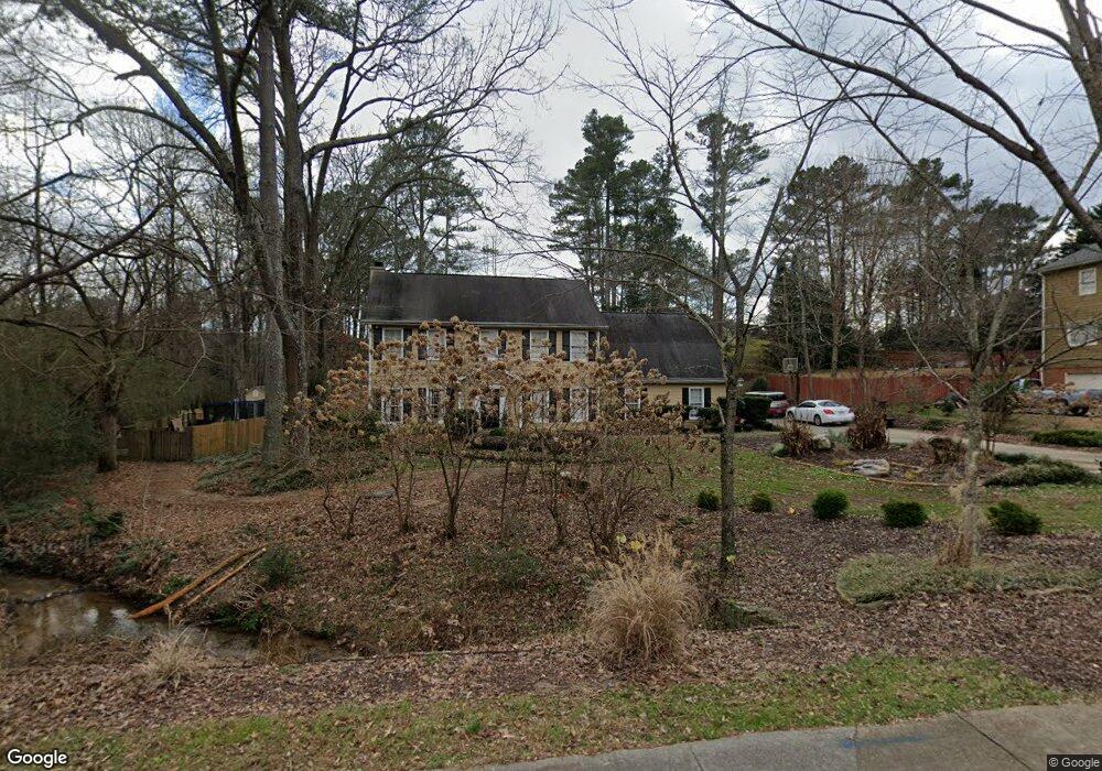
479 Lees Trace SW Marietta, GA 30064
Southwestern Marietta NeighborhoodEstimated Value: $429,000 - $608,471
4
Beds
3
Baths
2,494
Sq Ft
$222/Sq Ft
Est. Value
About This Home
This home is located at 479 Lees Trace SW, Marietta, GA 30064 and is currently estimated at $553,618, approximately $221 per square foot. 479 Lees Trace SW is a home located in Cobb County with nearby schools including A.L. Burruss Elementary School, Marietta Sixth Grade Academy, and Marietta Middle School.
Ownership History
Date
Name
Owned For
Owner Type
Purchase Details
Closed on
Nov 23, 2005
Sold by
Perry Albert
Bought by
Lawson Theresa and Lawson Stacey
Current Estimated Value
Home Financials for this Owner
Home Financials are based on the most recent Mortgage that was taken out on this home.
Original Mortgage
$175,000
Outstanding Balance
$95,886
Interest Rate
6.04%
Mortgage Type
New Conventional
Estimated Equity
$457,732
Purchase Details
Closed on
Jul 3, 1997
Sold by
Johnson Forrest D
Bought by
Perry Albert
Home Financials for this Owner
Home Financials are based on the most recent Mortgage that was taken out on this home.
Original Mortgage
$144,000
Interest Rate
7.98%
Mortgage Type
New Conventional
Create a Home Valuation Report for This Property
The Home Valuation Report is an in-depth analysis detailing your home's value as well as a comparison with similar homes in the area
Home Values in the Area
Average Home Value in this Area
Purchase History
| Date | Buyer | Sale Price | Title Company |
|---|---|---|---|
| Lawson Theresa | $245,000 | -- | |
| Perry Albert | $160,000 | -- |
Source: Public Records
Mortgage History
| Date | Status | Borrower | Loan Amount |
|---|---|---|---|
| Open | Lawson Theresa | $175,000 | |
| Previous Owner | Perry Albert | $144,000 |
Source: Public Records
Tax History Compared to Growth
Tax History
| Year | Tax Paid | Tax Assessment Tax Assessment Total Assessment is a certain percentage of the fair market value that is determined by local assessors to be the total taxable value of land and additions on the property. | Land | Improvement |
|---|---|---|---|---|
| 2025 | $624 | $209,984 | $52,000 | $157,984 |
| 2024 | $624 | $209,984 | $52,000 | $157,984 |
| 2023 | $471 | $183,836 | $46,000 | $137,836 |
| 2022 | $624 | $134,376 | $29,800 | $104,576 |
| 2021 | $641 | $134,376 | $29,800 | $104,576 |
| 2020 | $639 | $119,324 | $29,800 | $89,524 |
| 2019 | $639 | $119,324 | $29,800 | $89,524 |
| 2018 | $638 | $114,148 | $28,000 | $86,148 |
| 2017 | $513 | $114,148 | $28,000 | $86,148 |
| 2016 | $516 | $109,296 | $28,000 | $81,296 |
| 2015 | $563 | $102,116 | $28,000 | $74,116 |
| 2014 | $583 | $102,116 | $0 | $0 |
Source: Public Records
Map
Nearby Homes
- 1047 Chestnut Hill Cir SW
- 332 Rockmann Ln SW
- 1161 Rockmann Terrace SW
- 988 Grantham Way SW
- 1198 Seminary Dr SW
- 1211 Cliffpine Ct SW
- 1121 Cannongate Crossing SW
- 560 Manning Rd SW
- 1011 Cannongate Crossing SW
- 1017 Cannongate Crossing SW
- 839 Manning Villas Ct SW
- 916 Cannon Gate Crossing
- 652 Trailwood Ln SW
- 916 Cannongate Crossing SW Unit 916
- The Bainbridge Plan at Highvale
- The Oxford Plan at Highvale
- The Thomson Plan at Highvale
- The Vinings Plan at Highvale
- The Brooks Plan at Highvale
- The Pinehurst Plan at Highvale
- 485 Lees Trace SW
- 475 Lees Trace SW
- 1053 Foreststone Way SW
- 1057 Foreststone Way SW
- 1033 Chestnut Hill Cir SW
- 471 Lees Trace SW
- 474 Lees Trace SW Unit 1
- 1061 Foreststone Way SW
- 1052 Foreststone Way SW
- 1079 Foreststone Way SW
- 470 Lees Trace SW
- 467 Lees Trace SW
- 1035 Chestnut Hill Cir SW
- 496 Lees Trace SW
- 1073 Foreststone Way SW
- 1067 Foreststone Way SW
- 502 Lees Trace SW
- 1036 Chestnut Hill Cir SW
- 856 Trailside Ln SW
- 466 Lees Trace SW