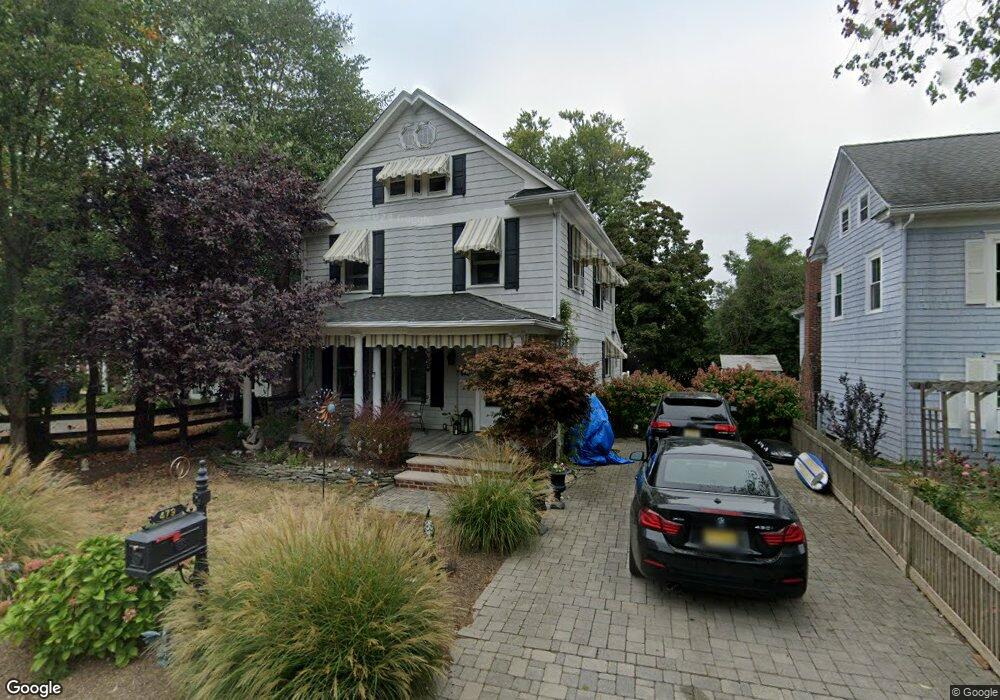
479 Locust Point Rd Rumson, NJ 07760
Locust NeighborhoodEstimated Value: $771,000 - $1,235,000
3
Beds
2
Baths
1,866
Sq Ft
$543/Sq Ft
Est. Value
About This Home
This home is located at 479 Locust Point Rd, Rumson, NJ 07760 and is currently estimated at $1,012,350, approximately $542 per square foot. 479 Locust Point Rd is a home located in Monmouth County with nearby schools including Navesink Elementary School, Bayshore Middle School, and Middletown - South High School.
Ownership History
Date
Name
Owned For
Owner Type
Purchase Details
Closed on
Mar 21, 2019
Sold by
Pereless Arthur E and Corcoran Pereless Nadine
Bought by
Corcoran Pereless Nadine
Current Estimated Value
Home Financials for this Owner
Home Financials are based on the most recent Mortgage that was taken out on this home.
Original Mortgage
$309,000
Outstanding Balance
$271,110
Interest Rate
4.3%
Mortgage Type
New Conventional
Estimated Equity
$741,240
Purchase Details
Closed on
Nov 12, 1997
Sold by
Hildebrand Jeffrey
Bought by
Pereless Arthur
Home Financials for this Owner
Home Financials are based on the most recent Mortgage that was taken out on this home.
Original Mortgage
$186,000
Interest Rate
7.28%
Mortgage Type
Purchase Money Mortgage
Purchase Details
Closed on
Mar 21, 1995
Sold by
Daiker Jeffrey
Bought by
Hildebrand Jeffrey and Hildebrand Anne
Create a Home Valuation Report for This Property
The Home Valuation Report is an in-depth analysis detailing your home's value as well as a comparison with similar homes in the area
Home Values in the Area
Average Home Value in this Area
Purchase History
| Date | Buyer | Sale Price | Title Company |
|---|---|---|---|
| Corcoran Pereless Nadine | -- | Olde School Title Svcs Llc | |
| Pereless Arthur | $195,700 | -- | |
| Hildebrand Jeffrey | $168,000 | -- |
Source: Public Records
Mortgage History
| Date | Status | Borrower | Loan Amount |
|---|---|---|---|
| Open | Corcoran Pereless Nadine | $309,000 | |
| Closed | Pereless Arthur | $186,000 |
Source: Public Records
Tax History Compared to Growth
Tax History
| Year | Tax Paid | Tax Assessment Tax Assessment Total Assessment is a certain percentage of the fair market value that is determined by local assessors to be the total taxable value of land and additions on the property. | Land | Improvement |
|---|---|---|---|---|
| 2025 | $11,232 | $838,000 | $581,600 | $256,400 |
| 2024 | $10,178 | $682,800 | $431,100 | $251,700 |
| 2023 | $10,178 | $585,600 | $399,200 | $186,400 |
| 2022 | $10,275 | $524,600 | $347,100 | $177,500 |
| 2021 | $10,275 | $494,000 | $336,100 | $157,900 |
| 2020 | $10,485 | $490,400 | $336,100 | $154,300 |
| 2019 | $10,338 | $489,500 | $336,100 | $153,400 |
| 2018 | $10,454 | $482,400 | $336,100 | $146,300 |
| 2017 | $9,985 | $470,100 | $336,100 | $134,000 |
| 2016 | $9,937 | $466,300 | $321,100 | $145,200 |
| 2015 | $9,954 | $466,000 | $321,100 | $144,900 |
| 2014 | $9,929 | $453,600 | $321,100 | $132,500 |
Source: Public Records
Map
Nearby Homes
- 538 Locust Point Rd
- 18 Clay Ct
- 942 Navesink River Rd
- 139 Monmouth Ave
- 809 Navesink River Rd
- 96 East Ave Unit 104
- 96 East Ave Unit 75
- 185 Monmouth Ave
- 38 East Ave
- 4 Isabella Ct
- 49 Pape Dr
- 97 Asbury Ave
- 502 Central Ave
- HAMPSHIRE Plan at Central Ave
- 498 Central Ave
- 608 Raritan Ave
- 383 Navesink Ave
- 7100 Prospect Ave
- 6998 Prospect Ave
- 500 Central Ave
- 475 Locust Point Rd
- 475 Locust Point Rd
- 471 Locust Point Rd
- 467 Locust Point Rd
- 201 Locust Ave
- 491 Locust Point Rd
- 207 Locust Ave
- 463 Locust Point Rd
- 211 Locust Ave
- 459 Locust Point Rd
- 458 Locust Point Rd
- 501 Locust Point Rd
- 500 Locust Point Rd
- 455 Locust Point Rd
- 474 Locust Point Rd
- 504 Locust Point Rd
- 509 Locust Point Rd
- 508 Locust Point Rd
- 451 Locust Point Rd
- 513 Locust Point Rd