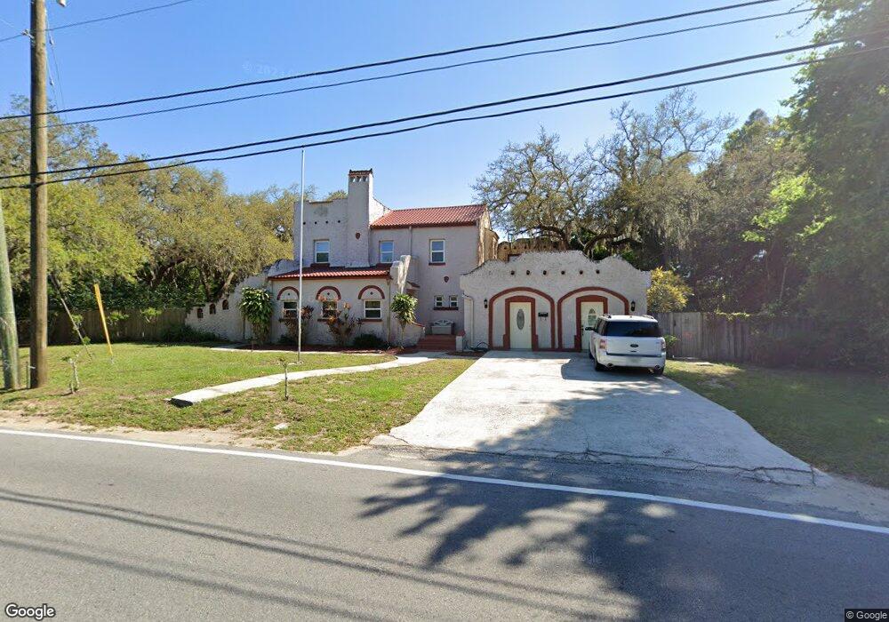
479 N Dixie Ave Titusville, FL 32796
Estimated Value: $435,000 - $518,082
7
Beds
4
Baths
3,845
Sq Ft
$125/Sq Ft
Est. Value
About This Home
This home is located at 479 N Dixie Ave, Titusville, FL 32796 and is currently estimated at $481,521, approximately $125 per square foot. 479 N Dixie Ave is a home located in Brevard County with nearby schools including Oak Park Elementary School, James Madison Middle School, and Astronaut High School.
Ownership History
Date
Name
Owned For
Owner Type
Purchase Details
Closed on
Sep 25, 2019
Sold by
Hanson Randall W
Bought by
Abbott De Ann Robertson
Current Estimated Value
Purchase Details
Closed on
Sep 24, 2019
Sold by
Abbott De Ann Robertson
Bought by
Hanson Randall W and Estate Of Warren H Bud Abbott
Purchase Details
Closed on
Aug 14, 2013
Sold by
Abbott Warren Harrison
Bought by
Abbott Warren Harrison and Abbott Deann Robertson
Purchase Details
Closed on
Dec 1, 2006
Sold by
Abbott Bernice A
Bought by
Abbott William H
Create a Home Valuation Report for This Property
The Home Valuation Report is an in-depth analysis detailing your home's value as well as a comparison with similar homes in the area
Home Values in the Area
Average Home Value in this Area
Purchase History
| Date | Buyer | Sale Price | Title Company |
|---|---|---|---|
| Abbott De Ann Robertson | -- | Attorney | |
| Hanson Randall W | -- | Attorney | |
| Abbott Warren Harrison | -- | Attorney | |
| Abbott William H | -- | None Available |
Source: Public Records
Tax History Compared to Growth
Tax History
| Year | Tax Paid | Tax Assessment Tax Assessment Total Assessment is a certain percentage of the fair market value that is determined by local assessors to be the total taxable value of land and additions on the property. | Land | Improvement |
|---|---|---|---|---|
| 2025 | $2,366 | $174,100 | -- | -- |
| 2024 | $2,313 | $169,200 | -- | -- |
| 2023 | $2,313 | $164,280 | $0 | $0 |
| 2022 | $2,234 | $159,500 | $0 | $0 |
| 2021 | $2,285 | $154,860 | $0 | $0 |
| 2020 | $2,281 | $152,730 | $0 | $0 |
| 2019 | $2,466 | $147,970 | $0 | $0 |
| 2018 | $2,403 | $144,230 | $0 | $0 |
| 2017 | $2,244 | $128,580 | $0 | $0 |
| 2016 | $2,147 | $124,800 | $24,200 | $100,600 |
| 2015 | $2,113 | $119,160 | $24,200 | $94,960 |
| 2014 | $1,987 | $113,060 | $24,200 | $88,860 |
Source: Public Records
Map
Nearby Homes
- 502 Vaughn St
- 2015 Malinda Ln
- 424 Lenore Ave
- 614 West Ct
- 610 East Ct
- 671 N Dixie Ave Unit 18A
- 1636 Violet Ave
- 1615 Violet Ave
- 160 N Williams Ave
- 2196 Pamela St
- 1539 Violet Ave
- 2135 Mayfair Way Unit Lot 71
- 2135 Mayfair Way Unit 84
- 2135 Mayfair Way Unit 98
- 105 McNeela Dr Unit 105
- 7.26 Route 1
- 130 Forrell Ave
- 0000 Buffalo Rd
- 106 S Mantor Ave
- Tbd N Washington Ave