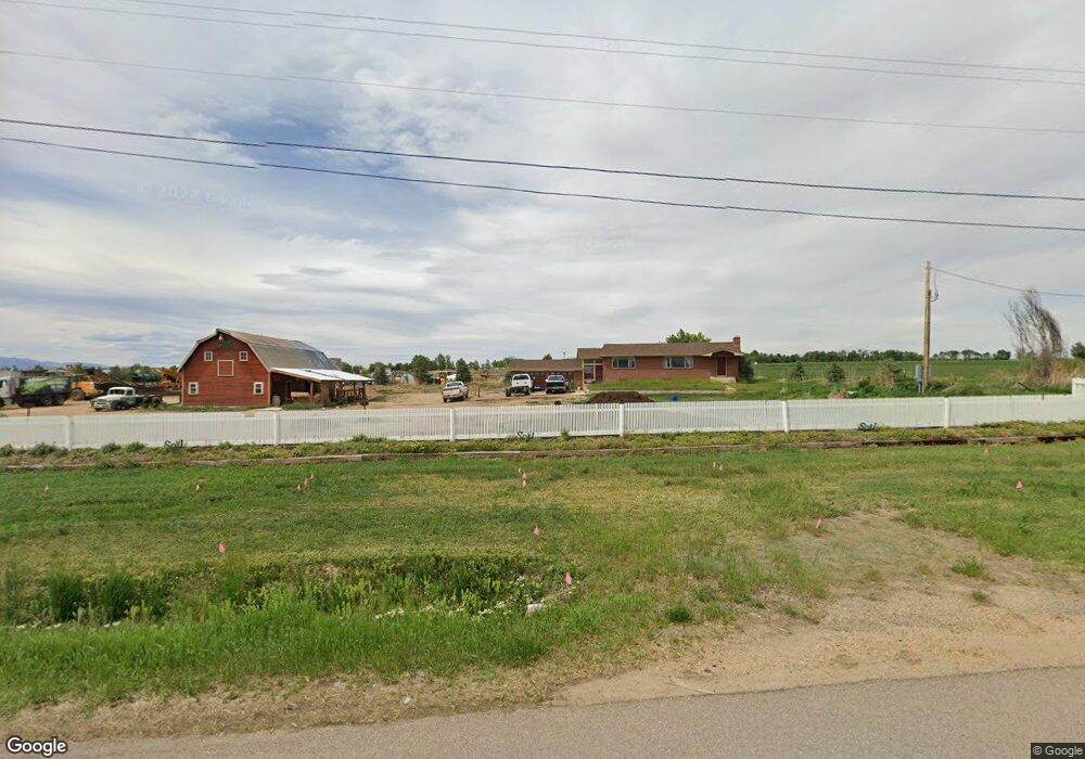
479 State Highway 66 Longmont, CO 80504
Estimated Value: $673,000 - $835,456
3
Beds
2
Baths
1,334
Sq Ft
$584/Sq Ft
Est. Value
About This Home
This home is located at 479 State Highway 66, Longmont, CO 80504 and is currently estimated at $779,614, approximately $584 per square foot. 479 State Highway 66 is a home with nearby schools including Mead Elementary School, Mead Middle School, and Mead High School.
Ownership History
Date
Name
Owned For
Owner Type
Purchase Details
Closed on
Dec 28, 2012
Sold by
Mehl Gunderson Revocable Trust
Bought by
Hoogland Brian G
Current Estimated Value
Purchase Details
Closed on
Jul 30, 2012
Sold by
Mehl Allan G
Bought by
Mehl Gunderson Revocable Trust
Purchase Details
Closed on
Oct 17, 2011
Sold by
Mehl Allan G
Bought by
Mehl Allan G
Purchase Details
Closed on
Jun 13, 2007
Sold by
Mehl Allan G
Bought by
Allan G Mehl Trust
Purchase Details
Closed on
Dec 27, 1996
Sold by
Utter Gary L
Bought by
Utter Deborah Jean
Purchase Details
Closed on
May 6, 1995
Purchase Details
Closed on
Jun 30, 1986
Sold by
Schlieker Barbara J
Bought by
Utter Gary Lee and Utter Deborah Jean
Create a Home Valuation Report for This Property
The Home Valuation Report is an in-depth analysis detailing your home's value as well as a comparison with similar homes in the area
Home Values in the Area
Average Home Value in this Area
Purchase History
| Date | Buyer | Sale Price | Title Company |
|---|---|---|---|
| Hoogland Brian G | $300,000 | Land Title Guarantee Company | |
| Mehl Gunderson Revocable Trust | -- | None Available | |
| Mehl Allan G | -- | None Available | |
| Allan G Mehl Trust | -- | None Available | |
| Utter Deborah Jean | -- | First American Heritage Titl | |
| -- | -- | -- | |
| Utter Gary Lee | $150,000 | -- |
Source: Public Records
Tax History Compared to Growth
Tax History
| Year | Tax Paid | Tax Assessment Tax Assessment Total Assessment is a certain percentage of the fair market value that is determined by local assessors to be the total taxable value of land and additions on the property. | Land | Improvement |
|---|---|---|---|---|
| 2025 | $3,994 | $53,030 | $25,070 | $27,960 |
| 2024 | $3,994 | $53,030 | $25,070 | $27,960 |
| 2023 | $3,832 | $46,190 | $22,860 | $23,330 |
| 2022 | $4,159 | $43,660 | $21,720 | $21,940 |
| 2021 | $4,233 | $44,910 | $22,340 | $22,570 |
| 2020 | $3,723 | $39,850 | $21,780 | $18,070 |
| 2019 | $3,715 | $39,850 | $21,780 | $18,070 |
| 2018 | $2,101 | $22,820 | $18,970 | $3,850 |
Source: Public Records
Map
Nearby Homes
- 13600 Elmore Rd
- 2464 Tyrrhenian Cir
- 1314 Colorado 66
- 2426 Spotswood St
- 2474 Ravenswood Ct
- 1720 Twilight Ct
- Biscayne Plan at Spring Valley
- Denali Plan at Spring Valley
- Acadia Plan at Spring Valley
- Congaree Plan at Spring Valley
- 1446 Coral Place
- 1766 Montgomery Cir
- 2432 Tyrrhenian Dr
- 1951 Sundance Dr
- 1440 Coral Place
- 1939 Sundance Dr
- 1444 Coral Place
- 1442 Coral Place
- 15261 Ypsilon Cir
- 1931 Rannoch Dr
- 13930 Elmore Rd
- 13975 Elmore Rd
- 13909 Elmore Rd
- 13876 Elmore Rd
- 540 Nesting Crane Ln
- 13941 Elmore Rd
- 13844 Elmore Rd
- 533 Nesting Crane Ln
- 13835 Elmore Rd
- 13820 Elmore Rd
- 536 Nesting Crane Ln
- 0 Nesting Crane Ln
- 13794 Elmore Rd
- 13861 Elmore Rd
- 13776 Elmore Rd
- 0 Elmore Rd
- 13761 Elmore Rd
- 529 Nesting Crane Ln
- 151 Highway 66
- 0 66th Hwy