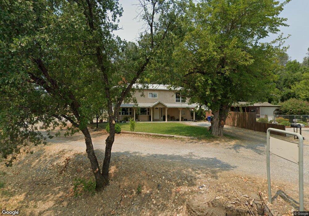
4790 Cedars Rd Redding, CA 96001
Country Heights NeighborhoodEstimated Value: $298,000 - $373,287
4
Beds
2
Baths
1,600
Sq Ft
$209/Sq Ft
Est. Value
About This Home
This home is located at 4790 Cedars Rd, Redding, CA 96001 and is currently estimated at $334,822, approximately $209 per square foot. 4790 Cedars Rd is a home located in Shasta County with nearby schools including Sycamore Elementary School, Sequoia Middle School, and Shasta High School.
Ownership History
Date
Name
Owned For
Owner Type
Purchase Details
Closed on
Jul 10, 2003
Sold by
Cramer Shirley Ann
Bought by
Webb Carie I and Webb Adam J
Current Estimated Value
Purchase Details
Closed on
Oct 26, 2000
Sold by
Federal Home Loan Mortgage Corp
Bought by
Webb Adam J and Webb Carie I
Purchase Details
Closed on
Jun 13, 2000
Sold by
Hines Gary and Hines Kathleen
Bought by
Federal Home Loan Mortgage Corporation
Purchase Details
Closed on
Jul 26, 1999
Sold by
Marie Hines Kathleen
Bought by
Hines Gary Lee
Create a Home Valuation Report for This Property
The Home Valuation Report is an in-depth analysis detailing your home's value as well as a comparison with similar homes in the area
Home Values in the Area
Average Home Value in this Area
Purchase History
| Date | Buyer | Sale Price | Title Company |
|---|---|---|---|
| Webb Carie I | -- | -- | |
| Webb Adam J | $59,000 | First American Title Co | |
| Federal Home Loan Mortgage Corporation | $44,890 | First American Title Ins Co | |
| Hines Gary Lee | -- | First American Title Co |
Source: Public Records
Tax History
| Year | Tax Paid | Tax Assessment Tax Assessment Total Assessment is a certain percentage of the fair market value that is determined by local assessors to be the total taxable value of land and additions on the property. | Land | Improvement |
|---|---|---|---|---|
| 2025 | $1,432 | $143,222 | $31,913 | $111,309 |
| 2024 | $1,409 | $140,415 | $31,288 | $109,127 |
| 2023 | $1,409 | $137,663 | $30,675 | $106,988 |
| 2022 | $1,383 | $134,965 | $30,074 | $104,891 |
| 2021 | $1,375 | $132,320 | $29,485 | $102,835 |
| 2020 | $1,391 | $130,964 | $29,183 | $101,781 |
| 2019 | $1,320 | $128,397 | $28,611 | $99,786 |
| 2018 | $1,330 | $125,880 | $28,050 | $97,830 |
| 2017 | $1,321 | $123,412 | $27,500 | $95,912 |
| 2016 | $1,278 | $120,993 | $26,961 | $94,032 |
| 2015 | $1,261 | $119,177 | $26,557 | $92,620 |
| 2014 | $1,251 | $116,843 | $26,037 | $90,806 |
Source: Public Records
Map
Nearby Homes
- 4549 Harrison Ave
- 2340 Wilsey Dr
- 2230 El Reno Ln
- 4920 Bonnyview Ave
- 4410 Westside Rd
- 2415 Marion Ct
- 2521 Radio Ln
- 2794 Summerbreeze Place
- 1400 Riviera Dr
- 0 Lot4 Unit 2 Ph 2 Stillwater Unit 25-4962
- 0 Lot3 Unit 2 Ph 2 Stillwater Unit 25-4961
- 0 Lot6 Unit 2 Ph 2 Stillwater Unit 25-4964
- 0 Lot5 Unit 2 Ph 2 Stillwater Unit 25-4963
- 0 Lot16 Unit 2 Ph 2 Stillwater Unit 25-4958
- 0 Lot9 Unit 2 Ph 2 Stillwater Unit 25-4967
- 0 Lot2 Unit 2 Ph 2 Stillwater Unit 25-4960
- 0 Lot11 Unit 2 Ph 2 Stillwater Unit 25-4953
- 0 Lot10 Unit 2 Ph 2 Stillwater Unit 25-4952
- 0 Lot7 Unit 2 Ph 2 Stillwater Unit 25-4965
- 1330 Scenic Way
- 4786 Cedars Rd
- 4768 Cedars Rd
- 4791 Cedars Rd
- 4821 Cedars Rd
- 4760 Cedars Rd
- 4747 Cedars Rd
- 4812 Westside Rd
- 2018 2030 Kenyon Dr
- 4726 Cedars Rd
- 2160 Kenyon Dr
- 2150 Kenyon Dr
- 2176-2184 Kenyon Dr
- 2178 Kenyon Dr
- 2180 Kenyon Dr
- 4700 Cedars Rd
- 2091 Kenyon Dr
- 2133 Miller St
- 2123 Miller St
- 2081 Kenyon Dr
- 2184 Kenyon Dr
Your Personal Tour Guide
Ask me questions while you tour the home.