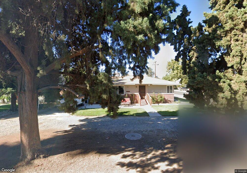
4791 N Arthur Ave Fresno, CA 93705
Bullard NeighborhoodEstimated Value: $267,000 - $304,000
2
Beds
1
Bath
933
Sq Ft
$306/Sq Ft
Est. Value
About This Home
This home is located at 4791 N Arthur Ave, Fresno, CA 93705 and is currently estimated at $285,304, approximately $305 per square foot. 4791 N Arthur Ave is a home located in Fresno County with nearby schools including Powers-Ginsburg Elementary, Bullard High School, and Endeavor Charter.
Ownership History
Date
Name
Owned For
Owner Type
Purchase Details
Closed on
Jun 25, 2015
Sold by
Vasquez Renee H
Bought by
Schram Robert A and Boyce Schram Cynthia L
Current Estimated Value
Home Financials for this Owner
Home Financials are based on the most recent Mortgage that was taken out on this home.
Original Mortgage
$84,000
Outstanding Balance
$65,199
Interest Rate
3.81%
Mortgage Type
New Conventional
Estimated Equity
$220,105
Purchase Details
Closed on
Feb 3, 2005
Sold by
Horiuchi Frank M and Horiuchi Masahiko Frank
Bought by
Vasquez Renee H
Create a Home Valuation Report for This Property
The Home Valuation Report is an in-depth analysis detailing your home's value as well as a comparison with similar homes in the area
Home Values in the Area
Average Home Value in this Area
Purchase History
| Date | Buyer | Sale Price | Title Company |
|---|---|---|---|
| Schram Robert A | $105,000 | First American Title Company | |
| Vasquez Renee H | -- | None Available |
Source: Public Records
Mortgage History
| Date | Status | Borrower | Loan Amount |
|---|---|---|---|
| Open | Schram Robert A | $84,000 |
Source: Public Records
Tax History Compared to Growth
Tax History
| Year | Tax Paid | Tax Assessment Tax Assessment Total Assessment is a certain percentage of the fair market value that is determined by local assessors to be the total taxable value of land and additions on the property. | Land | Improvement |
|---|---|---|---|---|
| 2025 | $1,553 | $126,183 | $37,853 | $88,330 |
| 2023 | $1,524 | $121,285 | $36,384 | $84,901 |
| 2022 | $1,503 | $118,908 | $35,671 | $83,237 |
| 2021 | $3,082 | $116,577 | $34,972 | $81,605 |
| 2020 | $3,031 | $115,383 | $34,614 | $80,769 |
| 2019 | $2,975 | $113,122 | $33,936 | $79,186 |
| 2018 | $2,940 | $110,905 | $33,271 | $77,634 |
| 2017 | $2,896 | $108,731 | $32,619 | $76,112 |
| 2016 | $2,852 | $106,600 | $31,980 | $74,620 |
| 2015 | $485 | $38,395 | $7,852 | $30,543 |
| 2014 | $474 | $37,644 | $7,699 | $29,945 |
Source: Public Records
Map
Nearby Homes
- 4702 N Fruit Ave
- 4895 N Thorne Ave
- 4939 N Fruit Ave
- 638 W Rialto Ave
- 709 W Alamos Ave
- 4734 N Harrison Ave
- 4666 N Harrison Ave
- 116 E Alamos Ave
- 4822 N Safford Ave
- 4843 N Palm Ave
- 1473 W Scott Ave
- 336 E Gettysburg Ave
- 929 W Norwich Ave
- 1110 W Fairmont Ave
- 4481 N Palm Ave
- 4480 N Palm Ave
- 4689 N Van Ness Blvd
- 1245 W Pico Ave
- 1027 W Ashcroft Ave
- 1582 W San Jose Ave
- 4783 N Arthur Ave
- 4773 N Arthur Ave
- 4792 N Vagedes Ave
- 4784 N Vagedes Ave
- 4815 N Arthur Ave
- 235 W Santa Ana Ave
- 4763 N Arthur Ave
- 4774 N Vagedes Ave
- 338 W Santa Ana Ave
- 4816 N Arthur Ave
- 4764 N Vagedes Ave
- 4755 N Arthur Ave
- 346 W Santa Ana Ave
- 4772 N Arthur Ave
- 4833 N Arthur Ave
- 230 W Santa Ana Ave
- 219 W Santa Ana Ave
- 408 W Santa Ana Ave
- 4745 N Arthur Ave
- 4750 N Arthur Ave