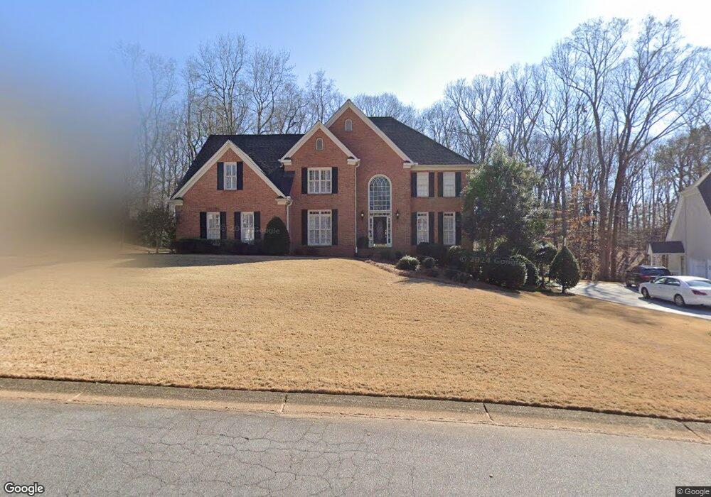
4794 Broxbourne Dr Marietta, GA 30068
East Cobb NeighborhoodEstimated Value: $997,414 - $1,085,000
4
Beds
5
Baths
3,684
Sq Ft
$284/Sq Ft
Est. Value
About This Home
This home is located at 4794 Broxbourne Dr, Marietta, GA 30068 and is currently estimated at $1,045,104, approximately $283 per square foot. 4794 Broxbourne Dr is a home located in Cobb County with nearby schools including Mount Bethel Elementary School, Dickerson Middle School, and Walton High School.
Ownership History
Date
Name
Owned For
Owner Type
Purchase Details
Closed on
May 28, 1998
Sold by
Daws Gerald L and Daws Linda M
Bought by
Means James W and Means Diane D
Current Estimated Value
Home Financials for this Owner
Home Financials are based on the most recent Mortgage that was taken out on this home.
Original Mortgage
$227,000
Outstanding Balance
$44,857
Interest Rate
7.23%
Mortgage Type
New Conventional
Estimated Equity
$1,000,247
Create a Home Valuation Report for This Property
The Home Valuation Report is an in-depth analysis detailing your home's value as well as a comparison with similar homes in the area
Home Values in the Area
Average Home Value in this Area
Purchase History
| Date | Buyer | Sale Price | Title Company |
|---|---|---|---|
| Means James W | $420,000 | -- |
Source: Public Records
Mortgage History
| Date | Status | Borrower | Loan Amount |
|---|---|---|---|
| Open | Means James W | $227,000 |
Source: Public Records
Tax History Compared to Growth
Tax History
| Year | Tax Paid | Tax Assessment Tax Assessment Total Assessment is a certain percentage of the fair market value that is determined by local assessors to be the total taxable value of land and additions on the property. | Land | Improvement |
|---|---|---|---|---|
| 2025 | $2,198 | $312,632 | $92,000 | $220,632 |
| 2024 | $2,204 | $312,632 | $92,000 | $220,632 |
| 2023 | $1,944 | $294,448 | $80,000 | $214,448 |
| 2022 | $2,067 | $266,808 | $80,000 | $186,808 |
| 2021 | $2,023 | $251,852 | $80,000 | $171,852 |
| 2020 | $2,054 | $262,480 | $80,000 | $182,480 |
| 2019 | $2,054 | $262,480 | $80,000 | $182,480 |
| 2018 | $2,054 | $262,480 | $80,000 | $182,480 |
| 2017 | $1,772 | $245,236 | $78,000 | $167,236 |
| 2016 | $6,228 | $245,236 | $78,000 | $167,236 |
| 2015 | $6,358 | $245,236 | $78,000 | $167,236 |
| 2014 | $6,400 | $245,236 | $0 | $0 |
Source: Public Records
Map
Nearby Homes
- 1044 Little Willeo Rd Unit 1
- 1420 Lafayette Ln
- 4528 Lashley Ct NE
- 5000 Lakeland Dr
- 909 Otter Way NE
- 1448 Heritage Glen Dr
- 748 Olde Towne Ln
- 742 Olde Towne Ln
- 4580 Roswell Rd
- 5197 Forest Brook Pkwy
- 4871 Karls Gate Dr
- 4831 Emmitt Point NE
- 748 Noble Oak Dr
- 775 Hadley Ln NE
- 767 Hadley Ln NE
- 5157 Forest Brook Pkwy
- 4796 Broxbourne Dr
- 4792 Broxbourne Dr
- 4793 Broxbourne Dr
- 1201 Lexham Dr
- 4790 Broxbourne Dr
- 4798 Broxbourne Dr
- 4742 Woodlawn Ct NE
- 4789 Broxbourne Dr
- 1185 Little Willeo Rd
- 4788 Broxbourne Dr
- 1200 Lexham Dr Unit 1200
- 1200 Lexham Dr
- 1203 Lexham Dr
- 4736 Woodlawn Ct NE
- 4702 Berwick Trace
- 4741 Woodlawn Ct NE
- 1202 Lexham Dr
- 4787 Broxbourne Dr
- 4840 Trevor Ct
- 4730 Woodlawn Ct NE