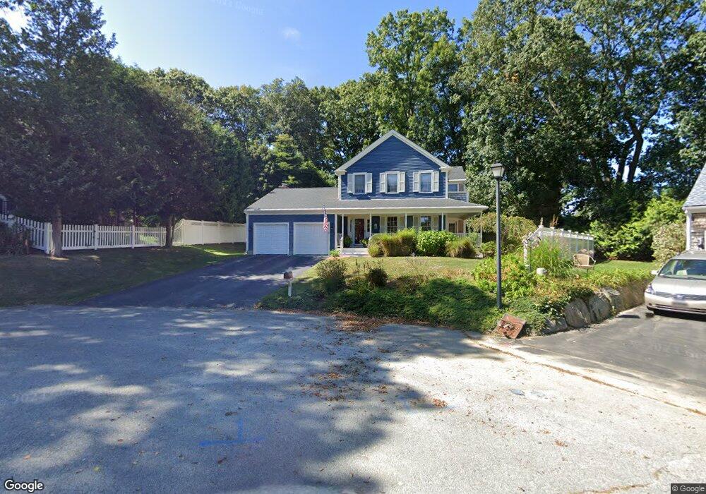
48 Anchorage Ct Bristol, RI 02809
Northeast Bristol NeighborhoodEstimated Value: $803,468 - $1,322,000
3
Beds
3
Baths
2,020
Sq Ft
$546/Sq Ft
Est. Value
About This Home
This home is located at 48 Anchorage Ct, Bristol, RI 02809 and is currently estimated at $1,103,117, approximately $546 per square foot. 48 Anchorage Ct is a home located in Bristol County with nearby schools including Mt. Hope High School, Highlander Charter Middle and High School, and Our Lady of Mt. Carmel School.
Ownership History
Date
Name
Owned For
Owner Type
Purchase Details
Closed on
Jul 19, 1999
Sold by
Eric Johnson Homes Inc
Bought by
Harlow Richard J and Harlow Elizabeth
Current Estimated Value
Home Financials for this Owner
Home Financials are based on the most recent Mortgage that was taken out on this home.
Original Mortgage
$240,000
Interest Rate
7.39%
Create a Home Valuation Report for This Property
The Home Valuation Report is an in-depth analysis detailing your home's value as well as a comparison with similar homes in the area
Home Values in the Area
Average Home Value in this Area
Purchase History
| Date | Buyer | Sale Price | Title Company |
|---|---|---|---|
| Harlow Richard J | $306,000 | -- |
Source: Public Records
Mortgage History
| Date | Status | Borrower | Loan Amount |
|---|---|---|---|
| Open | Harlow Richard J | $248,000 | |
| Closed | Harlow Richard J | $192,000 | |
| Closed | Harlow Richard J | $100,000 | |
| Closed | Harlow Richard J | $240,000 |
Source: Public Records
Tax History Compared to Growth
Tax History
| Year | Tax Paid | Tax Assessment Tax Assessment Total Assessment is a certain percentage of the fair market value that is determined by local assessors to be the total taxable value of land and additions on the property. | Land | Improvement |
|---|---|---|---|---|
| 2025 | $7,156 | $517,800 | $179,700 | $338,100 |
| 2024 | $7,156 | $517,800 | $179,700 | $338,100 |
| 2023 | $6,918 | $517,800 | $179,700 | $338,100 |
| 2022 | $6,731 | $517,800 | $179,700 | $338,100 |
| 2021 | $7,831 | $544,600 | $219,300 | $325,300 |
| 2020 | $7,663 | $544,600 | $219,300 | $325,300 |
| 2019 | $7,472 | $544,600 | $219,300 | $325,300 |
| 2018 | $6,832 | $444,200 | $167,100 | $277,100 |
| 2017 | $6,860 | $459,800 | $162,700 | $297,100 |
| 2016 | $6,791 | $459,800 | $162,700 | $297,100 |
| 2015 | $6,451 | $459,800 | $162,700 | $297,100 |
| 2014 | $5,476 | $419,320 | $141,000 | $278,320 |
Source: Public Records
Map
Nearby Homes
- 16 Smith St
- 1 Betsy Dr
- 3 Betsy Dr
- 22 Harrison St
- 126 Narrows Rd
- 7 Broadview Ave
- 48 Narrows Rd
- 683 Metacom Ave Unit 79
- 669 Metacom Ave Unit 17
- 6 Scott Ln
- 0 Overhill Rd Unit 1382248
- 4 Read Ave
- 85 Canario Dr
- 11 Stonegate Rd
- 0 Barton Ave
- 7 Knowlton Ct
- 3 Knowlton Ct
- 5 Knowlton Ct
- 1 Knowlton Ct
- 1220 Hope St