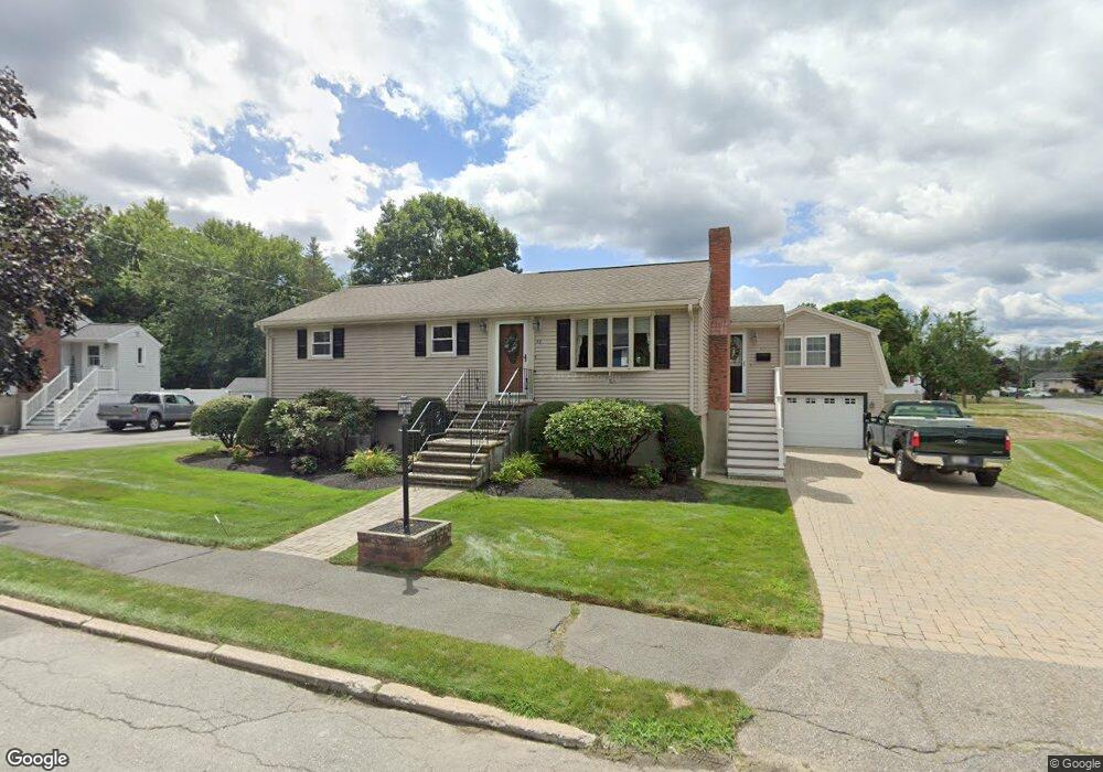
48 Bancroft St Waltham, MA 02451
North Waltham NeighborhoodEstimated Value: $926,000 - $1,010,000
3
Beds
2
Baths
2,583
Sq Ft
$376/Sq Ft
Est. Value
About This Home
This home is located at 48 Bancroft St, Waltham, MA 02451 and is currently estimated at $972,471, approximately $376 per square foot. 48 Bancroft St is a home located in Middlesex County with nearby schools including Douglas Macarthur Elementary School, John F Kennedy Middle School, and Waltham Sr High School.
Ownership History
Date
Name
Owned For
Owner Type
Purchase Details
Closed on
Dec 1, 1982
Bought by
Campbell Richard A and Campbell Denise A
Current Estimated Value
Create a Home Valuation Report for This Property
The Home Valuation Report is an in-depth analysis detailing your home's value as well as a comparison with similar homes in the area
Home Values in the Area
Average Home Value in this Area
Purchase History
| Date | Buyer | Sale Price | Title Company |
|---|---|---|---|
| Campbell Richard A | $90,000 | -- |
Source: Public Records
Mortgage History
| Date | Status | Borrower | Loan Amount |
|---|---|---|---|
| Closed | Campbell Richard A | $53,000 | |
| Closed | Campbell Richard A | $81,000 |
Source: Public Records
Tax History
| Year | Tax Paid | Tax Assessment Tax Assessment Total Assessment is a certain percentage of the fair market value that is determined by local assessors to be the total taxable value of land and additions on the property. | Land | Improvement |
|---|---|---|---|---|
| 2025 | $7,594 | $773,300 | $466,700 | $306,600 |
| 2024 | $7,217 | $748,700 | $446,000 | $302,700 |
| 2023 | $7,159 | $693,700 | $404,700 | $289,000 |
| 2022 | $7,147 | $641,600 | $363,400 | $278,200 |
| 2021 | $7,069 | $626,400 | $363,400 | $263,000 |
| 2020 | $6,772 | $566,700 | $338,700 | $228,000 |
| 2019 | $7,024 | $554,800 | $334,500 | $220,300 |
| 2018 | $6,156 | $488,200 | $309,800 | $178,400 |
| 2017 | $5,768 | $459,200 | $280,800 | $178,400 |
| 2016 | $5,419 | $442,700 | $264,300 | $178,400 |
| 2015 | $5,358 | $408,100 | $231,300 | $176,800 |
Source: Public Records
Map
Nearby Homes
- 7 Field Rd
- 542 Concord Ave
- 14 Benjamin Rd
- 89 Hardy Pond Rd
- 44 Lakeview Terrace
- 1105 Lexington St Unit 6-4
- 353 Concord Ave
- 21 Lakeview Ave
- 9 April Ln Unit 9
- 86 Indian Rd
- 11 Autumn Ln
- 203 College Farm Rd
- 22 Fairbanks Rd
- 28 Hillcrest St
- 8 Dobbins St
- 8 Phinney Rd
- 72 Grassland St
- 15 Cedarcroft Ln
- 34 Allen St
- 170 Clocktower Dr Unit 103
- 15 Meadow Ln
- 42 Bancroft St
- 45 Bancroft St
- 45 Bancroft St Unit 1
- 9 Meadow Ln
- 93 Copeland St
- 101 Copeland St
- 109 Copeland St
- 36 Bancroft St
- 131 Berkley St
- 35 Bancroft St
- 86 Copeland St
- 123 Berkley St
- 120 Copeland St
- 115 Copeland St
- 85 Copeland St
- 10 Meadow Ln
- 30 Bancroft St
- 29 Bancroft St
- 117 Berkley St
Your Personal Tour Guide
Ask me questions while you tour the home.