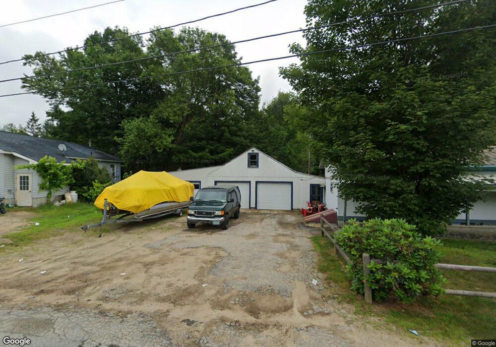
48 Bell St North Woodstock, NH 03262
Estimated Value: $367,265 - $448,000
3
Beds
2
Baths
1,232
Sq Ft
$331/Sq Ft
Est. Value
About This Home
This home is located at 48 Bell St, North Woodstock, NH 03262 and is currently estimated at $407,316, approximately $330 per square foot. 48 Bell St is a home located in Grafton County with nearby schools including Lin-Wood Public Elementary School.
Ownership History
Date
Name
Owned For
Owner Type
Purchase Details
Closed on
Dec 12, 2023
Sold by
Whitman Susan M
Bought by
Susan M Whitman Ret and Whitman
Current Estimated Value
Purchase Details
Closed on
Sep 20, 2004
Sold by
Sardone Rebecca C
Bought by
Whitman Susan M
Home Financials for this Owner
Home Financials are based on the most recent Mortgage that was taken out on this home.
Original Mortgage
$90,000
Interest Rate
6.02%
Mortgage Type
Purchase Money Mortgage
Create a Home Valuation Report for This Property
The Home Valuation Report is an in-depth analysis detailing your home's value as well as a comparison with similar homes in the area
Home Values in the Area
Average Home Value in this Area
Purchase History
| Date | Buyer | Sale Price | Title Company |
|---|---|---|---|
| Susan M Whitman Ret | -- | None Available | |
| Whitman Susan M | $140,000 | -- | |
| Whitman Susan M | $140,000 | -- |
Source: Public Records
Mortgage History
| Date | Status | Borrower | Loan Amount |
|---|---|---|---|
| Previous Owner | Whitman Susan M | $90,000 |
Source: Public Records
Tax History Compared to Growth
Tax History
| Year | Tax Paid | Tax Assessment Tax Assessment Total Assessment is a certain percentage of the fair market value that is determined by local assessors to be the total taxable value of land and additions on the property. | Land | Improvement |
|---|---|---|---|---|
| 2024 | $3,410 | $167,800 | $64,500 | $103,300 |
| 2023 | $3,262 | $167,800 | $64,500 | $103,300 |
| 2022 | $3,084 | $167,800 | $64,500 | $103,300 |
| 2021 | $3,188 | $167,800 | $64,500 | $103,300 |
| 2020 | $3,348 | $167,800 | $64,500 | $103,300 |
| 2019 | $3,041 | $140,200 | $58,300 | $81,900 |
| 2018 | $3,047 | $140,200 | $58,300 | $81,900 |
| 2016 | $2,787 | $140,100 | $58,300 | $81,800 |
| 2015 | $2,652 | $140,100 | $58,300 | $81,800 |
| 2014 | $2,669 | $141,300 | $56,700 | $84,600 |
| 2012 | $2,667 | $149,140 | $55,670 | $93,470 |
Source: Public Records
Map
Nearby Homes
- 23 Oakes St
- 17 Ridge Dr Unit A-14
- 14 Monroe Dr Unit 92
- 6 Monroe Dr Unit 111
- 11 Cascade Dr Unit 288
- 65 Riverfront Dr Unit 217
- 164 Deer Park Dr Unit 160D
- 164 Deer Park Dr Unit 161D
- 164 Deer Park Dr Unit 168D
- 156 Deer Park Dr Unit 135 A
- 206-011 Lost River Rd
- 45 Riverfront Dr Unit 242
- 16 Riverfront Dr Unit 293
- 16 Riverfront Dr Unit 292
- 56 Kancamagus Hwy
- 25 Main St
- 252-254 Lost River Rd
- 9 Moose Ln
- 34 Franklin St
- 5 Robin Rd Unit 1