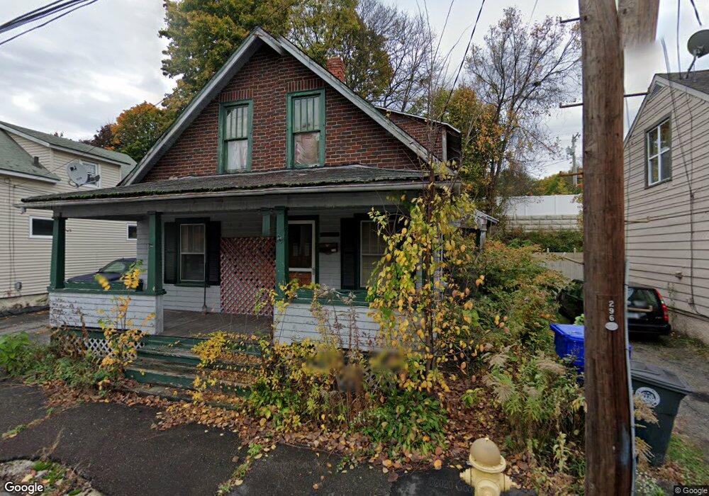
48 Britton Ave Torrington, CT 06790
Estimated Value: $267,000 - $309,000
2
Beds
2
Baths
1,536
Sq Ft
$188/Sq Ft
Est. Value
About This Home
This home is located at 48 Britton Ave, Torrington, CT 06790 and is currently estimated at $289,143, approximately $188 per square foot. 48 Britton Ave is a home located in Litchfield County with nearby schools including Torrington Middle School, Torrington High School, and St. Peter School.
Ownership History
Date
Name
Owned For
Owner Type
Purchase Details
Closed on
Jun 27, 2025
Sold by
Bonilla Jose
Bought by
Cando Paul A
Current Estimated Value
Home Financials for this Owner
Home Financials are based on the most recent Mortgage that was taken out on this home.
Original Mortgage
$294,566
Outstanding Balance
$294,059
Interest Rate
6.77%
Mortgage Type
New Conventional
Estimated Equity
-$4,916
Purchase Details
Closed on
Feb 13, 2023
Sold by
Partners Management Llc
Bought by
Bonilla Jose
Purchase Details
Closed on
May 16, 1983
Bought by
Belancik Bernard Joseph
Create a Home Valuation Report for This Property
The Home Valuation Report is an in-depth analysis detailing your home's value as well as a comparison with similar homes in the area
Home Values in the Area
Average Home Value in this Area
Purchase History
| Date | Buyer | Sale Price | Title Company |
|---|---|---|---|
| Cando Paul A | $300,000 | -- | |
| Bonilla Jose | -- | None Available | |
| Bonilla Jose | -- | None Available | |
| Belancik Bernard Joseph | -- | -- |
Source: Public Records
Mortgage History
| Date | Status | Borrower | Loan Amount |
|---|---|---|---|
| Open | Cando Paul A | $294,566 | |
| Previous Owner | Belancik Bernard Joseph | $72,293 | |
| Previous Owner | Belancik Bernard Joseph | $56,063 | |
| Previous Owner | Belancik Bernard Joseph | $55,283 |
Source: Public Records
Tax History Compared to Growth
Tax History
| Year | Tax Paid | Tax Assessment Tax Assessment Total Assessment is a certain percentage of the fair market value that is determined by local assessors to be the total taxable value of land and additions on the property. | Land | Improvement |
|---|---|---|---|---|
| 2025 | $6,414 | $166,810 | $19,530 | $147,280 |
| 2024 | $4,460 | $92,970 | $19,530 | $73,440 |
| 2023 | $4,459 | $92,970 | $19,530 | $73,440 |
| 2022 | $3,071 | $65,140 | $19,530 | $45,610 |
| 2021 | $3,008 | $65,140 | $19,530 | $45,610 |
| 2020 | $3,008 | $65,140 | $19,530 | $45,610 |
| 2019 | $2,534 | $54,890 | $19,530 | $35,360 |
| 2018 | $2,534 | $54,890 | $19,530 | $35,360 |
| 2017 | $2,511 | $54,890 | $19,530 | $35,360 |
| 2016 | $2,511 | $54,890 | $19,530 | $35,360 |
| 2015 | $2,511 | $54,890 | $19,530 | $35,360 |
| 2014 | $2,473 | $68,100 | $24,080 | $44,020 |
Source: Public Records
Map
Nearby Homes
- 48 Brookside Ave
- 291 E Main St
- 107 E Pearl St
- 7 George St
- 183 Brightwood Ave
- 148 Hillside Ave
- 279 Main St
- 105 E Elm St
- 187 Hillside Ave
- 19 Harwinton Ave
- 482 Main St
- 00 Winthrop St & E Elm St
- 17 Prospect Place
- 636 E Main St
- 333 Hillside Ave Unit 10
- 129 Calhoun St
- 82 Water St
- 96 Edward Ave
- 184 Harwinton Ave
- 25 Lipton Place
- 48 Britton Ave Unit 2
- 48 Britton Ave Unit 1
- 52 Britton Ave
- 42 Britton Ave
- 32 Britton Ave Unit 2
- 32 Britton Ave Unit 2
- 0 Britton Ave Unit 2
- 36 Britton Ave
- 339 Main St
- 305 E Main St
- 345 E Main St
- 24 Britton Ave
- 67 Britton Ave
- 17 Britton Ave
- 11 Britton 2nd Floor Ave
- 301 E Main St
- 18 Britton Ave
- 11 Britton Ave
- 11 Britton Ave Unit 3
- 11 Britton Ave Unit 2