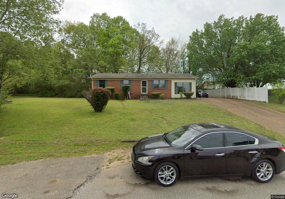
48 Cannon Dr Lexington, TN 38351
Estimated Value: $132,320 - $514,000
--
Bed
1
Bath
1,275
Sq Ft
$198/Sq Ft
Est. Value
About This Home
This home is located at 48 Cannon Dr, Lexington, TN 38351 and is currently estimated at $251,830, approximately $197 per square foot. 48 Cannon Dr is a home located in Henderson County with nearby schools including Paul G. Caywood Elementary School, Lexington Middle School, and Lexington Montessori Center.
Ownership History
Date
Name
Owned For
Owner Type
Purchase Details
Closed on
Mar 19, 2009
Sold by
First Bank
Bought by
Phillips Tim
Current Estimated Value
Purchase Details
Closed on
Nov 14, 2002
Sold by
Dian Arnold
Bought by
Arnold Monty L
Home Financials for this Owner
Home Financials are based on the most recent Mortgage that was taken out on this home.
Original Mortgage
$56,245
Interest Rate
5.98%
Purchase Details
Closed on
Nov 19, 1971
Bought by
Arnold Monty B
Create a Home Valuation Report for This Property
The Home Valuation Report is an in-depth analysis detailing your home's value as well as a comparison with similar homes in the area
Home Values in the Area
Average Home Value in this Area
Purchase History
| Date | Buyer | Sale Price | Title Company |
|---|---|---|---|
| Phillips Tim | $38,000 | -- | |
| Arnold Monty L | $55,000 | -- | |
| Arnold Monty B | -- | -- |
Source: Public Records
Mortgage History
| Date | Status | Borrower | Loan Amount |
|---|---|---|---|
| Previous Owner | Arnold Monty B | $56,245 |
Source: Public Records
Tax History Compared to Growth
Tax History
| Year | Tax Paid | Tax Assessment Tax Assessment Total Assessment is a certain percentage of the fair market value that is determined by local assessors to be the total taxable value of land and additions on the property. | Land | Improvement |
|---|---|---|---|---|
| 2025 | -- | $25,150 | $0 | $0 |
| 2024 | $629 | $25,150 | $1,500 | $23,650 |
| 2023 | $629 | $25,150 | $1,500 | $23,650 |
| 2022 | $387 | $11,400 | $1,375 | $10,025 |
| 2021 | $387 | $11,400 | $1,375 | $10,025 |
| 2020 | $387 | $11,400 | $1,375 | $10,025 |
| 2019 | $387 | $11,400 | $1,375 | $10,025 |
| 2018 | $346 | $9,900 | $1,375 | $8,525 |
| 2017 | $346 | $9,900 | $1,375 | $8,525 |
| 2016 | $349 | $9,675 | $1,375 | $8,300 |
| 2015 | $349 | $9,675 | $1,375 | $8,300 |
| 2014 | $348 | $9,663 | $0 | $0 |
Source: Public Records
Map
Nearby Homes
- 000 Highway 412 W
- 000 Hwy 412 W
- 000 Highway 104 S
- 00 Hwy 412 W
- 440 Oak Point Dr
- Lot 103 Oak Point Dr
- 405 W Church St
- 0 Harbor Dr Unit 2503068
- 185 Eastern Shores Dr
- 153 Timber Ridge Dr
- 700 Dick Barry Ln
- 000 Tract 3 Brazil Bottom Rd
- 000 Tract 2 Brazil Bottom Rd
- 000 Tract #1 Brazil Bottom Rd
- 348 Eastern Shores Dr
- 369 Eastern Shores Dr
- 000 Brittney Ln
- 420 Lakeshore Dr
- 14955 Highway 104 N
- 000 Cypress Cove