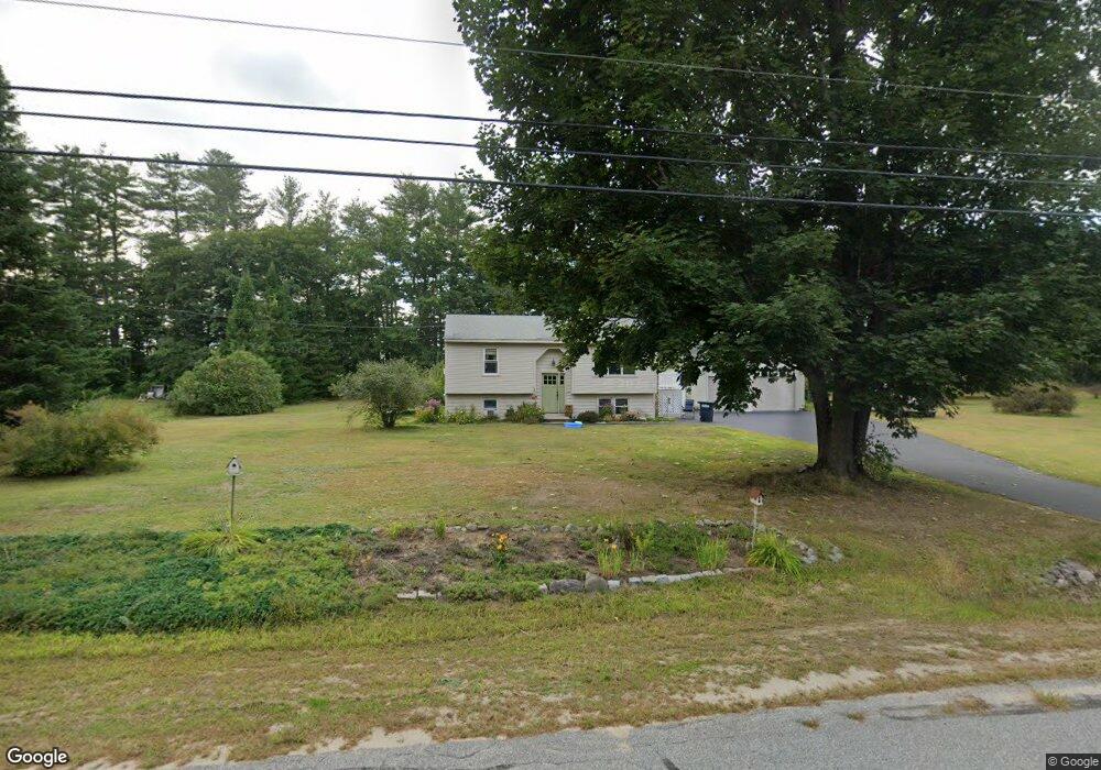
48 Cornfield Rd Buxton, ME 04093
Estimated Value: $388,950 - $452,000
3
Beds
2
Baths
828
Sq Ft
$493/Sq Ft
Est. Value
About This Home
This home is located at 48 Cornfield Rd, Buxton, ME 04093 and is currently estimated at $408,488, approximately $493 per square foot. 48 Cornfield Rd is a home with nearby schools including Bonny Eagle High School.
Ownership History
Date
Name
Owned For
Owner Type
Purchase Details
Closed on
May 18, 2023
Sold by
Quincannon Helen G
Bought by
Drew Katherine R and Quincannon Jason A
Current Estimated Value
Purchase Details
Closed on
May 26, 2017
Sold by
Quincannon Helen G and Quincannon Stephen M
Bought by
Quincannon Helen G and Quincannon Stephen M
Home Financials for this Owner
Home Financials are based on the most recent Mortgage that was taken out on this home.
Original Mortgage
$83,100
Interest Rate
3.34%
Mortgage Type
Commercial
Create a Home Valuation Report for This Property
The Home Valuation Report is an in-depth analysis detailing your home's value as well as a comparison with similar homes in the area
Home Values in the Area
Average Home Value in this Area
Purchase History
| Date | Buyer | Sale Price | Title Company |
|---|---|---|---|
| Drew Katherine R | -- | None Available | |
| Quincannon Helen G | -- | -- |
Source: Public Records
Mortgage History
| Date | Status | Borrower | Loan Amount |
|---|---|---|---|
| Previous Owner | Quincannon Helen G | $83,100 |
Source: Public Records
Tax History
| Year | Tax Paid | Tax Assessment Tax Assessment Total Assessment is a certain percentage of the fair market value that is determined by local assessors to be the total taxable value of land and additions on the property. | Land | Improvement |
|---|---|---|---|---|
| 2025 | $3,109 | $272,700 | $97,200 | $175,500 |
| 2024 | $2,997 | $272,700 | $97,200 | $175,500 |
| 2023 | $2,844 | $272,700 | $97,200 | $175,500 |
| 2022 | $2,815 | $274,900 | $97,200 | $177,700 |
| 2021 | $2,690 | $186,022 | $60,800 | $125,222 |
| 2020 | $2,712 | $186,022 | $60,800 | $125,222 |
| 2019 | $2,473 | $166,900 | $60,800 | $106,100 |
| 2018 | $2,360 | $166,900 | $60,800 | $106,100 |
| 2017 | $2,270 | $166,900 | $60,800 | $106,100 |
| 2016 | $2,178 | $166,900 | $60,800 | $106,100 |
| 2015 | $2,161 | $166,900 | $60,800 | $106,100 |
| 2014 | $2,061 | $162,300 | $60,800 | $101,500 |
| 2013 | $2,029 | $162,300 | $60,800 | $101,500 |
Source: Public Records
Map
Nearby Homes
- 9 Johnson Farm Rd
- 17 Johnson Farm Rd
- 1306 Long Plains Rd
- 0 Waterman
- 430 Narragansett Trail
- 00 Miso Way
- 00 Deering Dr
- 48 Tickle Way
- 14 David Dr
- 82 Carll Rd
- 196 Old Orchard Rd
- 3 Trapper John Rd
- 281 Narragansett Trail
- 69 Old Orchard Rd
- 18 Eaton Dr
- 207 Dunnell Rd
- 222 Main St
- 3 S Branch Dr
- 153 Mckenney Rd
- 83 Main St
- 42 Cornfield Rd
- 58 Cornfield Rd
- 43 Cornfield Rd
- 49 Cornfield Rd
- 55 Cornfield Rd
- 34 Cornfield Rd
- 35 Cornfield Rd
- 61 Cornfield Rd
- 70 Cornfield Rd
- 27 Cornfield Rd
- 26 Cornfield Rd
- 71 Cornfield Rd
- 21 Cornfield Rd
- 28 Cheechako Rd
- 18 Cornfield Rd
- 82 Cornfield Rd
- 18 Cheechako Rd
- 83 Cornfield Rd
- 13 Cornfield Rd
- 10 Cornfield Rd
Your Personal Tour Guide
Ask me questions while you tour the home.