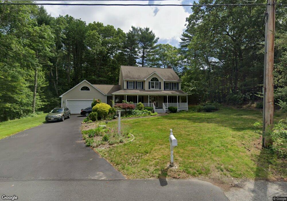
48 Darby Dr Mansfield, MA 02048
Estimated Value: $851,460 - $898,000
4
Beds
3
Baths
2,106
Sq Ft
$416/Sq Ft
Est. Value
About This Home
This home is located at 48 Darby Dr, Mansfield, MA 02048 and is currently estimated at $875,365, approximately $415 per square foot. 48 Darby Dr is a home located in Bristol County with nearby schools including Jordan/Jackson Elementary School, Everett W. Robinson Elementary School, and Harold L. Qualters Middle School.
Ownership History
Date
Name
Owned For
Owner Type
Purchase Details
Closed on
May 9, 2025
Sold by
Kuruganti Padma and Kuruganti Subramanyam
Bought by
Kiruganti
Current Estimated Value
Purchase Details
Closed on
Jul 21, 2006
Sold by
Prokopchuk Shirley A and Prokopchuk Walter
Bought by
Kuruganti Subramanyam and Kuruganti Padma
Home Financials for this Owner
Home Financials are based on the most recent Mortgage that was taken out on this home.
Original Mortgage
$416,000
Interest Rate
6.67%
Mortgage Type
Purchase Money Mortgage
Purchase Details
Closed on
Aug 31, 2001
Sold by
Plant Charles A and Plant Eileen M
Bought by
Prokopchuk Walter and Prokopchuk Shirley A
Create a Home Valuation Report for This Property
The Home Valuation Report is an in-depth analysis detailing your home's value as well as a comparison with similar homes in the area
Home Values in the Area
Average Home Value in this Area
Purchase History
| Date | Buyer | Sale Price | Title Company |
|---|---|---|---|
| Kiruganti | -- | None Available | |
| Kiruganti | -- | None Available | |
| Kuruganti Subramanyam | $520,000 | -- | |
| Kuruganti Subramanyam | $520,000 | -- | |
| Prokopchuk Walter | $355,000 | -- | |
| Prokopchuk Walter | $355,000 | -- |
Source: Public Records
Mortgage History
| Date | Status | Borrower | Loan Amount |
|---|---|---|---|
| Previous Owner | Prokopchuk Walter | $372,000 | |
| Previous Owner | Prokopchuk Walter | $392,000 | |
| Previous Owner | Prokopchuk Walter | $392,000 | |
| Previous Owner | Kuruganti Subramanyam | $416,000 |
Source: Public Records
Tax History
| Year | Tax Paid | Tax Assessment Tax Assessment Total Assessment is a certain percentage of the fair market value that is determined by local assessors to be the total taxable value of land and additions on the property. | Land | Improvement |
|---|---|---|---|---|
| 2025 | $9,903 | $751,900 | $294,800 | $457,100 |
| 2024 | $9,584 | $709,900 | $307,500 | $402,400 |
| 2023 | $9,284 | $658,900 | $307,500 | $351,400 |
| 2022 | $8,938 | $589,200 | $285,000 | $304,200 |
| 2021 | $8,700 | $566,400 | $237,400 | $329,000 |
| 2020 | $8,566 | $557,700 | $237,400 | $320,300 |
| 2019 | $7,936 | $521,400 | $198,200 | $323,200 |
| 2018 | $7,530 | $506,700 | $189,300 | $317,400 |
| 2017 | $7,402 | $492,800 | $184,100 | $308,700 |
| 2016 | $7,146 | $463,700 | $175,200 | $288,500 |
| 2015 | $6,960 | $449,000 | $175,200 | $273,800 |
Source: Public Records
Map
Nearby Homes
Your Personal Tour Guide
Ask me questions while you tour the home.