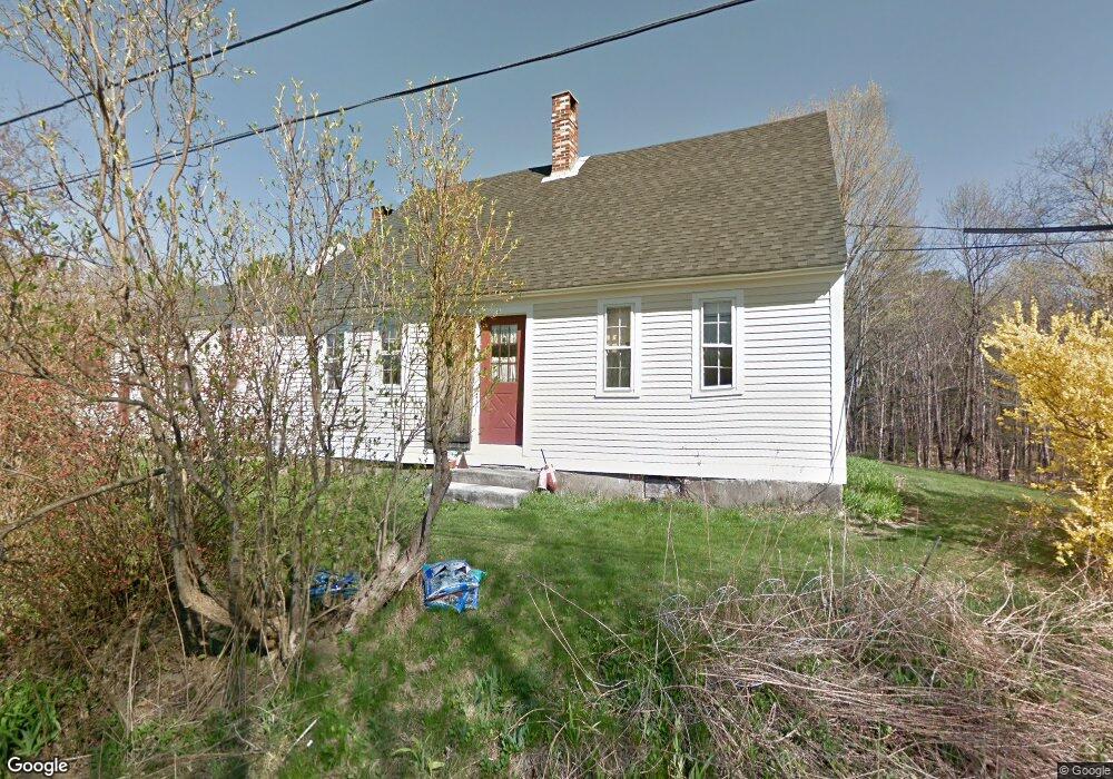
48 Richards Ln Freeport, ME 04032
Estimated Value: $598,000 - $876,000
5
Beds
3
Baths
3,334
Sq Ft
$234/Sq Ft
Est. Value
About This Home
This home is located at 48 Richards Ln, Freeport, ME 04032 and is currently estimated at $780,719, approximately $234 per square foot. 48 Richards Ln is a home located in Cumberland County with nearby schools including Morse Street School, Mast Landing School, and Freeport Middle School.
Create a Home Valuation Report for This Property
The Home Valuation Report is an in-depth analysis detailing your home's value as well as a comparison with similar homes in the area
Home Values in the Area
Average Home Value in this Area
Tax History
| Year | Tax Paid | Tax Assessment Tax Assessment Total Assessment is a certain percentage of the fair market value that is determined by local assessors to be the total taxable value of land and additions on the property. | Land | Improvement |
|---|---|---|---|---|
| 2025 | $5,680 | $410,100 | $161,100 | $249,000 |
| 2024 | $5,373 | $402,500 | $153,500 | $249,000 |
| 2023 | $4,902 | $356,500 | $139,500 | $217,000 |
| 2022 | $4,676 | $342,600 | $125,600 | $217,000 |
| 2021 | $4,574 | $342,600 | $125,600 | $217,000 |
| 2020 | $4,416 | $315,400 | $116,300 | $199,100 |
| 2019 | $4,217 | $294,900 | $109,800 | $185,100 |
| 2018 | $4,101 | $272,500 | $86,500 | $186,000 |
| 2017 | $3,918 | $262,100 | $84,600 | $177,500 |
| 2016 | $3,865 | $244,600 | $80,100 | $164,500 |
| 2015 | $3,903 | $232,300 | $76,700 | $155,600 |
| 2014 | $3,852 | $243,800 | $76,700 | $167,100 |
| 2013 | $3,872 | $244,300 | $75,500 | $168,800 |
Source: Public Records
Map
Nearby Homes
- 42 Durham Rd
- 10 Durham Rd
- 212 Main St
- 8 Statler Ln
- 5 Holbrook St
- 67 Farmview Ln
- 11 Orchard Hill Rd
- 1 Wardtown Rd
- 39 Hunter Rd
- 143 Bragdon Rd
- 1260 Us Route 1
- 15 Linwood Rd Unit 15
- 4 Harper's Trail
- 10 Prout Rd
- 21 Renee Rd
- 15 Tinkers Way
- 26 Harvest Ridge Rd Unit 24
- 20 Harvest Ridge Rd Unit 23
- 0 Prout Rd
- 42A Wardtown Rd
Your Personal Tour Guide
Ask me questions while you tour the home.