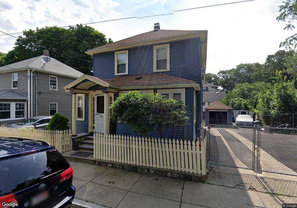
48 Stow Rd Mattapan, MA 02126
Southern Mattapan NeighborhoodEstimated Value: $613,345 - $693,000
4
Beds
3
Baths
1,717
Sq Ft
$373/Sq Ft
Est. Value
About This Home
This home is located at 48 Stow Rd, Mattapan, MA 02126 and is currently estimated at $639,836, approximately $372 per square foot. 48 Stow Rd is a home located in Suffolk County with nearby schools including Berea Seventh-day Adventist Academy.
Ownership History
Date
Name
Owned For
Owner Type
Purchase Details
Closed on
Jul 15, 2024
Sold by
Raye Rodney G
Bought by
Raye Rodney G and Raye Sonya M
Current Estimated Value
Purchase Details
Closed on
Apr 15, 2005
Sold by
Goode Richard A and Goode Ruby L
Bought by
Raye Rodney G
Home Financials for this Owner
Home Financials are based on the most recent Mortgage that was taken out on this home.
Original Mortgage
$244,000
Interest Rate
5.78%
Mortgage Type
Purchase Money Mortgage
Create a Home Valuation Report for This Property
The Home Valuation Report is an in-depth analysis detailing your home's value as well as a comparison with similar homes in the area
Home Values in the Area
Average Home Value in this Area
Purchase History
| Date | Buyer | Sale Price | Title Company |
|---|---|---|---|
| Raye Rodney G | -- | None Available | |
| Raye Rodney G | -- | None Available | |
| Raye Rodney G | $305,000 | -- | |
| Raye Rodney G | $305,000 | -- |
Source: Public Records
Mortgage History
| Date | Status | Borrower | Loan Amount |
|---|---|---|---|
| Previous Owner | Raye Rodney G | $244,000 | |
| Previous Owner | Raye Rodney G | $90,000 |
Source: Public Records
Tax History Compared to Growth
Tax History
| Year | Tax Paid | Tax Assessment Tax Assessment Total Assessment is a certain percentage of the fair market value that is determined by local assessors to be the total taxable value of land and additions on the property. | Land | Improvement |
|---|---|---|---|---|
| 2025 | $5,394 | $465,800 | $142,200 | $323,600 |
| 2024 | $4,979 | $456,800 | $166,000 | $290,800 |
| 2023 | $4,673 | $435,100 | $158,100 | $277,000 |
| 2022 | $4,465 | $410,400 | $149,100 | $261,300 |
| 2021 | $4,240 | $397,400 | $149,100 | $248,300 |
| 2020 | $3,728 | $353,000 | $119,200 | $233,800 |
| 2019 | $3,472 | $329,400 | $97,000 | $232,400 |
| 2018 | $3,227 | $307,900 | $97,000 | $210,900 |
| 2017 | $3,228 | $304,800 | $97,000 | $207,800 |
| 2016 | $2,915 | $265,000 | $97,000 | $168,000 |
| 2015 | $2,569 | $212,100 | $93,100 | $119,000 |
| 2014 | $2,482 | $197,300 | $96,000 | $101,300 |
Source: Public Records
Map
Nearby Homes
- 30 Glenhill Rd
- 15-17 W Selden St
- 124 Selden St
- 23 Maryknoll St
- 808 Morton St Unit 3
- 139 Selden St
- 18 Astoria St
- 147 Fairmount St
- 32 Crowell St
- 157 Delhi St
- 32 Violet St
- 67 Idaho St
- 44 Evans St
- 84-86 Codman Hill Ave
- 36 Oakridge St
- 73 Stanton St
- 10 Sutton St
- 567B Norfolk St
- 11 French St
- 10 Briarcliff Terrace
- 46 Stow Rd
- 34 Stow Rd
- 41 Glenhill Rd
- 51 Stow Rd
- 45 Stow Rd
- 33 Glenhill Rd Unit 35
- 33-35 Glenhill Rd
- 14 Lena Terrace Unit 1
- 14 Lena Terrace Unit 2
- 30 Stow Rd
- 37 Stow Rd
- 31 Glenhill Rd
- 31 Stow Rd Unit 33
- 31 Stow Rd Unit 1
- 40 Glenhill Rd
- 28 Stow Rd
- 34 Glenhill Rd
- 86 Lorna Rd
- 80 Lorna Rd Unit 82
- 27 Glenhill Rd