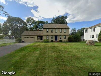
48 Tolland Rd North Andover, MA 01845
Estimated Value: $750,000 - $932,000
3
Beds
3
Baths
1,882
Sq Ft
$438/Sq Ft
Est. Value
About This Home
This home is located at 48 Tolland Rd, North Andover, MA 01845 and is currently estimated at $824,032, approximately $437 per square foot. 48 Tolland Rd is a home located in Essex County with nearby schools including Franklin Elementary School, North Andover Middle School, and North Andover High School.
Ownership History
Date
Name
Owned For
Owner Type
Purchase Details
Closed on
Dec 28, 2006
Sold by
Randall Leon N and Randall Ann T
Bought by
Randall Glen P and Randall Scott T
Current Estimated Value
Home Financials for this Owner
Home Financials are based on the most recent Mortgage that was taken out on this home.
Original Mortgage
$475,727
Outstanding Balance
$292,668
Interest Rate
6.29%
Mortgage Type
Purchase Money Mortgage
Estimated Equity
$547,059
Create a Home Valuation Report for This Property
The Home Valuation Report is an in-depth analysis detailing your home's value as well as a comparison with similar homes in the area
Home Values in the Area
Average Home Value in this Area
Purchase History
| Date | Buyer | Sale Price | Title Company |
|---|---|---|---|
| Randall Glen P | $495,727 | -- |
Source: Public Records
Mortgage History
| Date | Status | Borrower | Loan Amount |
|---|---|---|---|
| Open | Randall Glen P | $475,727 | |
| Previous Owner | Randall Leon N | $50,000 | |
| Previous Owner | Randall Leon N | $60,000 |
Source: Public Records
Tax History Compared to Growth
Tax History
| Year | Tax Paid | Tax Assessment Tax Assessment Total Assessment is a certain percentage of the fair market value that is determined by local assessors to be the total taxable value of land and additions on the property. | Land | Improvement |
|---|---|---|---|---|
| 2024 | $8,055 | $726,300 | $339,100 | $387,200 |
| 2023 | $7,694 | $628,600 | $286,300 | $342,300 |
| 2022 | $7,332 | $541,900 | $248,700 | $293,200 |
| 2021 | $7,059 | $498,200 | $226,100 | $272,100 |
| 2020 | $6,767 | $492,500 | $220,400 | $272,100 |
| 2019 | $6,604 | $492,500 | $220,400 | $272,100 |
| 2018 | $7,156 | $492,500 | $220,400 | $272,100 |
| 2017 | $6,873 | $481,300 | $207,500 | $273,800 |
| 2016 | $6,568 | $460,300 | $209,500 | $250,800 |
| 2015 | $6,736 | $468,100 | $193,400 | $274,700 |
Source: Public Records
Map
Nearby Homes
- 106 Berkeley Rd
- 9 Chatham Cir
- 9 Chatham Cir Unit 9
- 10 Cotuit St
- 18 Kingston St Unit 113
- 56 Village Green Dr
- 38 Village Green Dr Unit 38
- 44 Kingston St Unit 44
- 138 Kingston St Unit 138
- 156 Chestnut St Unit 4
- 1 Longwood Dr Unit 5
- 3 Longwood Dr Unit 104
- 2 Longwood Dr Unit 407
- 335 Chestnut St
- 210 Chickering Rd Unit 102A
- 223 Chickering Rd
- 59 Farrwood Ave Unit 6
- 112 Lisa Ln
- 156 High St
- 15 Copley Cir