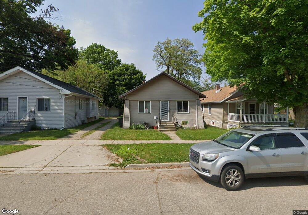
48 Winter St Battle Creek, MI 49015
Central Battle Creek NeighborhoodEstimated Value: $109,000 - $112,000
2
Beds
1
Bath
826
Sq Ft
$134/Sq Ft
Est. Value
About This Home
This home is located at 48 Winter St, Battle Creek, MI 49015 and is currently estimated at $110,411, approximately $133 per square foot. 48 Winter St is a home located in Calhoun County with nearby schools including Ann J. Kellogg School, Springfield Middle School, and Battle Creek Central High School.
Ownership History
Date
Name
Owned For
Owner Type
Purchase Details
Closed on
Oct 14, 2014
Sold by
Kilgore Jerry W and Kilgore Nancy A
Bought by
Kilgore Jerry W and Kilgore Nancy A
Current Estimated Value
Purchase Details
Closed on
Jan 4, 2008
Sold by
Reule Justus David
Bought by
Mortgage Electronic Registration Systems
Purchase Details
Closed on
Jun 13, 2001
Sold by
Reule David E and Reule Cheryl E
Bought by
Reule Justus D
Purchase Details
Closed on
Feb 18, 2000
Sold by
Reule David E and Reule Cheryl C
Bought by
Reule David E and Reule Cheryl C
Purchase Details
Closed on
Nov 4, 1999
Sold by
Trudgeon Estate June
Bought by
Reule David E and Reule Cheryl C
Purchase Details
Closed on
Oct 10, 1999
Sold by
Trudgeon June
Create a Home Valuation Report for This Property
The Home Valuation Report is an in-depth analysis detailing your home's value as well as a comparison with similar homes in the area
Home Values in the Area
Average Home Value in this Area
Purchase History
| Date | Buyer | Sale Price | Title Company |
|---|---|---|---|
| Kilgore Jerry W | -- | None Available | |
| Mortgage Electronic Registration Systems | $48,000 | None Available | |
| Reule Justus D | -- | -- | |
| Reule David E | -- | -- | |
| Reule David E | $30,000 | -- | |
| -- | -- | -- |
Source: Public Records
Tax History Compared to Growth
Tax History
| Year | Tax Paid | Tax Assessment Tax Assessment Total Assessment is a certain percentage of the fair market value that is determined by local assessors to be the total taxable value of land and additions on the property. | Land | Improvement |
|---|---|---|---|---|
| 2025 | -- | $40,700 | $0 | $0 |
| 2024 | $691 | $39,344 | $0 | $0 |
| 2023 | $790 | $32,108 | $0 | $0 |
| 2022 | $625 | $26,656 | $0 | $0 |
| 2021 | $746 | $25,074 | $0 | $0 |
| 2020 | $701 | $23,583 | $0 | $0 |
| 2019 | $699 | $18,813 | $0 | $0 |
| 2018 | $699 | $18,251 | $674 | $17,577 |
| 2017 | $677 | $15,185 | $0 | $0 |
| 2016 | $676 | $15,762 | $0 | $0 |
| 2015 | $924 | $15,336 | $1,965 | $13,371 |
| 2014 | $924 | $14,374 | $1,965 | $12,409 |
Source: Public Records
Map
Nearby Homes
- 100 Eldred St
- 296 Meachem Ave
- 71 Burnham St W
- 35 Eldred St
- 236 Burnham St W
- 127 W Territorial Rd
- 41 Randolph St
- 171 Goguac St W
- 57 Boulder St
- 212 Goguac St W
- 235 Fairfield Ave
- 32 Territorial Rd E
- 137 Fairfield Ave
- 210 Battle Creek Ave
- 324 Goguac St W
- 1 Grand Blvd
- 349 Goguac St W
- 184 Territorial Rd W
- 256 Burr St
- 39 Harris St