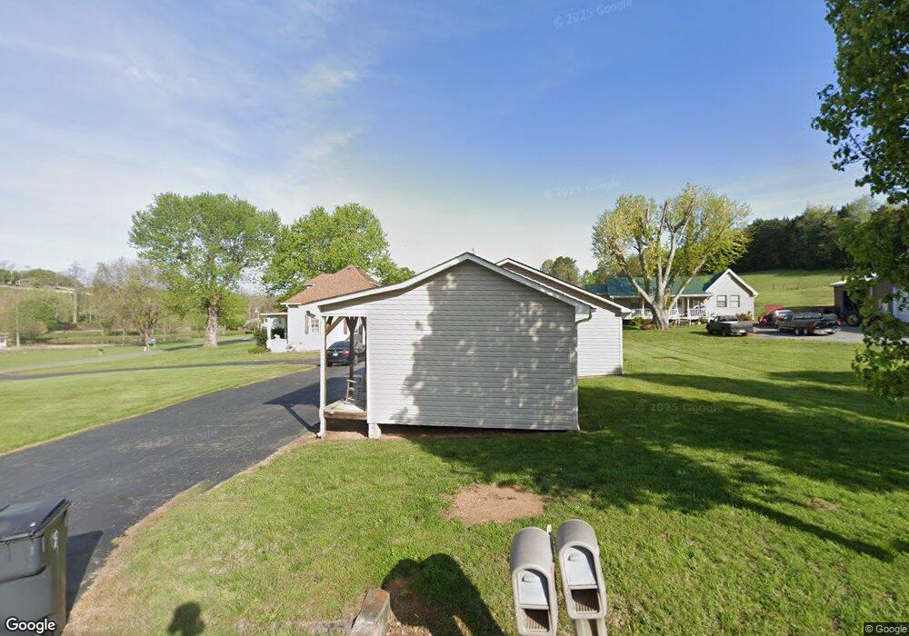
480 Benton Hale Rd Morristown, TN 37813
Estimated Value: $254,000 - $436,000
2
Beds
3
Baths
2,576
Sq Ft
$124/Sq Ft
Est. Value
About This Home
This home is located at 480 Benton Hale Rd, Morristown, TN 37813 and is currently estimated at $320,199, approximately $124 per square foot. 480 Benton Hale Rd is a home located in Hamblen County with nearby schools including Witt Elementary School, Lincoln Heights Middle School, and Morristown West High School.
Ownership History
Date
Name
Owned For
Owner Type
Purchase Details
Closed on
May 31, 2005
Sold by
Parrott Billy H
Bought by
Dearing Eddie Dale
Current Estimated Value
Home Financials for this Owner
Home Financials are based on the most recent Mortgage that was taken out on this home.
Original Mortgage
$77,700
Interest Rate
5.69%
Purchase Details
Closed on
Oct 16, 1973
Bought by
Parrott Billy and Parrott Wanda
Create a Home Valuation Report for This Property
The Home Valuation Report is an in-depth analysis detailing your home's value as well as a comparison with similar homes in the area
Home Values in the Area
Average Home Value in this Area
Purchase History
| Date | Buyer | Sale Price | Title Company |
|---|---|---|---|
| Dearing Eddie Dale | $120,000 | -- | |
| Parrott Billy | $7,000 | -- |
Source: Public Records
Mortgage History
| Date | Status | Borrower | Loan Amount |
|---|---|---|---|
| Closed | Parrott Billy | $77,700 |
Source: Public Records
Tax History Compared to Growth
Tax History
| Year | Tax Paid | Tax Assessment Tax Assessment Total Assessment is a certain percentage of the fair market value that is determined by local assessors to be the total taxable value of land and additions on the property. | Land | Improvement |
|---|---|---|---|---|
| 2024 | $1,227 | $62,275 | $15,125 | $47,150 |
| 2023 | $1,227 | $62,275 | $0 | $0 |
| 2022 | $1,227 | $62,275 | $15,125 | $47,150 |
| 2021 | $916 | $46,475 | $15,125 | $31,350 |
| 2020 | $916 | $46,475 | $15,125 | $31,350 |
| 2019 | $822 | $38,575 | $10,650 | $27,925 |
| 2018 | $822 | $38,575 | $10,650 | $27,925 |
| 2017 | $822 | $38,575 | $10,650 | $27,925 |
| 2016 | $768 | $38,575 | $10,650 | $27,925 |
| 2015 | $714 | $38,575 | $10,650 | $27,925 |
| 2014 | -- | $38,575 | $10,650 | $27,925 |
| 2013 | -- | $41,300 | $0 | $0 |
Source: Public Records
Map
Nearby Homes
- 5474 Saint Paul Rd
- 5056 Spencer Hale Rd
- 3520 Sublett Rd
- 848 Spencer Hale Rd
- 1500 S Davy Crockett Pkwy
- 453 Statem Gap Rd
- 5704 Long Creek Rd
- 4996 Saint Paul Rd
- 2262 Fernwood Church Rd
- 0 Old White Pine Rd
- 1160 Statem Gap Rd
- 2895 Coffey Rd
- 1163 Nathan Dr
- 3017 Hardy Rd
- 1418 Mae Collins Rd
- 4207 Clyde Thomas Rd
- 1051 Wilson Hale Rd
- 5262 Buell Chapel Rd
- TBD Buell Chapel Rd
- 0 Tbd River View Dr Unit Lot@WP001
- 1294 Old Witt Rd
- 1294 Old Witt Rd Unit P/O 9
- 487 Benton Hale Rd
- 351 Benton Hale Rd
- 481 Benton Hale Rd
- 341 Benton Hale Rd
- 1205 Old Witt Rd
- 1204 Old Witt Rd
- 1300 Old Witt Rd
- 1310 Old Witt Rd
- 552 Cove Rd
- 1325 Old Witt Rd
- 522 Cove Rd
- 468 Benton Hale Rd
- 1405 Old Witt Rd
- 4902 S Davy Crockett Pkwy
- 517 Cove Rd
- 4880 S Davy Crockett Pkwy
- 1165 Old Witt Rd
- 510 Witt Rd